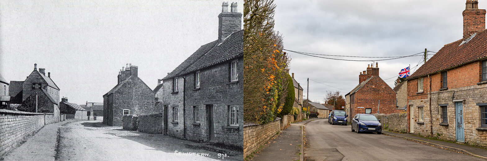
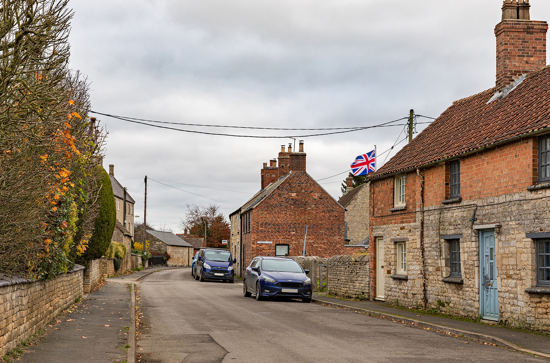
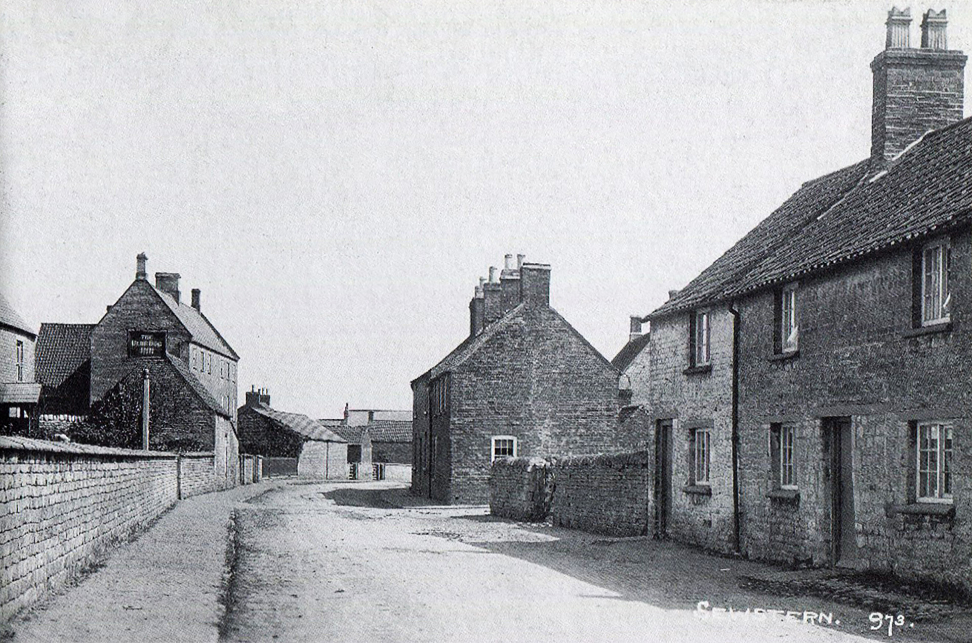
Main Street – 1920s
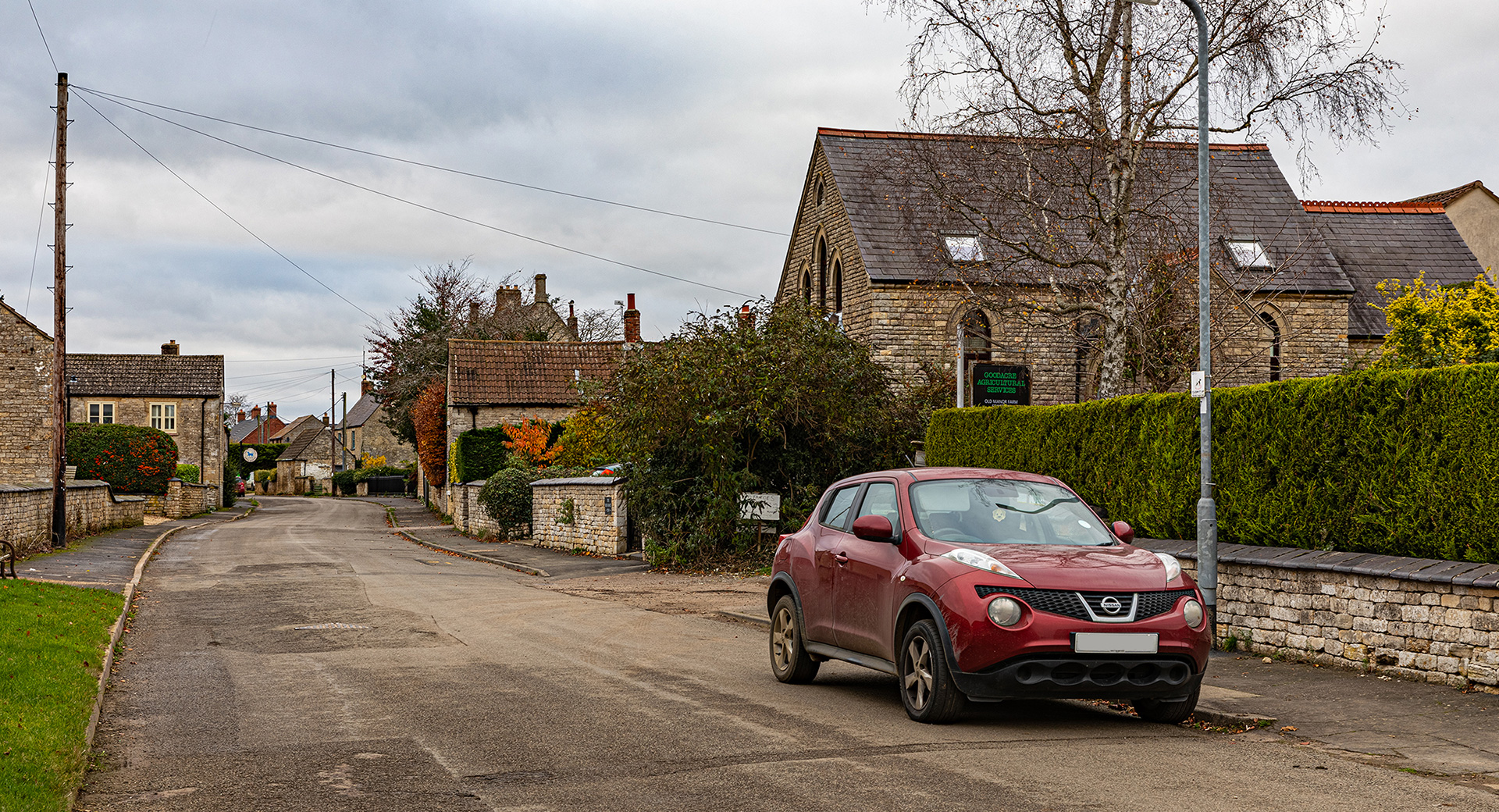
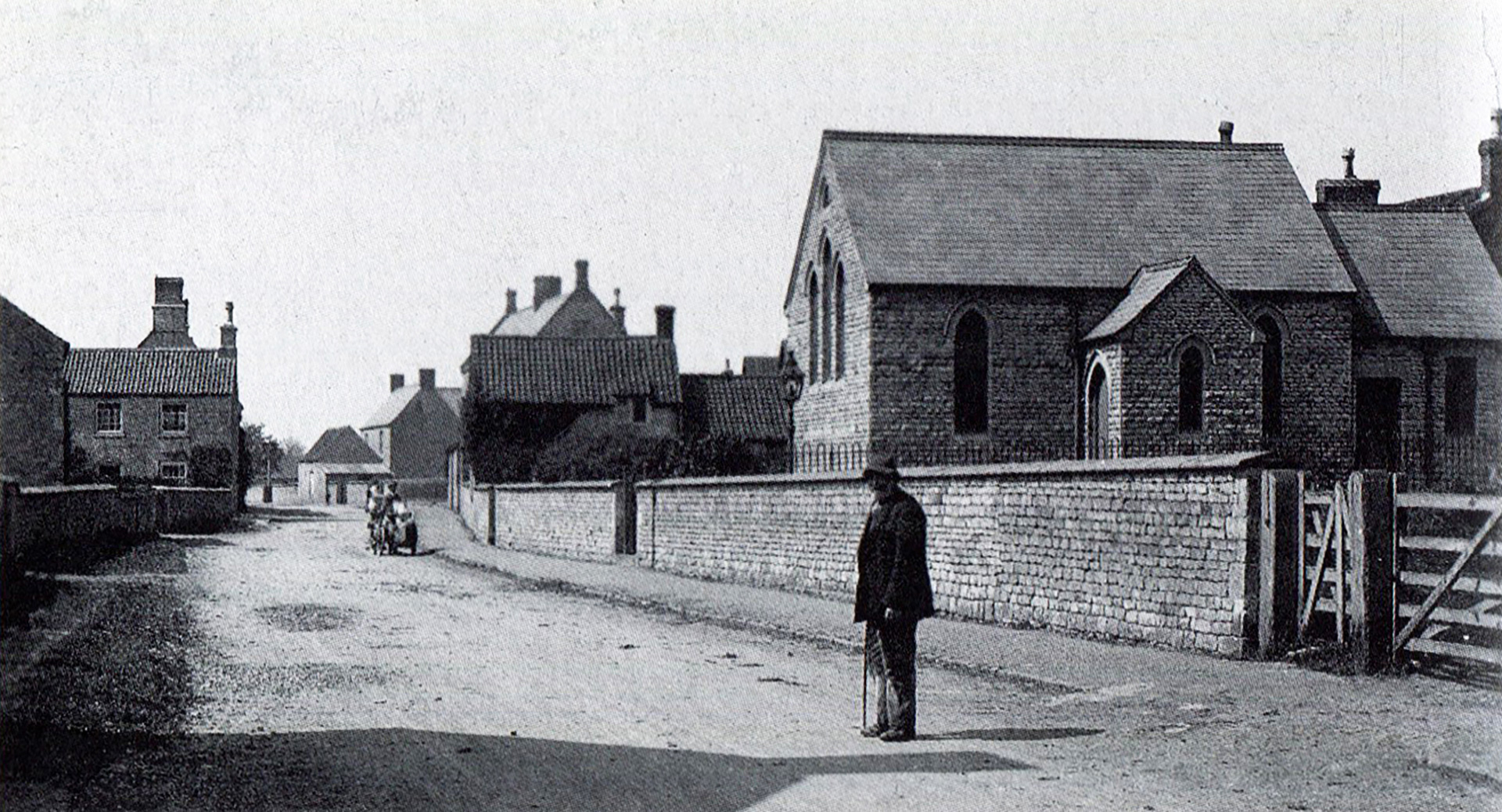
When Michael Goodacre heard that Sewstern would be one of the next villages being highlighted in this series, he wrote to me with an invitation to have a chat. Michael came to the village in 1959. “When I married, my father went to Escritt and Darrell, an estate agent in Grantham, searching for a farm for us. The Sewstern Old Manor Farm was the only place available in their portfolio to start as a tenant. We immediately loved the place. About 20 years ago, my son took over.” In general, most of the older buildings, farms, houses and cottages are still there. Some hedges are taller, some garden walls have become smaller, and some new homes have been built. Michael’s finger hovered over the old picture of Main Street taken from the School Lane junction. “At the corner behind the hedge is a new house. A bit further on, partly visible on the old postcard, is The Blue Dog Inn, the only one of three pubs left in the village. Its name references the political colour of Sir William Manners, the major landowner in the 1820s. Also, the pub sign is featured.” Next is an outhouse and a three-storey building with a railing and a boundary wall. That Grade II listed building, which seems a bit out-of-place in a rural village, was a pair of farmhouses. In the top centre, there is a datestone inscribed ‘A TW 1752’. “I was told flax was stored on the top floor”, recollected Michael. Historian Pam Fisher wrote in the Buckminster and Sewstern edition of The Victoria History of Leicestershire series: “The main crops in the area were oats (62%), barley (23%), wheat (13%) and beans (2%). Flax and hemp were probably also grown, as there were hempdressers in Sewstern in 1762. The most likely builder was Thomas Watkinson, a wealthy woolcomber. His ‘brother’, John Mason, was also a woolcomber, and may have shared the house.”
Opposite was the Post Office, a limestone building run for 48 years by the Laxtons, from 1901 to 1924 and from 1932 until 1956. In 1956 Mrs Alice Laxton, also a parish councillor, was advised by her doctor to give up her duties as sub-postmistress. She died at the end of 1957. “My Nan lived in the old post office in the 1960s and 1970s”, recalls Tracey Baxter Dixon.
Pam Fischer: “Sewstern post office opened in 1896 in the house of wheelwright and farmer Thomas Sharp. It closed in 1924, but a post office reopened in 1932, closing again in 2000.”
In 1982 Sewstern had 65 houses one by one known by the postmistress, June Bets. She came to the village in 1959 and started running the post office in 1967. Mrs Bets delivered letters, parcels, and other post from her bicycle on foot in bad weather.
“Next to it, Bet Hopcrofts lived in the red brick house, at the corner with Church Street.” The stone wall is the site of the Village Hall. Michael Goodacre immersed himself in village life right after arriving in Sewstern. He explained: “Together with other villagers, local donations of more than £1,800 (fundraising already did begin in 1945!) and a £2,100 Ministry of Education grant, enabled the new Village Hall to be completed in 1962.” When taking the new picture, the week after Remembrance Day, the Union Jack was calmly waving. In front, on the right-hand side of the photographs, two cottages are still there. “I love the then and now pictures”, said Kate Louise Tomson. And she concluded: “I need to paint my front door!”
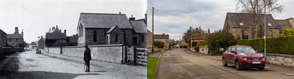
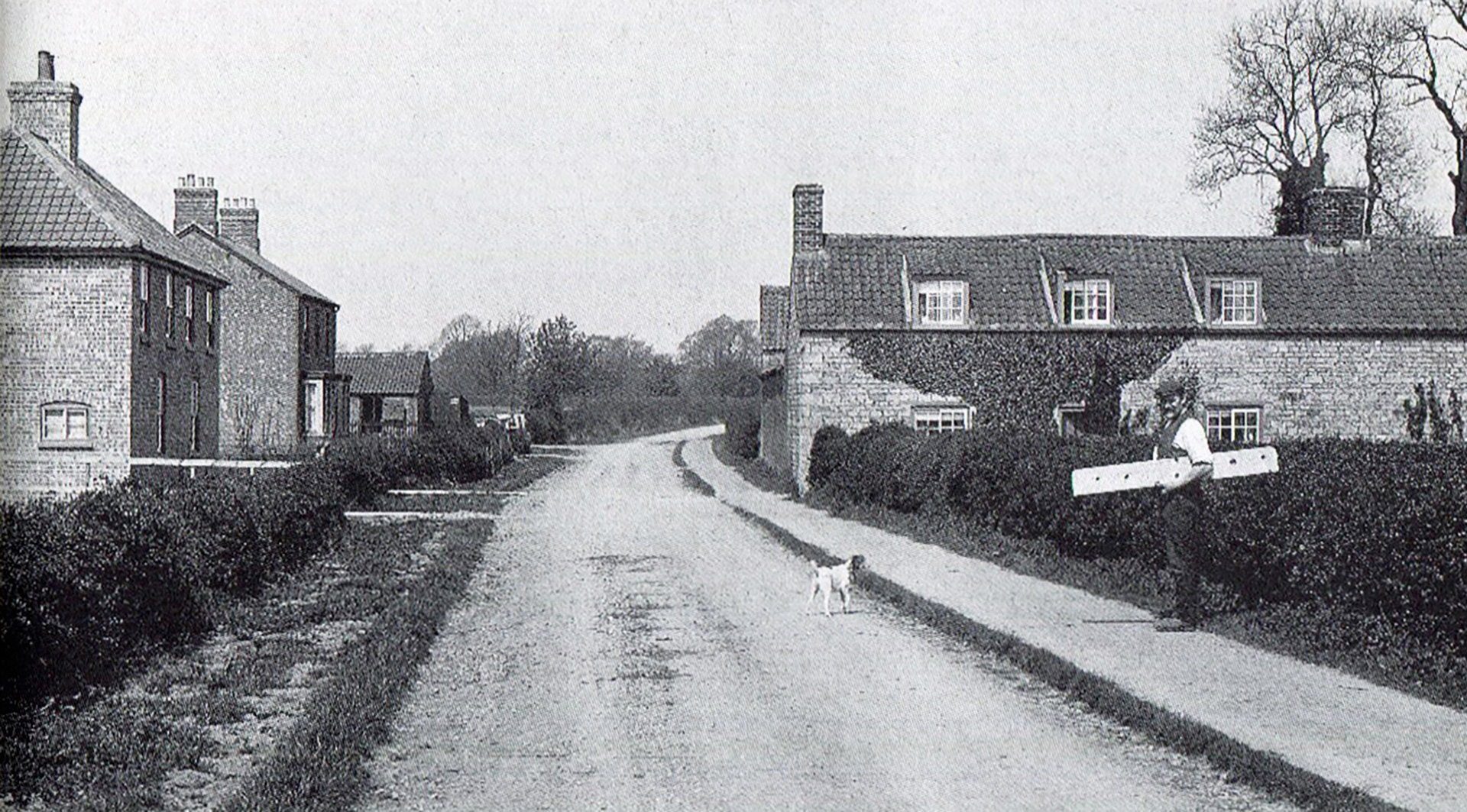
Farms were for a large part of the village’s history a major employer. Michael Goodacre counted about seven farms when he moved into the village in 1959. A Melton Times’ article published in 1982 mentioned three farms: Goodacre’s, Newton’s and Exton’s. Much of the farmland was owned by the Tollemache family in 2017. The old postcard shows a long stone wall in front of the Wesleyan chapel on the right, the main feature in these pictures. The entrance to Old Manor Farm was moved closer to the chapel. Now there is a sign put up by Michael’s son.
About the Wesleyan chapel, Pam Fisher explained: “There was a Wesleyan chapel in Sewstern, built in 1820 by subscription”, explained Pam Fisher. “It was described as a building used exclusively for worship and could accommodate 80 people. In 1903-4 the Wesleyan congregation built a replacement chapel closer to the centre of the village. It was said to have cost £600 and would seat 140. It was redecorated in 1954, but since been converted into a private house.” “That must have been in the mid-1960s”, added Michael Goodacre.
Main Street was walled in as shown in the old picture. Most parts are still there, but sometimes the wall has been lowered. Michael told about his research on the blue saddleback coping stones. “Some have the name of the manufacturer stamped: Stanley Bros, Brick and Tile Work, Nuneaton. This kind of coping stone was as I found out manufactured in the 1920s.” That leaves the question of whether Main Street was walled in the 1920s or these particular coping stones were added at that time.
School Lane
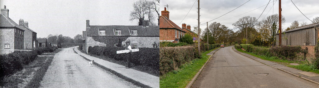
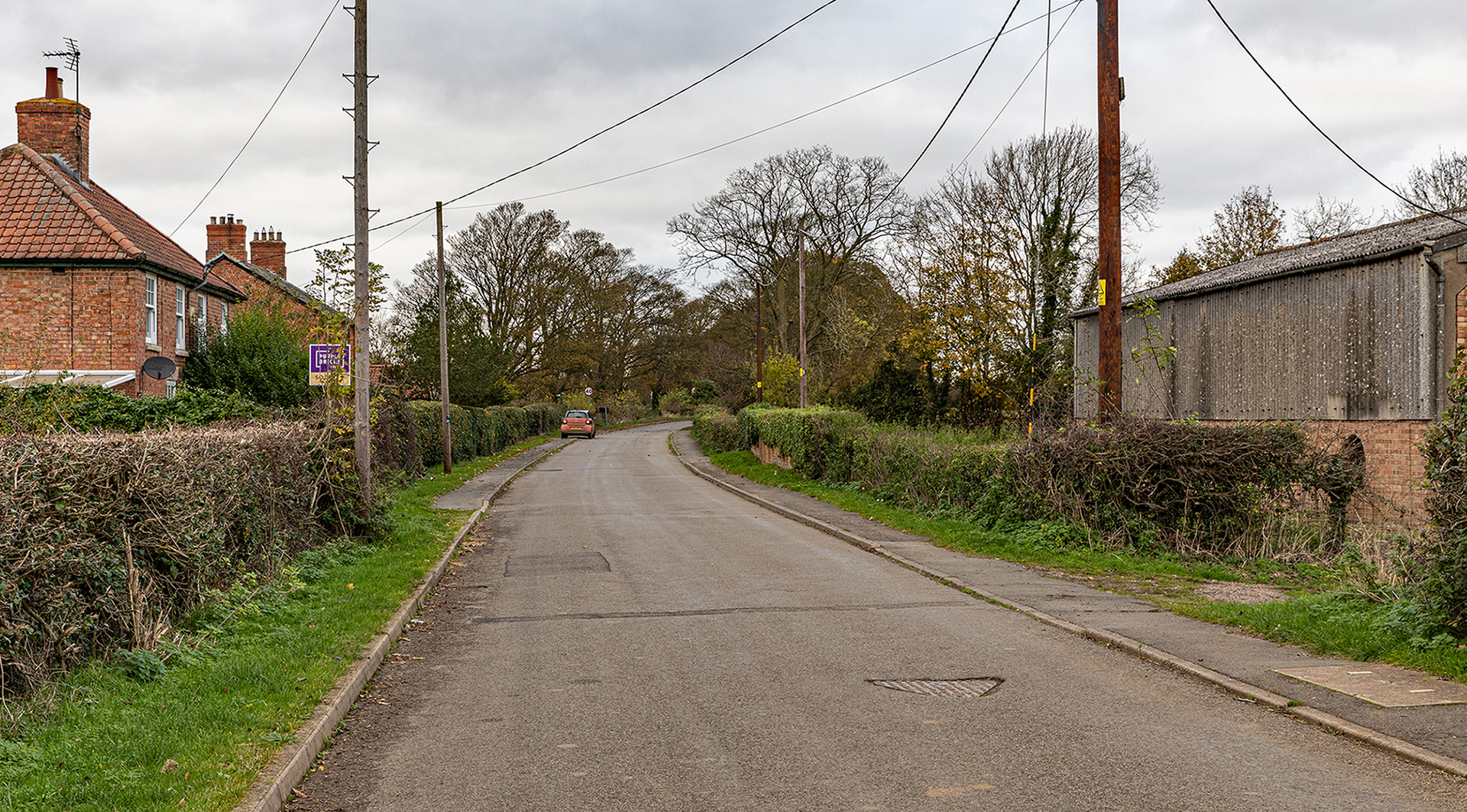
On the left one or both of the houses are indicated as the village smithy on an 1885-1900 OS Map. Michael Goodacre is not sure if the cottages on the right were still there when he came to the village. John Exton told: “The footings and bits of the wall of the cottages are still there and are overgrown by ivy and grass.” Some villagers suggested there was a water tower behind the demolished cottages, but there is no proof on old maps, “The existing farm building went up in a year or two after I came here.”, Michael continued. “I can’t work out what that chap is holding. It looks like a piece of timber.”
On the village
in 2017 all the farmland, commercial and residential properties in the neighbouring village, Buckminster, was owned by the Tollemache family. In the Buckminster and Sewstern edition of The Victoria History of Leicestershire series, Pam Fisher wrote: “Sir William Manners also owned farmland and houses in Sewstern in 1793, but he and his descendants had a limited interest in land and property acquisition in that village [Sewstern]. The village grew organically, and the style, size and paintwork of its properties mostly reflect the individual tastes of different freeholders.” The most used building material was local limestone. “The nearest source of limestone was Gunby, just half a mile to the east of Sewstern. I was carted in from there”, explained Michael: “Limestone was the better material.”
During the first part of the 20th century, Sewstern was dependent upon agriculture and ironstone, becoming a more dormitory village with a thriving industrial estate in the 1980s.
Sewstern once had three pubs: The Waggon and Horses, The Red Lion Inn and The Blue Dog Inn. The Waggon and Horses, which closed in the 1870s, was on Main Street not far from the Wesleyan chapel. The Red Lion Inn was situated on the village crossroad: Sewstern Lane with Main Street.
Sewstern Lane is an ancient track, which may date back to the Bronze Age. It was a Roman highway, and later an important droving route for cattle being taken from Scotland and northern England to London, and became known as The Drift. At Sewstern, this point and for most of its length, Sewstern Lane forms the boundary between Lincolnshire and Leicestershire. Michael Goodacre: “There is a story, because the Red Lion was in the county boundary, if the Leicestershire police came, people could nip back out at the Lincolnshire side, and if the Lincolnshire police came, people got out at the other side. But there is no door at the back of what was The Red Lion. And I have looked many times but never seen any proof of a back door. The Red Lion Inn closed in 1956.”
“In 1894 they started digging up iron ore in Sewstern. It was the earl of Dysart who granted a 60-year lease over an area of almost 20,000 acres in Lincolnshire, Leicestershire and Rutland, including Sewstern to the Holwell Iron Company Ltd.”, said Michael. “They supplied it mainly to the Asfordby ironworks near Melton Mowbray, and to Scunthorpe in North Lincolnshire, and Corby in Northamptonshire.” Between 1937 and 1968, on the eastern side of Sewstern, a new technique of quarrying for ironstone, on a rolling opencast basis, was introduced. Fields were returned to agricultural use within a season. The result can be seen in the landscape, with the fields in the quarried area, and also Back Lane, lying some 7 to 15 feet below the level of other roads.
More pictures
Would you like to add pictures? Send a message.
Domesday Book

Sewstern was a settlement in Domesday Book, in the hundred of Framland and the county of Leicestershire.
It had a recorded population of 7 households in 1086, putting it in the smallest 40% of settlements recorded in Domesday.
Land of William Lovet
- Households: 6 villagers. 1 freeman.
- Ploughland: 5 ploughlands. 1 lord’s plough teams. 1.5 men’s plough teams.
Valuation
- Annual value to lord: 10 shillings in 1086; 3 shillings when acquired by the 1086 owner.
Owners
- Tenant-in-chief in 1086: William Lovet.
- Lord in 1086: William Lovet.
3 responses to “Sewstern”
Fascinating history and great to know the village dates back to before the Domesday Book. Thanks to the villagers for sharing their knowledge.
Re Sewstern – Michael, I know him well. If you ever decide to do an article about Saltby, I lived there from 1938 until 1969. Like Michael, my Dad rented a farm there. Saltby was a virtually self-contained village back in the days when I was a lad. I am now 91, retired and living in Cottesmore.
It would be lovely to have a chat with you on Saltby, George. Let me know when I can come round.