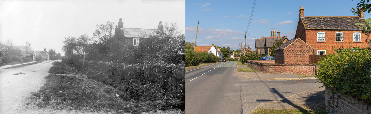
Normanton Lane – 1900s
The first house on the left is Threeshires Farmhouse, a mid-18th century whitewashed house, formerly known as Greenshires Farmhouse or Greenacres. Next to it, but not yet built when the photographer took the old picture, are four terraced cottages, later made into two dwellings, Field Cottage and Wheelhouse Cottage. In one of the four cottages, Christine Robinson, now 71, was born. “My great granny, granny, grandad, aunties, uncles and cousins, all lived in the village. I have stayed in three houses in Normanton with my mum, dad, two sisters, and brother. It was such a lovely little village.”
Normanton is a one-street village. The farms and smallholdings were mainly on the left-hand side, and the workers lived on the opposite east side. Families rarely moved out of Normanton. Threeshires Farmhouse was the home to the Lovitts. The barn of Little Covert Farm, where the Flavells lived, is the last that can be detected in the new image. In between lies Bell Field House. Along the other side, the new picture shows part of the houses where the Skinners and the Spicks lived, followed by two semi-detached larger cottages. Similar cottages are also found further along Normanton Lane. The house at the front belonged to the Ablewhites. A short private street leads to Normanton Court. The old and new pictures cover about half of the village.


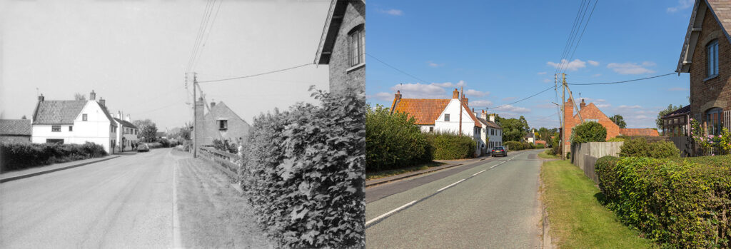
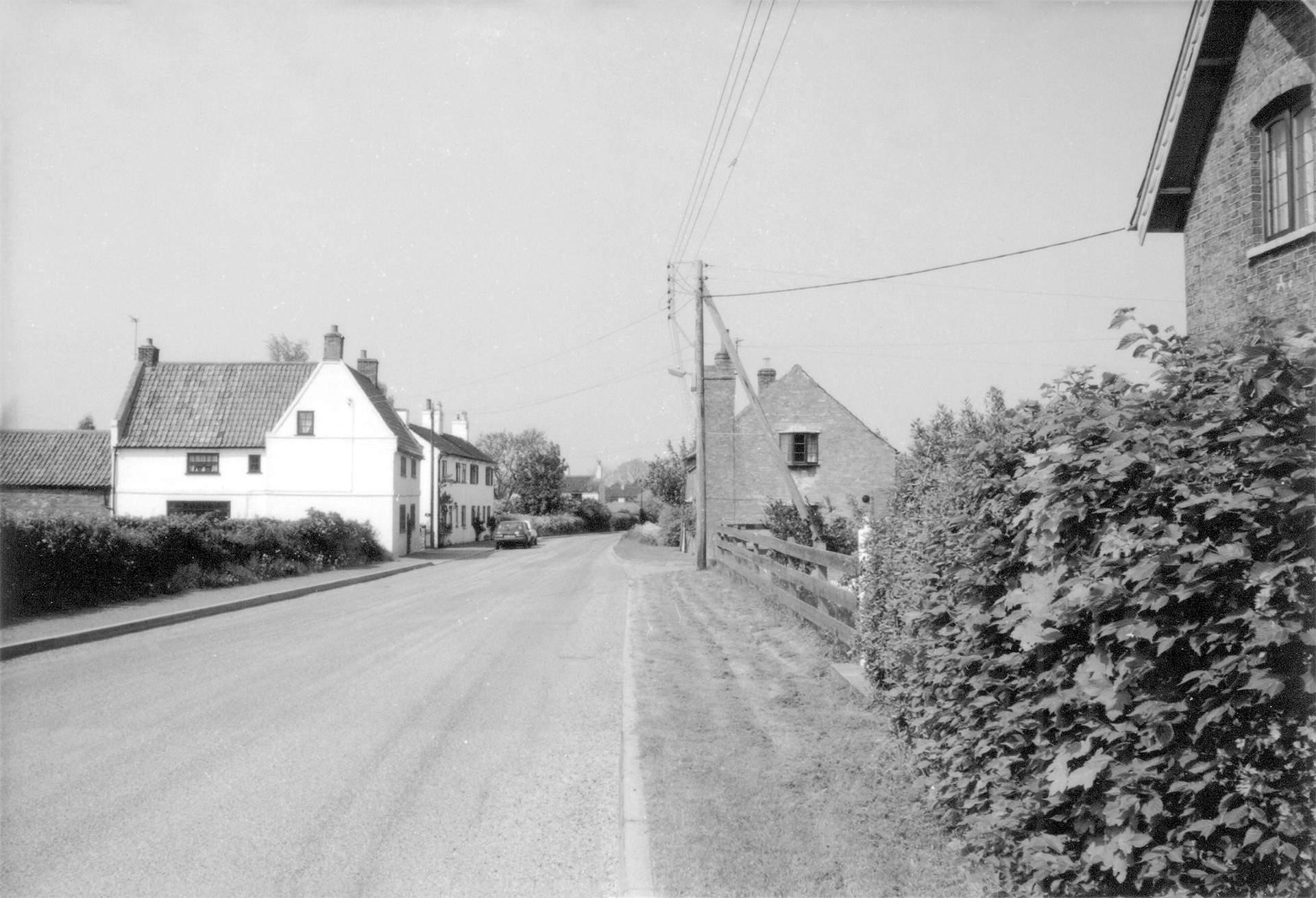
The older picture was taken between 1989 and 1992 by Dr Michael Honeybone (Collection Bottesford History Group). Not that much changed. On the left-hand side is Threeshires Farmhouse. Adjacent are Field Cottage and Wheelhouse Cottage. On the opposite side, the house in the front (now with a conservatory) is Winthorpe House, as part of two semi-detached larger cottages.

Normanton Airfield
The village is well known for the Normanton airfield (officially RAF Bottesford), adjacent to the northeast side of the village. The airfield was built in 1940 by George Wimpey & Co. Ltd and became operational in September 1941, used by British, Australian and American forces during WWII. Its construction cut off the road to Staunton in the Vale (Nottinghamshire) and Long Bennington (Lincolnshire). The Homestead, a 19th-century farmhouse, was the last house of the village on the edge of the airfield. Frances Hallam recollected: “Mrs Staniford lived in The Homestead during the war. She ran a little shop for the airmen, selling sweets and cigarettes. I lived there as a teenager, from 1974 to 1979. My dad altered the house, also replacing the old sash windows. A small building nearest to the road was an old wash house with a fire boiler and a pump outside. I believe the pump, the hedge and the ditch are still there.” The Homestead was also Audrey Hamerton’s home from the age of 3 to 21, and her cousin Denis Staniford, who died in 2014.
Christine Robinson added: “The soldiers often exercised along Normanton Lane, and they would tell us not to hang about and to get home. I was so sad when they left.”
After the war, Normanton airfield became a relief landing ground and was closed to flying in June 1947. The site was finally closed down in March 1960.
Normanton Hall Farmhouse

That’s me on the chestnut, named Goldie”, said Theresa Harrison, “in front of Francis Ablewhite on Snaffles.” After some thinking, she said the older picture was taken around 1989-1992, definitely not earlier. The older image is of the farmhouse, just as the one taken from the other was captured by Dr Michael Honeybone and part of the Bottesford History Group collection.


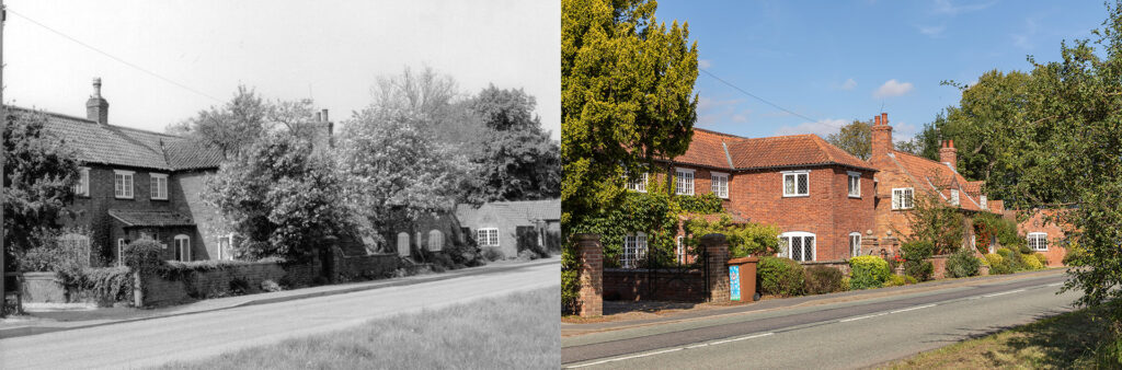
Normanton Hall Farmhouse is a late 18th-century Grade II listed house with two storeys, altered in the 20th century.


Other stories
Christine Robinson: “When I was young, the long walk to the school at Bottesford in winter was awful as the weather was worse than now, wetter and colder. We also carried goods we brought from Mr Malshers shop opposite Bottesford Cross, on our way from school back home for other Normanton villagers. Everyone looked after one another in those days.”
When Sheryl Lee informed for pictures of The Keep, Frances Hallam recalled John Lee was living in that house. “There was a windmill water pump in the field at the side of The Keep. I don’t have any photos but have looked at old maps, and it appears the layout of the place was just the area we knew as the courtyard. There is no evidence of the house to the right if viewed off the road. I suspect it was once a farm and maybe had a different name. I remember John getting one of the first lawnmowers and mowing the field where the windpump stood. He was like a child with a new toy with that mower.”
On the village
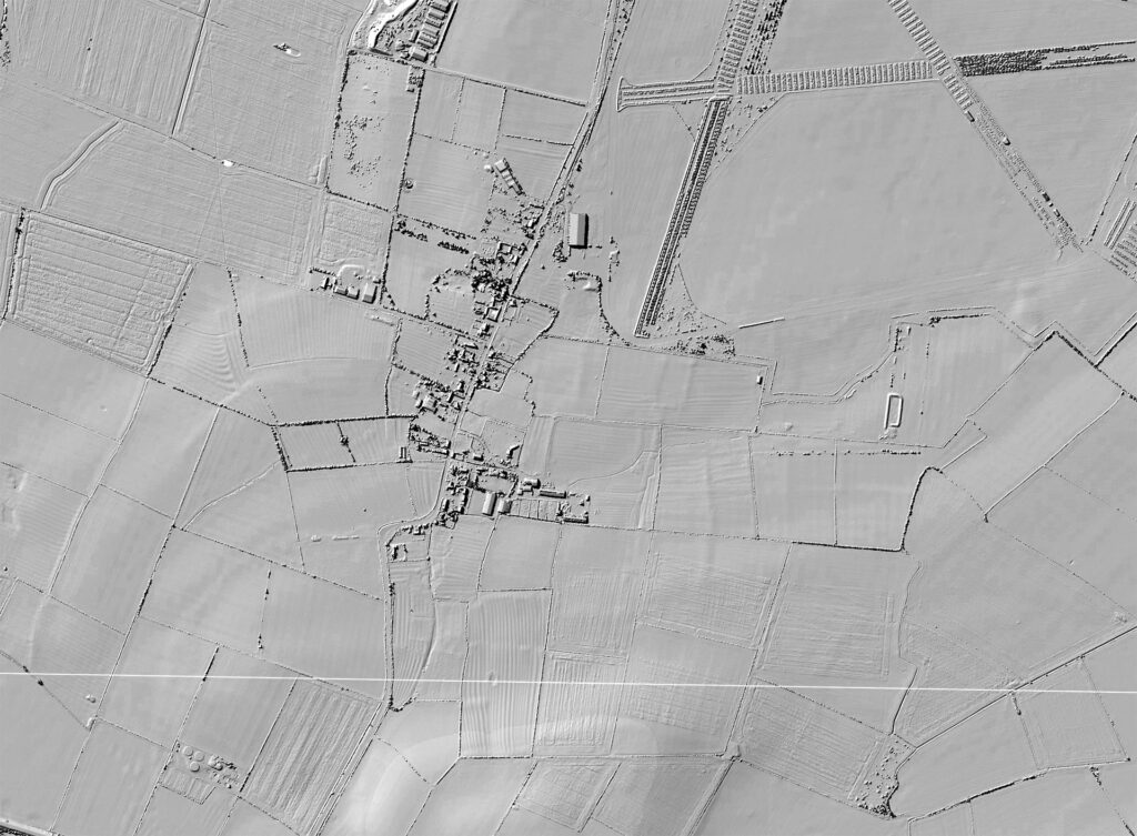
Frances Hallam: “Normanton remains a typical medieval layout of a village with one main street. There is still strong evidence of this in the ridge and furrow fields, clearly seen on LIDAR mapping. But Normanton would be older, its name indicating a Norman town. My dad was keen on metal detecting and found a few Roman items. So it must have always been an important place, being high and the River Devon flowing close by.”
More pictures
No additional pictures Normanton. Contact me if you like to share your photos.
Domesday Book
No reference of Normanton in the Domesday Book.