The first week of October 2023, my husband walked the Hadrian’s Wall Path, a classic among the National Trails. Starting in Bowness-on-Solway, he walked the 84 miles, arriving in Wallsend six days later.
I am also a keen hiker, but due to knee problems, I became the support act. When my husband walked, I wandered around with my camera and tripod and made a series of then-an-now photographs for the Travel in Time project.
This is the second episode of this journey.
View on the Solway
Sunday, 1 October 2023.
I left Bowness-on-Solway around 1 o’clock and headed east on the main road towards the next village, Port Carlisle. Upon arrival, I parked my car near the Solway Methodist Church, constructed in 1861. I then crossed the street and walked into the scrub to get a better view of the Solway estuary. The 180-degree vista was simply breathtaking, reflecting the area’s natural beauty.
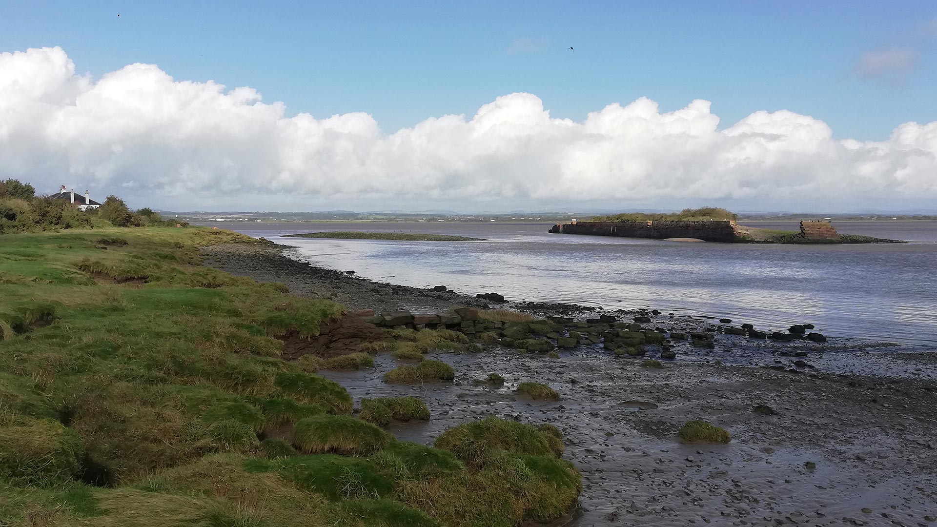
With an old postcard clutched in my hand, I walked towards the Old Harbour Wall. This wall is the only remaining part of a 19th-century island where goods were once loaded and unloaded from ships. The postcard dates back to the early 1900s but does not depict the island more to the right. A small boat lies in the fairway between the harbour island and the shoreline, which was eroded more than 100 years ago.
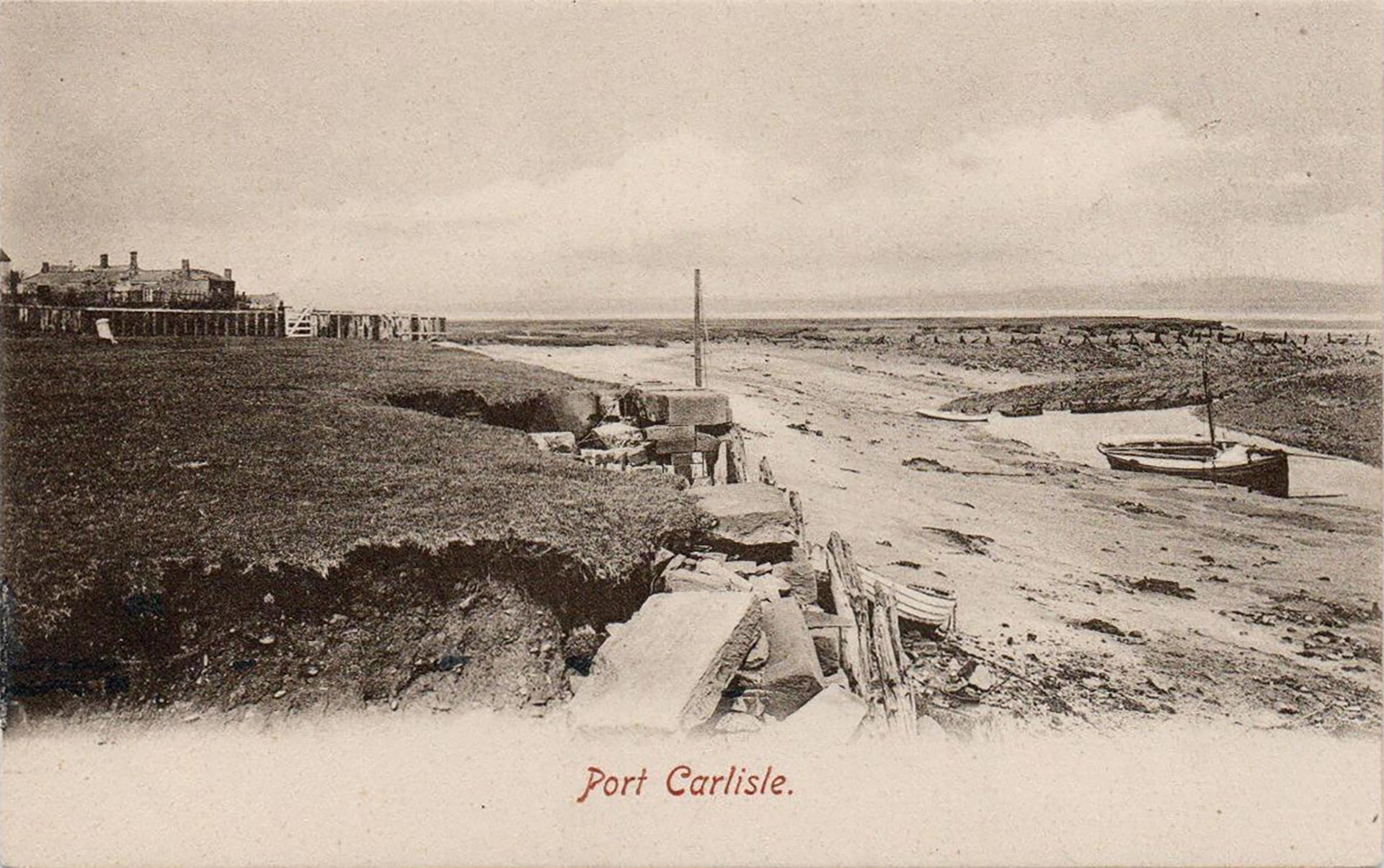
Over the years, the water has eroded more land. Only a few stones of the mainland quay wall remain.
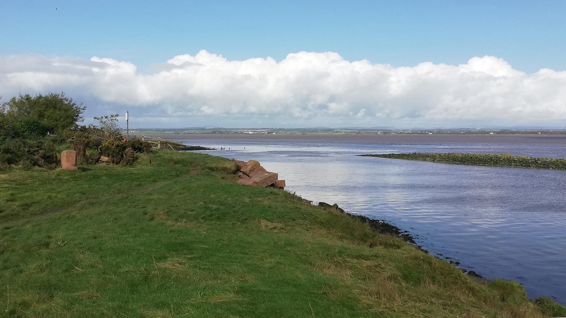
As I returned to my car to collect my photography equipment, I noticed a group of birdwatchers strolling down the Hadrian’s Wall Path. I had checked the tide tables earlier that morning and knew the tide was rising.
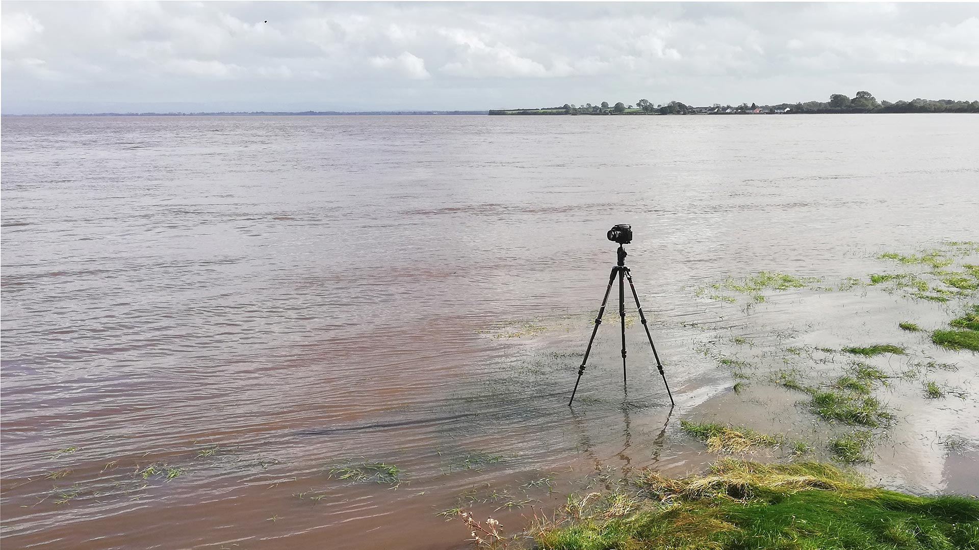
At first, most of the area was still muddy when I reached the estuary, but the water levels rapidly changed. I decided to set up my second camera and started recording a timelapse. After that, I unpacked my lunch and enjoyed watching the rising tide.
(Continue reading after the timelapse)
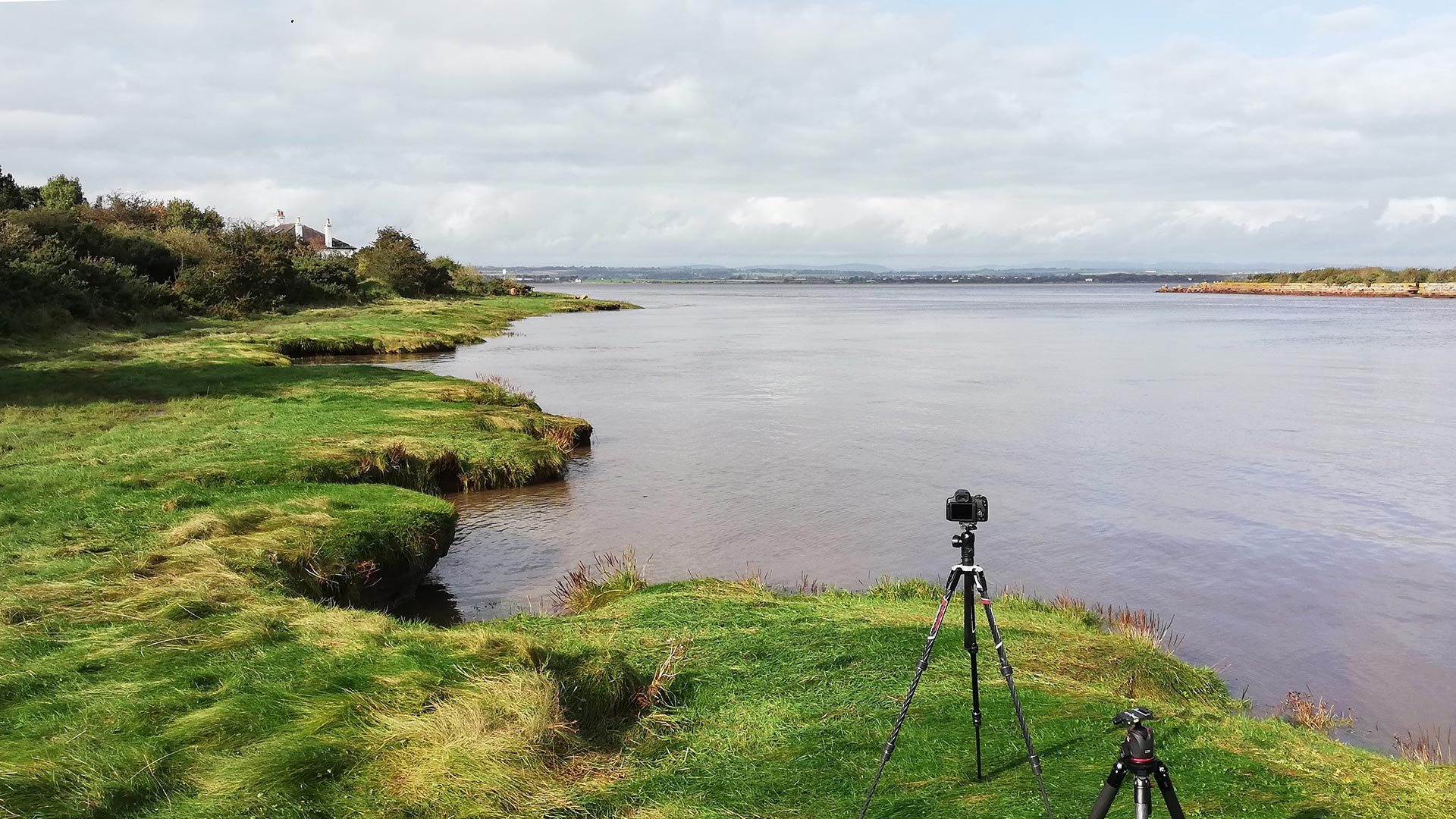
In The Marches. Border Walks With My Father (London: Vintage, 2017), a book by the British academic, author, broadcaster, and former diplomat and politician Rory Stewart, I read with interest about Solway Firth’s history and his adventure to cross the estuary on foot, accompanied by Mark Messenger, landlord of the Highland Laddie Inn on the English side of the estuary.
“We were stepping into an estuary, a mile wide and ten miles long, walking towards the far shore and Scotland. The waves were gentle but we had to keep a steady pace, to keep our boots free of the ‘wicky’ sand. Mark explained that some fluke combination of the rippling outflow of the Esk and the Eden and the tides of the Atlantic Ocean had just created this new ford at low tide. A similar route has existed in the Middle Ages.”
Port Carlisle’s history
While the timelapse was running, two people from the village took the time to chat. Both were interested in what I was doing and talked about the local history.
The original name for Port Carlisle was Fisher’s Cross, a name still printed on late 19th-century Ordnance Survey maps. The lost cross is one of many stone crosses that guided fishermen along the Solway.
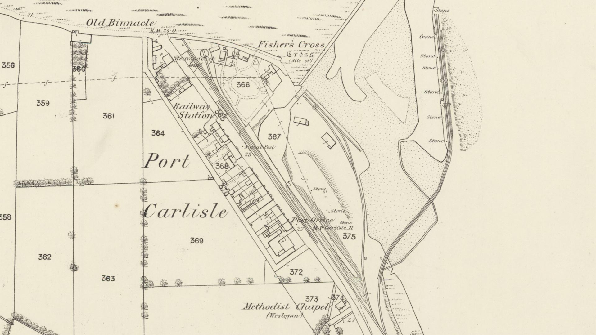
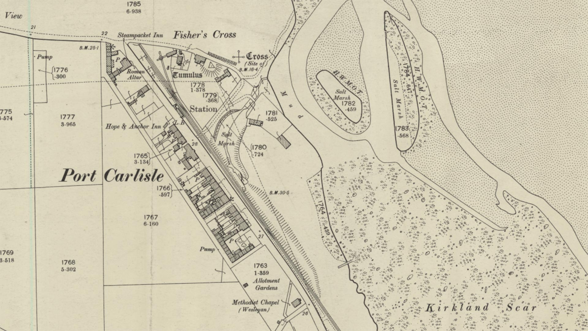
In 1819, a port was built to serve Carlisle. Within four years, a canal was constructed to handle freight and passengers between Carlisle and the seaport gateway to Ireland, Scotland and Liverpool. The canal was 11.5 miles long and included dressed sandstone walls, a sea lock, a basin and a stone dock in the Solway. Large coal vessels could transfer their load onto the canal’s barges. The journey lasted three hours and was significantly faster than transport by cart on the poor roads. As a result, transport became easier, and the price of coal dropped dramatically.
Port Carlisle became the hub for transhipment trade and passenger traffic via steam packets. In 1826, a steamboat named ‘The Solway’ launched a route to Liverpool, while other vessels took passengers and goods to Whitehaven.
The village became a popular tourist destination. In 1844, Victorian baths opened, with hot and cold saltwater baths. The village attracted settlers from various professions, including a surgeon, shipowner, boot maker, blacksmith and master mariners.
At the end of the first half of the 19th century, several canals were filled and converted into railways. For Port Carlisle, the Act of Parliament was passed in 1853, and the line opened in 1854. The offshore wharf was connected to the rail system to maintain access to Carlisle. It took less than half an hour to reach the city via rail.
When the railway from Carlisle to Silloth opened two years later, the direct passenger service to Carlisle stopped. A horse-drawn tram called the Dandy was substituted to join the Silloth line at Drumburgh.
The Old Dandy
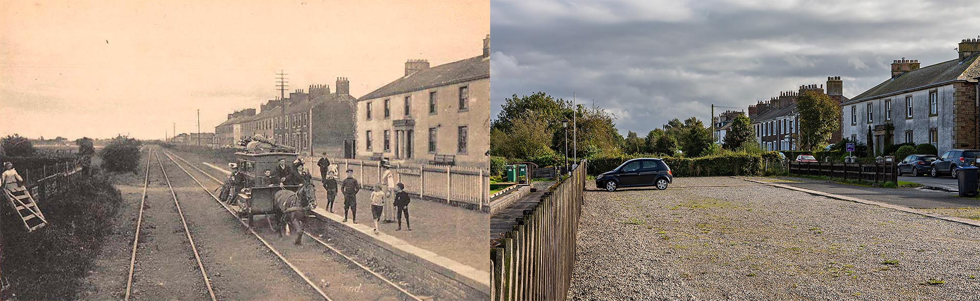
Some say the Port Carlisle Dandy was a curious invention, often described as the only one-horse railway in England. Through the years the North British Railway built four of these cars at its St Margaret’s Works in Edinburgh. One of the cars is on display at the National Railway Museum in York.
The name Dandy could come from the Dandy Waggons which were used on old waggonways for the carriage of horses or a Dandy Wagon as a 19th-century American reference to a horse-drawn private buggy.
Freight continued to travel on the railway from Port Carlisle. But only for a short time. The estuary silted and much better dock facilities at Silloth were used.
The Dandy remained operational until early 1914. That year, a steam sentinel railmotor named the Flower of Yarrow was introduced to prevent the line from closing. This service continued until the branch was closed in 1932, and the railway was dismantled. Currently, the Hadrian’s Wall Path follows the railway’s course.
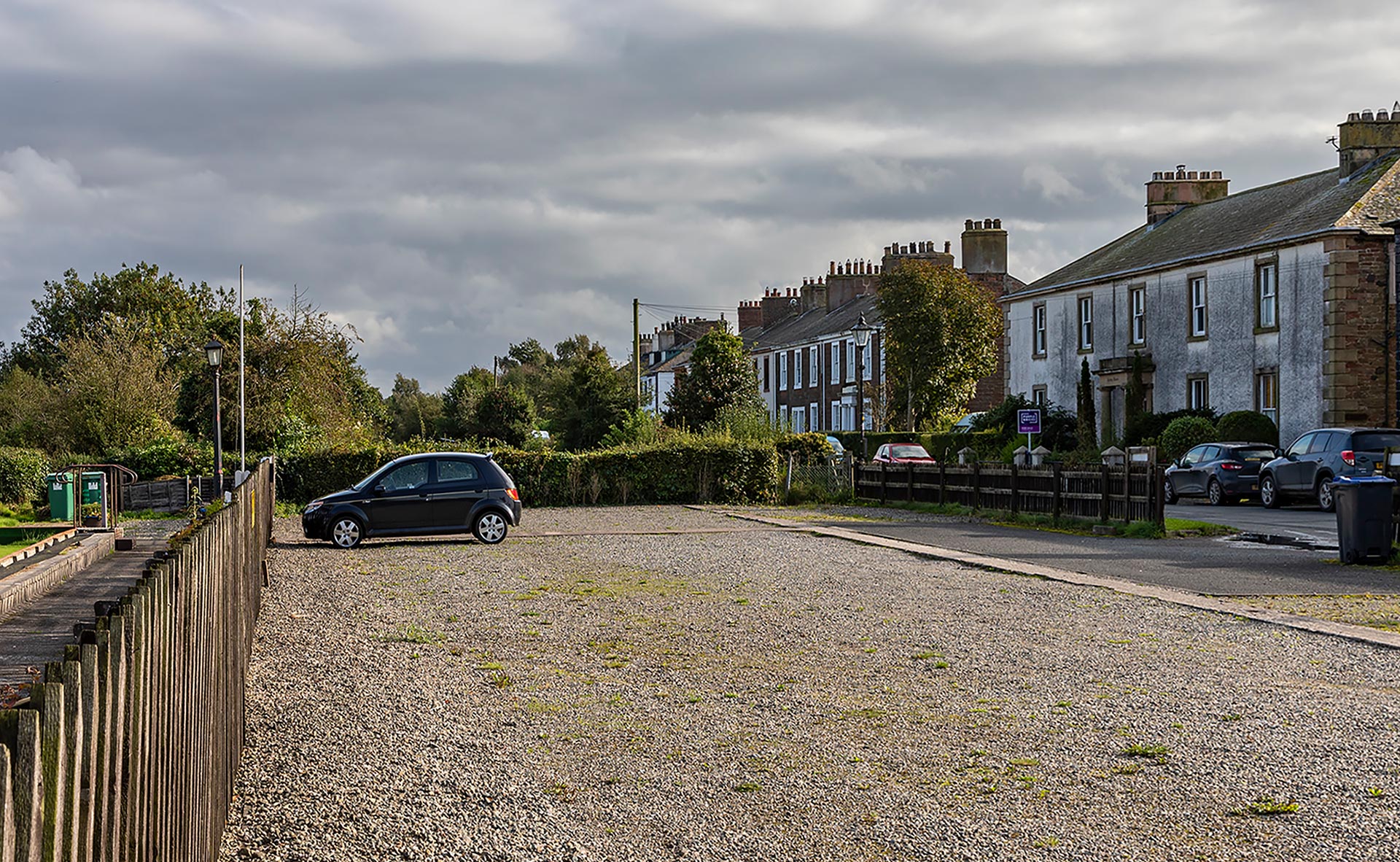
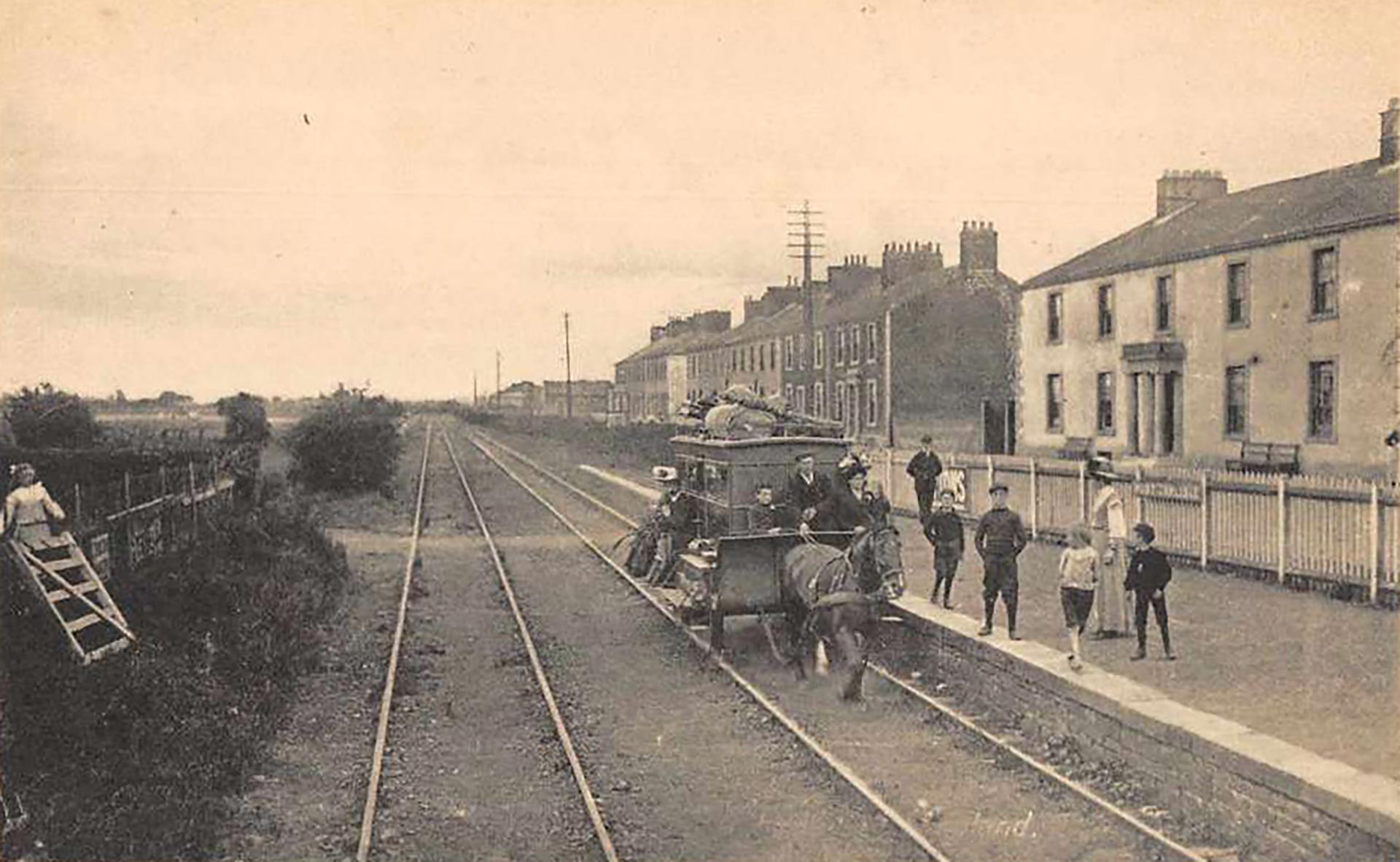
Front Street
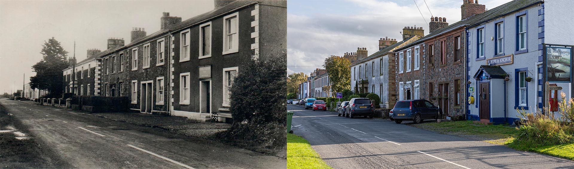
Front Street is Port Carlisle’s main street, where a part of the village’s history comes to life.
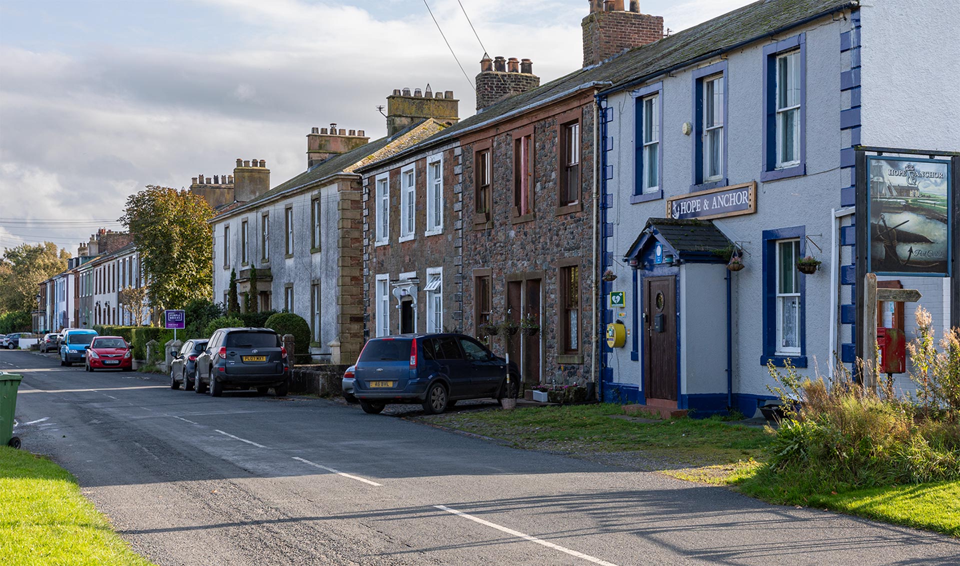
To the right is the Hope and Anchor, the local pub that is unfortunately closed. The building has been transformed into a five-bedroom holiday cottage with the bar and restaurant features still in place.
Moving towards the left, you will come across Solway House, which was originally built as a hotel in 1830 to cater to the passenger traffic on the nearby Carlisle Canal.
Next, eight houses forming a terrace, constructed in the early 19th century of red sandstone, lie hidden behind the tree. They are named Dearham, Eden View, Eskdale, Northlands, Sandheys, Solway Side, The Dunes and The Hollies.
The last terrace in the street consists of six houses, named Dalvean, Galegarth, Harbour View, Hazeldene, the former Post Office and Sea View. Hazeldene is dated over the entrance with the year 1810 and initials T.P.D.
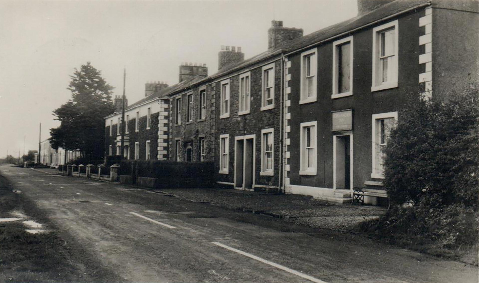
In general Port Carlisle is a lost harbour, but once a thriving port that hoped to rival Liverpool. My husband had passed here hours ago and was more than halfway to his destination for the first day, Carlisle. I had to hurry…
Ordnance Survey Maps
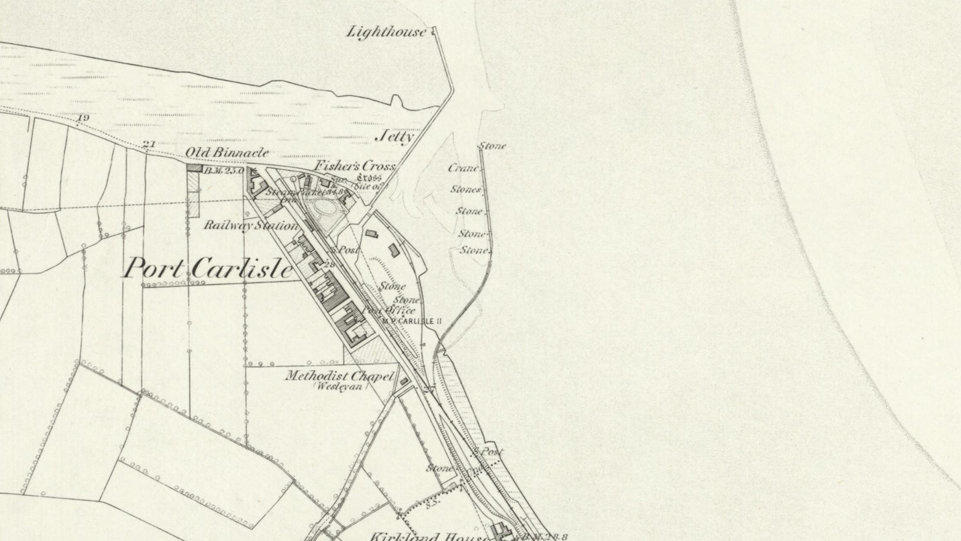

Re-use: CC-BY (NLS).