The first week of October 2023, my husband walked the Hadrian’s Wall Path, a classic among the National Trails. Starting in Bowness-on-Solway, he walked the 84 miles, arriving in Wallsend six days later.
I am also a keen hiker, but due to knee problems, I became the support act. When my husband walked, I wandered around with my camera and tripod and made a series of then-an-now photographs for the Travel in Time project.
This is the third episode of this journey.
Burgh-by-Sands
Sunday, 1 October 2023
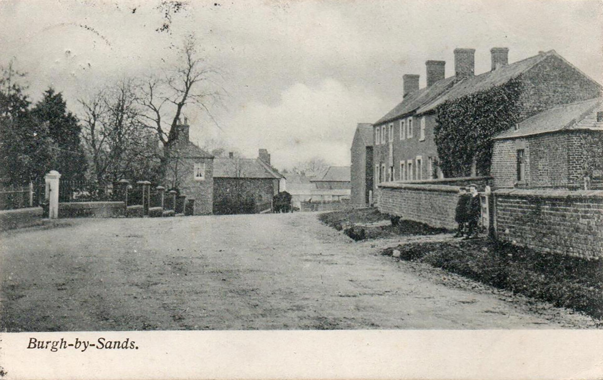
I arrived in Carlisle a few hours after my husband had completed his first day of walking. He was waiting for me in The County Hotel, where we would spend the night, a welcome sight after a day of travel. My extended stay in Port Carlisle meant I had to skip my planned stop in Burgh-by-Sands for two remakes: one of Burgh House opposite the playing field (picture on the left), and a postcard pictured a few hundred feet more to the village’s east side near the crossroad to Moorhouse (picture on the right).
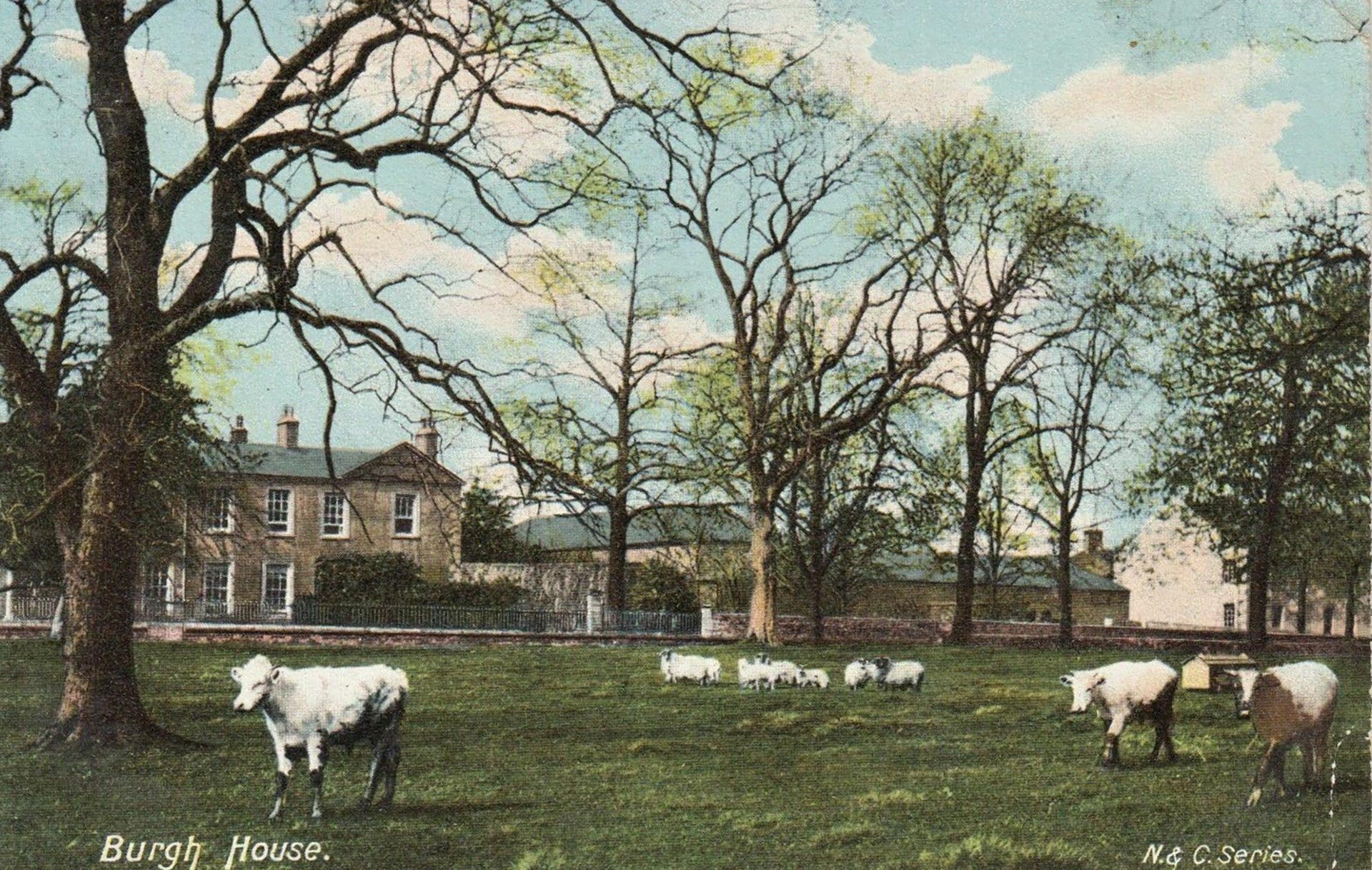
The Burgh House is located between the course of the Vallum and the Hadrian’s Wall to the north, where they are only 200 feet apart, along the main road which runs through the area once occupied by the Vallum during the Roman times.
Burgh House is a Grade II listed building that dates back to 1769. It was initially a single house but was later divided into two separate dwellings. The right side of the building is known as Burgh House, while the left is called Fulwood House. There is also a former barn attached to Fulwood House. The garden wall, situated south of Burgh House and Fulwood House, is also listed. This low brick wall dates back to the late 18th century and can be seen in the postcard.
In the other postcard, the fence on the left belongs to Burgh Head House. Cross Farm is in the middle, consisting of a late 17th-century house and adjoining barns. Desmesne Farmhouse is located on the right.
King Edward I of England (1239-1307) passed away due to dysentery in the village at Burgh Marsh while he was planning his next battle against the Scots. He had set up his camp on the marsh so that his army could cross over to Scotland during low tide.
Carlisle
After arriving at the hotel, I change my clothes, and we go out for a meal. The city has a lively atmosphere. I am impressed by the hotel’s exterior. It was initially called the Red Lion Hotel and has a rich history.
According to Jollie’s Cumberland Guide & Directory, John Boustead was the innkeeper and butcher of the Red Lion. After Boustead passed away in 1827, his widow continued running the inn until she died in 1834. When the property owner, likely Wilfred Gate, went bankrupt in 1837 due to the failure of the Carlisle Old Bank, the Boustead family purchased the property. Rowland Boustead became the innkeeper and butcher. When he died in 1847, aged 44, he left all his property to his brother James.
The Cumbria Archives has a ground plan dated 1855 entitled Botchergate: rebuild part of the Red Lion (reference number: CA/E/4/109). The plan includes a killing shop, commercial room, and parlour produced by J. Hodgson for Samuel Boustead. In 1885, the property on the corner site underwent rebuilding for Samuel Boustead. You can find a keystone above the door with the initials S.B. and the year mentioned.
Extensions were made to the building on Botchergate between 1894 and 1896 based on plans drawn by J. Murchie for Samuel Boustead in 1893. These plans are held in the Cumbria Archives (reference number: CA/E/4/12227).
Now the ground floor holds shops and pubs, while the hotel is located above. The pub on the corner still reflects the atmosphere of the past, with the original Royal Doulton tiles well-preserved. Also, the hotel’s former billiard room has these tiles, although some were removed in 1990. When we express our interest in the hotel’s history, a friendly receptionist smiles and says, “The hotel needs a bit more love.”
Monday, 2 October 2023
After a good breakfast, we buy lunch at the local supermarket. I can smell the fresh-baked McVitie’s biscuits from the nearby factory. Then, we drive to Eden Bridge to find a parking spot. From the banks of the River Eden, I wish my husband a safe walk for the second day of his Hadrian’s Wall adventure.
I wander in the neighbourhood for two remakes for the next two hours.

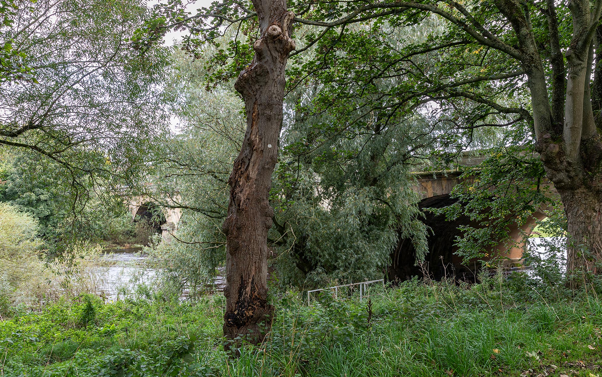
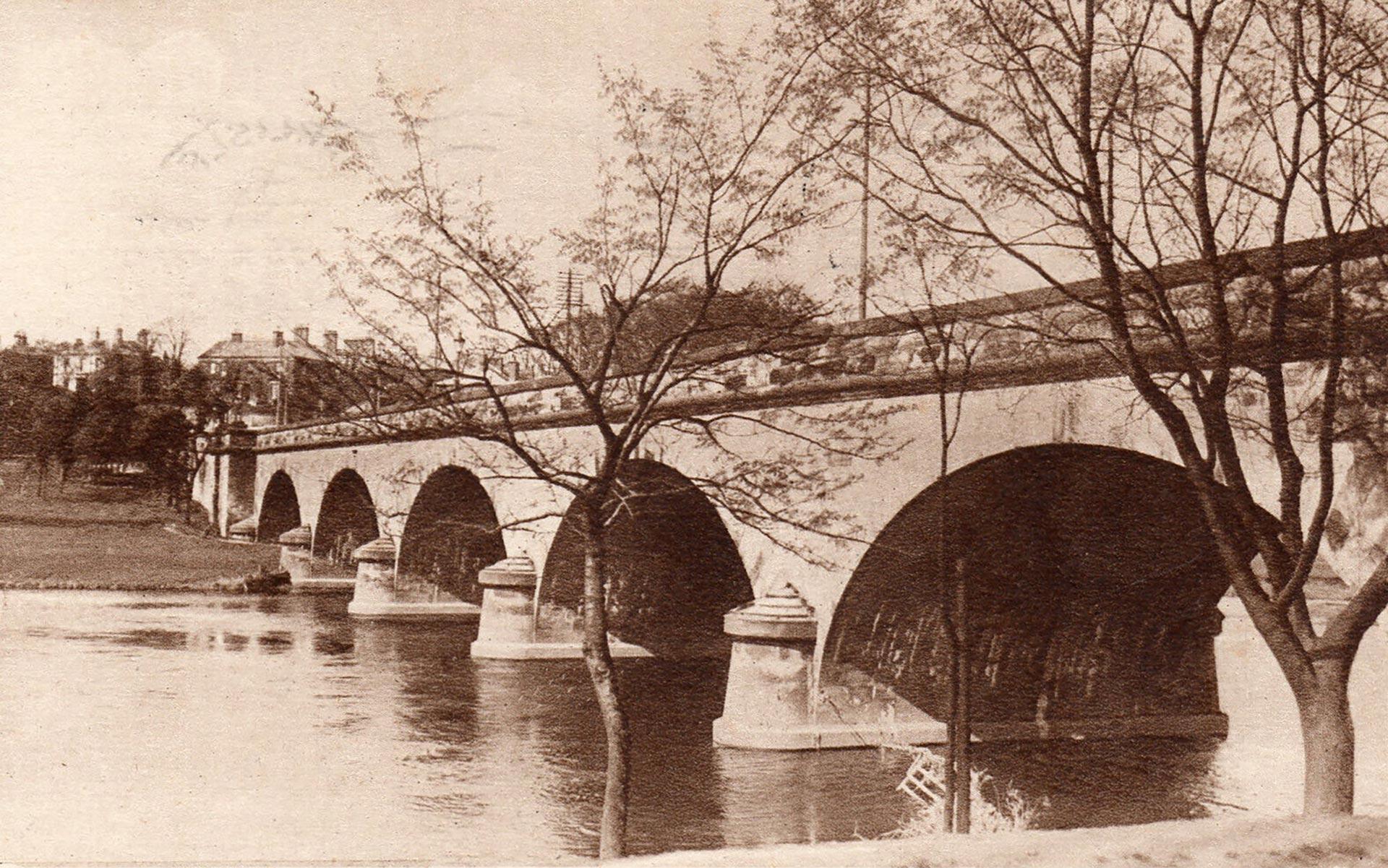
I start at the footpath, with a view of the River Eden and the arched Eden Bridge. Over the years the trees have grown, making it difficult to take the remake due to the branches and leaves.
The footpath is busy with people walking to the university and people walking their dogs. A woman asks what I am doing. When I explain, she assumes it is a university project.
Stanwix

I walk across Eden Bridge to Stanwix on the river’s north bank. Stanwix was an old parish that was gradually incorporated into Carlisle in 1887 and 1951, and it is now a city district. Stanwix means ‘stone wall(s)’ and is situated on the site of a Roman fort known as Uxelodunum or Petriana.
During the Middle Ages, two wooden bridges were constructed over the River Eden’s two branches. One of the bridges deteriorated over time, while the other collapsed. In 1600, Queen Elizabeth I (r. 1558-1603) ordered the reconstruction of both bridges in stone. The north bridge was named Priest Beck Bridge, while the south bridge was called Eden Bridge.
Over 200 years had passed before the government decided to reconstruct the bridges. The project commenced in 1812 and was completed in 1815, resulting in a single bridge designed by Robert Smirke. The new bridge, also known as Eden Bridge, was built over the northern branch of the river, with five elliptical arches. On the other hand, the southern bridge was reduced to a mere causeway. The government contributed to the bridge’s costs as it was part of a national route to the north.
Charles G. Harper wrote in his Guidebook. The Manchester and Glasgow Road, published in 1907: “… the noble Eden Bridge, carrying the road across the river to Stanwix. The bridge, built a hundred years ago, is monumental, and even the lamp-standards, designed for it at the same time are fine. But the over-head trolley-wires are an offence to the spirit of the thing, and the city of Carlisle cares so little for it that ugly electric light standards are placed at intervals, and the fine old iron lamps that might so easily and handsomely been adapted, now serve no useful purpose.”
In 1932, the Carlisle City Council initiated a plan to widen the bridge. This scheme was proposed to provide employment opportunities for the local unemployed population affected by the Great Depression. Thomas Mawson designed the plans, and Percy Dalton, the city’s engineer, oversaw the project. As a part of this project, a row of houses on the Stanwix side, known as Eden Terrace, was demolished. The rubble from these houses was used to create a garden in the same location. The garden provided a beautiful view of the bridge for the people of Carlisle.
This garden was established in 1933 as an extension of Rickerby Park. It serves as a War Memorial for the counties of Westmorland and Cumberland. It provides pedestrian access to the park from the main road and Eden Bridge.
Designed by Prentice Mawson, son of a nationally recognized architect, the garden features planted borders, shrubberies, and ornamental ponds, officially known as Eden Bridge Memorial Garden.
The names Chinese Gardens or Japanese Gardens are often used to refer to the gardens. Still, in reality, there is nothing particularly Oriental about the design. Thomas Mawson was famous for his grand Italianate garden designs in stately homes, such as Rydal Hall in Cumbria. The association with the Oriental style may be due to the topiary in the gardens.
With numerous sitting places for quiet contemplation overlooking the city and the river, I take my time to enjoy the atmosphere with traffic rushing nearby. Examining the postcard, it is clear that the photo was taken from above the lower, circular garden area. To set up my tripod, I navigate through the scrub and brambles.
With four lanes of traffic, a cycle path and a footpath on each side, the Grade I listed Eden Bridge is likely to be busy at any time of the day.


Memorial Bridge

The next destination is the Memorial Bridge in Rickerby Park, which acts as a pedestrian and cycle link to the eastern part of Carlisle. The bridge was built in 1922 by local craftsmen using around 100 tons of steel and boasts an impressive single span of 200 feet. The bridge is situated where the River Eden and the much smaller River Petteril meet.
I park my car in a parking lot at the park entrance on Brampton Road. As I walk along the impressive Rickerby Cenotaph, which was unveiled by the Earl of Lonsdale in May 1922, I notice a herd of cows near the Memorial Bridge. About a dozen of them are grazing near the spot where I have to place my tripod. Fortunately, the animals do not seem to mind my presence and continue grazing.
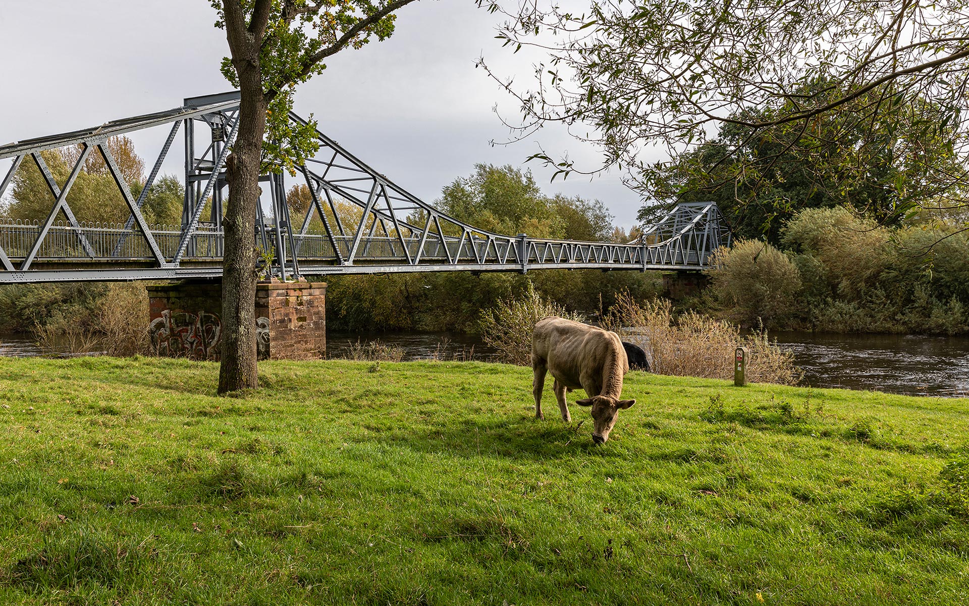
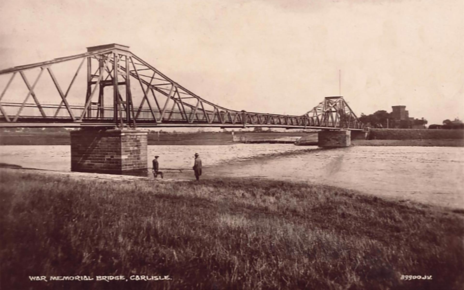
Most of the morning is gone, so I have to play catch up with my husband, who walked on this bridge several hours ago.
Ordnance Survey Maps


Re-use: CC-BY (NLS).
Story 4
Crosby-on-Eden (will come soon)