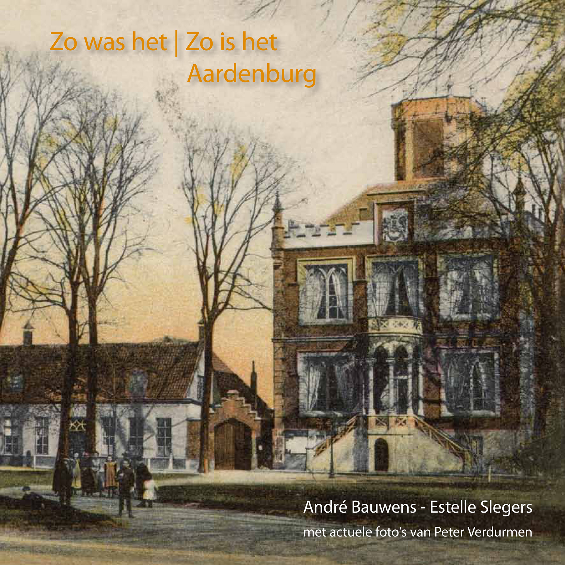
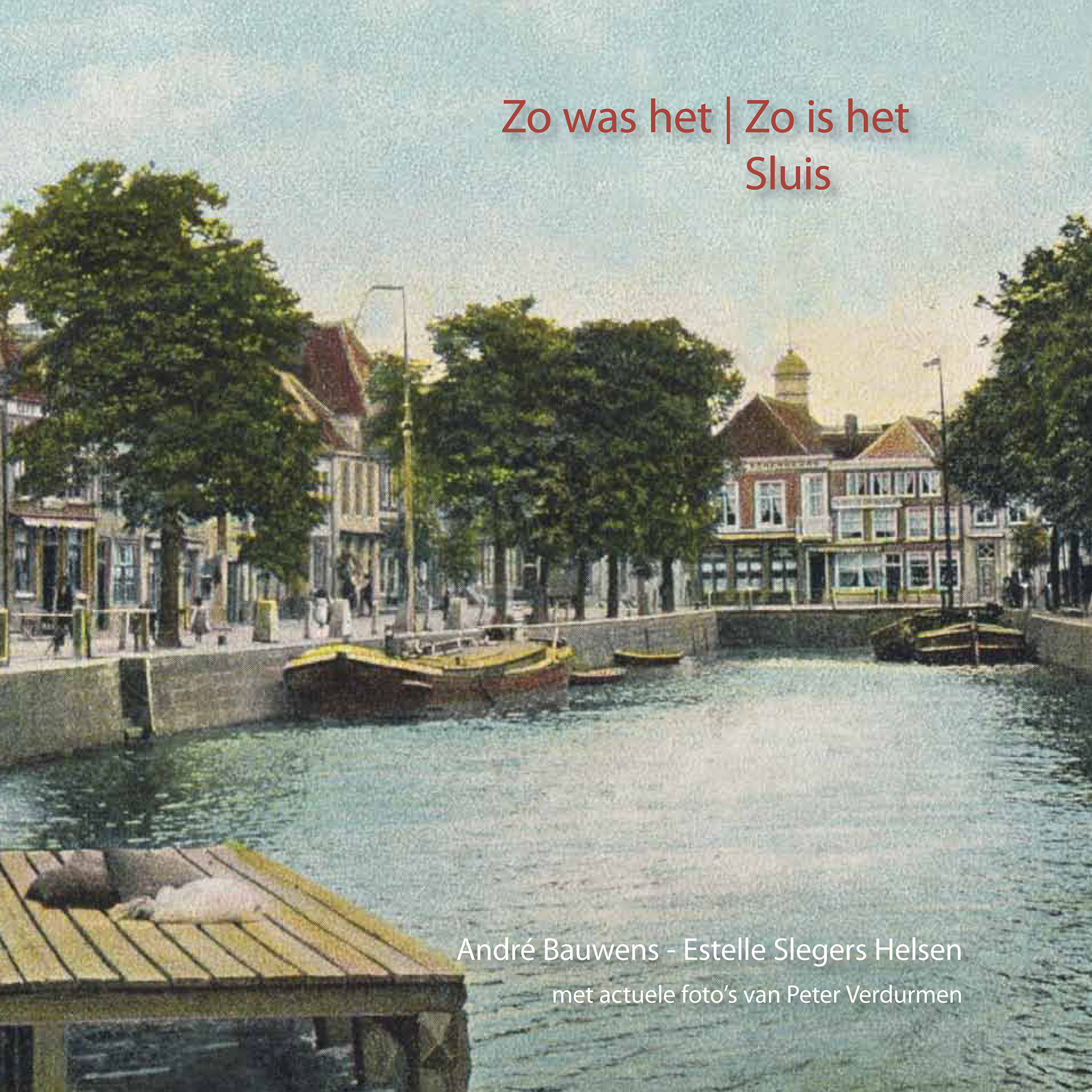
In 2014 historian André Bauwens, history researcher Estelle Slegers Helsen and photographer Peter Verdurmen highlighted the past and present of the main streets in Sluis, a small Dutch city near the Belgian border. This is article #4.
In 2014 realiseerden historicus André Bauwens, onderzoekster Estelle Slegers Helsen en fotograaf Peter Verdurmen een reeks over vroeger en nu in Sluis, een stadje in Nederland op de grens met België. Dit is artikel #4.
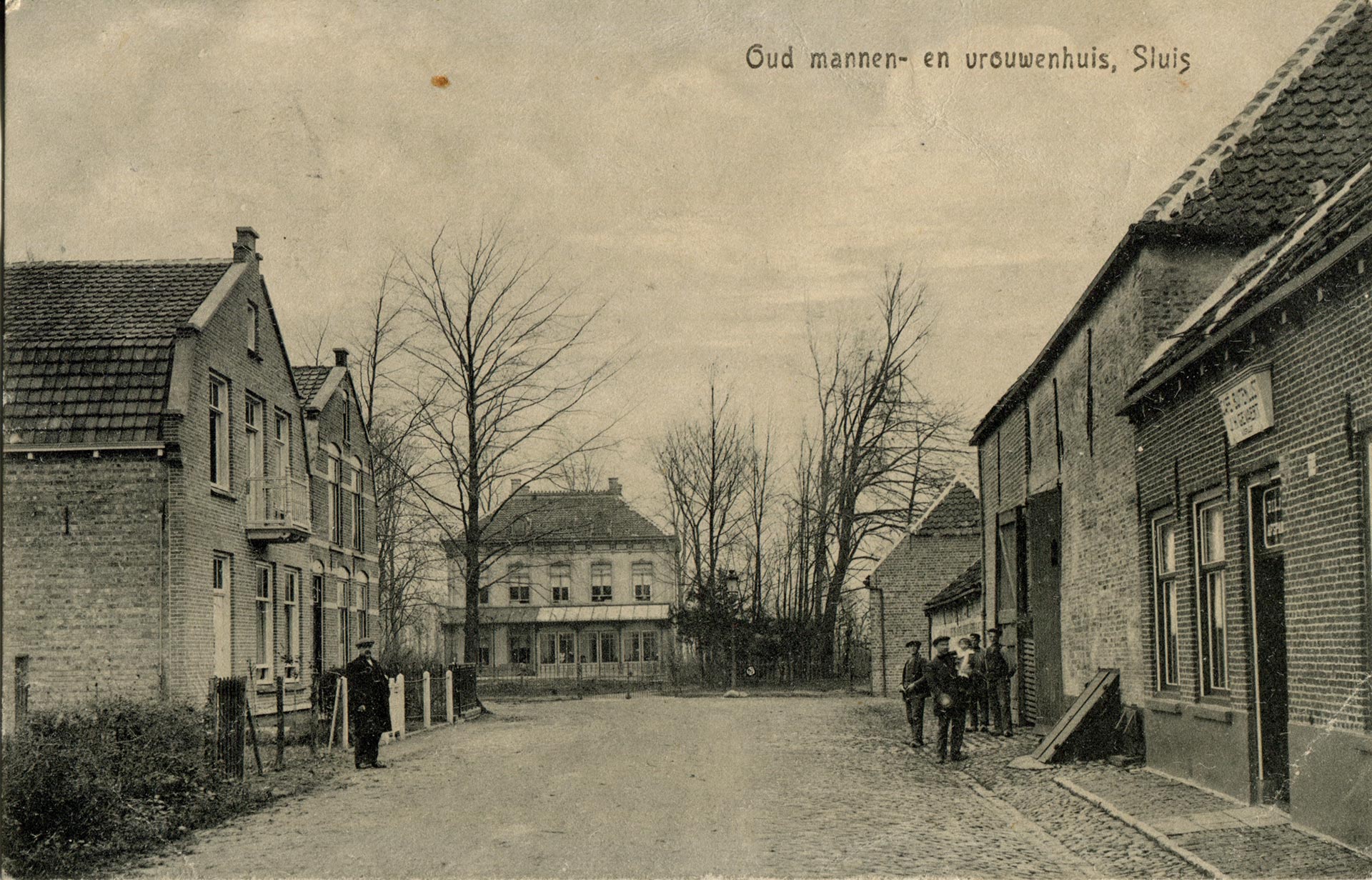
(EN) The north end of the Hoogstraat around 1920, seen from the centre of Sluis. In the background Rozenoord, once the villa with the same name owned by the Blankert family. Gevaert held a café on the far right.
“The pastor, the mayor, the doctor and a few retired farmers lived in the first part (the south end) of the Hoogstraat. Labourers lived near Rozenoord, at the north end of the street. They were all farm workers,” says Charles Verstraete.
(NL) Het einde van de Hoogstraat omstreeks 1920 vanuit het centrum van Sluis gezien. Op de achtergrond Rozenoord, ooit de gelijknamige villa van de familie Blankert. Uiterst rechts hield Gevaert café.
“In het eerste deel van de Hoogstraat woonden de dominee, de burgemeester, de dokter en een paar boeren op rust. In de buurt van Rozenoord, aan het eind van de straat, huisden meer werkmensen. Het waren allemaal landarbeiders”, weet Charles Verstraete.

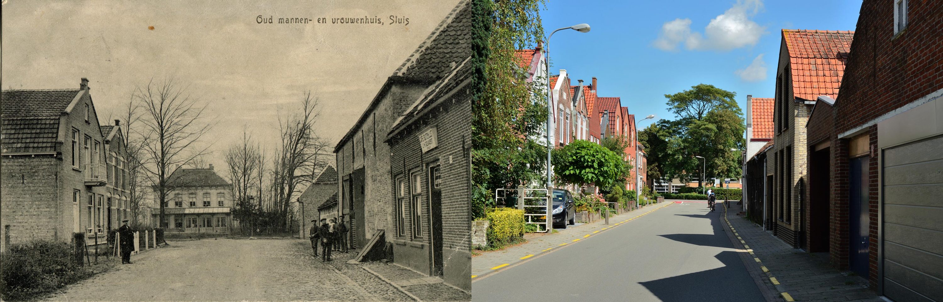
Then – The north end of the Hoogstraat around 1920, seen from the centre of Sluis. In the background Rozenoord, once the villa with the same name owned by the Blankert family. Gevaert held a café on the far right. | Now – The north end of Hoogstraat in 2013.
Toen – Het einde van de Hoogstraat omstreeks 1920 vanuit het centrum van Sluis gezien. Op de achtergrond Rozenoord, ooit de gelijknamige villa van de familie Blankert. Uiterst rechts hield Gevaert café. | Nu – Het einde van de Hoogstraat in 2013.
(EN) Charles Verstraete continues: “The Kapellestraat was an upmarket street without side entrances. In the Oude Kerkstraat were many small houses and in between the back entrances of the houses in the Kapellestraat.” He also remembers that there were workers’ houses on the Beestenmarkt: “A whole row. The people who lived there worked for farmers or were labourers. They also lived near the windmill in the Nieuwstraat.” Before the Second World War, several patrician houses stood on the Markt. “They were divided into two, sometimes three homes,” says André D’hoore.
In the past, Sluis had cobblestone streets. René Heijens: “The pavement was a mixed bag, with or without a doorstep. It was all different. Some were chained off, so you had to get off the pavement. Others had a doorstep or a basement trap, which made a cellar easily accessible from the street.” Before the Second World War, transport was almost exclusively by horse. “Sometimes something fell on the street. That was for the sparrows. The streets were not cleaned,” says Charles Verstraete. “After the war, everything was paved again,” George van Poecke testifies: “The random clinker bricks and tiles were cleared and replaced.”
Sluis has a bypass, but even now, cars can drive through the shopping streets. Before the construction of the bypass, all traffic had to go through the city centre. “When motorists had to wait, disputes began,” recalls Julien du Fossé. Loading and unloading usually caused delays. “When I had a delivery,” says the former beverage merchant André D’hoore, “the cars sometimes stood in a queue up to the boarding house on the other side of Sluis. Mayor Van Hootegem suggested moving my business along the Vrijstraat to the vacant shoe factory along the Sint-Annaweg.” “Other villages were not in favour of a bypass, but Sluis, especially the mayor, was,” concludes Julien du Fossé.
(NL) Charles Verstraete vervolgt: “De Kapellestraat was een chiquere straat. Er waren daar geen poortjes. In de Oude Kerkstraat stonden veel kleine huizen met daartussen achteruitgangen van de huizen in de Kapellestraat.” Voorts herinnert hij zich nog dat er op de Beestenmarkt werkmanshuisjes stonden: “Een hele rij. De mensen die daar woonden, werkten bij boeren of waren arbeiders. Ook aan de molen in de Nieuwstraat woonden landarbeiders en boerenknechten.” Voor de Tweede Wereldoorlog stonden aan de Markt een aantal patriciërshuizen. “Die waren opgedeeld in twee, soms drie woningen”, zegt André D’hoore.
In Sluis lagen in de straten kinderkopjes. René Heijens: “Iedereen legde zijn stoep zoals hij zelf wou, met of zonder dorpel, allemaal verschillend. Sommigen hadden er nog een ketting naast. Dan moest je van de stoep af. Anderen hadden trapjes. Of er was een kelderval. Dat maakte een kelder makkelijk toegankelijk vanaf de straat.” Vervoer ging voor de Tweede Wereldoorlog bijna uitsluitend per paard. “Er viel wel eens wat op straat. Dat was voor de mussen. De straten werden niet schoongemaakt”, zegt Charles Verstraete. “Na de oorlog werd alles opnieuw bestraat”, getuigt George van Poecke: “Allerlei soorten klinkers en tegels werden opgeruimd en vervangen.”
Ook nu rijden er nog auto’s door de winkelstraten. Voor de aanleg van de rondweg moest echter alle verkeer door het centrum. “Chauffeurs moesten wachten en dan was het ruzie”, herinnert Julien du Fossé zich. Laden en lossen was meestal de oorzaak van het oponthoud. “Wanneer bij mij werd gelost”, zegt de vroegere drankhandelaar André D’hoore, “stonden de auto’s soms stil tot aan het pensionaat, dat is de andere kant van Sluis. Burgemeester Van Hootegem stelde voor om mijn zaak aan de Vrijstraat te verhuizen naar de leegstaande schoenfabriek aan de Sint-Annaweg.” “Nergens waren ze voor een rondweg, maar wel in Sluis en vooral de burgemeester”, besluit Julien du Fossé.
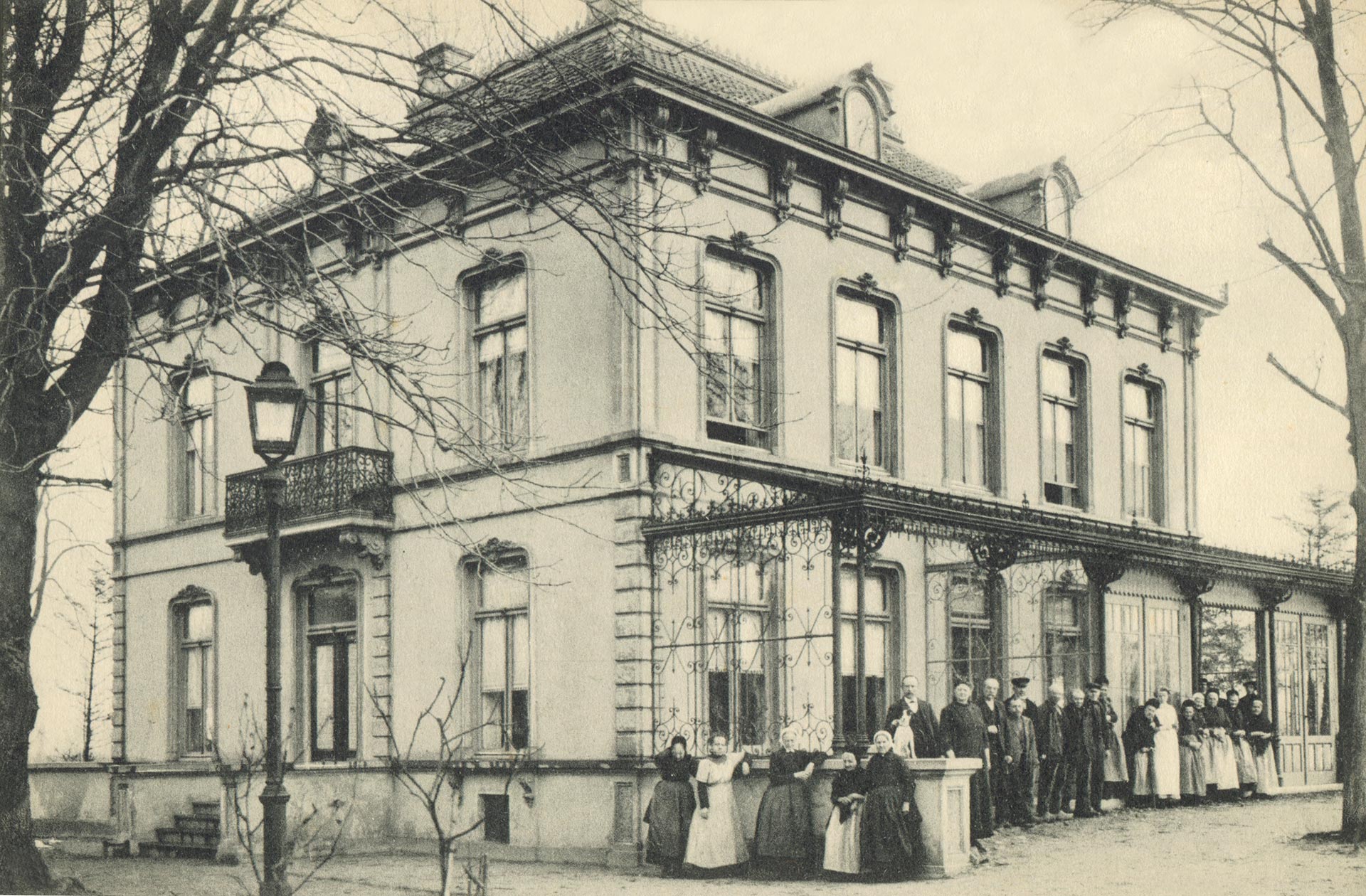
In 1913 the Vereniging Protestantsch Tehuis bought the villa Rozenoord to help the elderly, the poor and the disabled. Many elderly people have spent their last years of life there. In this photo from 1917, the care staff and the managers. The residents, men and women separated, are often still in traditional costumes.
In 1913 kocht de Vereniging Protestantsch Tehuis de villa Rozenoord om hulp te kunnen bieden aan ouden van dagen, armen en gehandicapten. Tal van bejaarden hebben er hun laatste levensjaren doorgebracht. Op deze foto uit 1917 poseren de bewoners – mannen en vrouwen gescheiden – veelal nog in dracht, verzorgend personeel en de leidinggevenden.
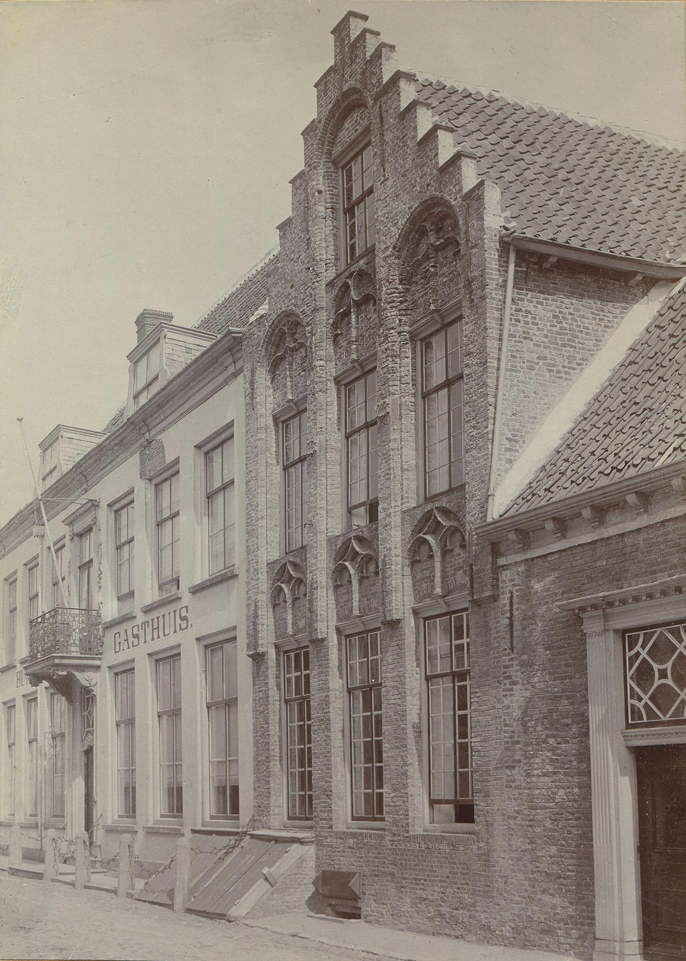
Until the end of the Second World War, more to the city centre, where the residential care complex Het Rondeel is located, stood the Burgergasthuis, a hospital. To the right was a beautiful 16th-century building with crow-stepped gables. Before the Second World War, two families lived there. After the liberation at the end of 1944, the front part of this building was still standing, yet it was demolished.
Wat meer naar het centrum, daar waar het woonzorgcomplex Het Rondeel gevestigd is, stond tot eind Tweede Wereldoorlog het Burgergasthuis, dat een functie had in de ziekenverpleging. Naast het gasthuis stond een fraai pand met trapgevel uit de zestiende eeuw. De jaren voor de Tweede Wereldoorlog woonden er twee gezinnen. Na de bevrijding in 1944 stond de gevel van dit pand nog recht. Toch werd het afgebroken.
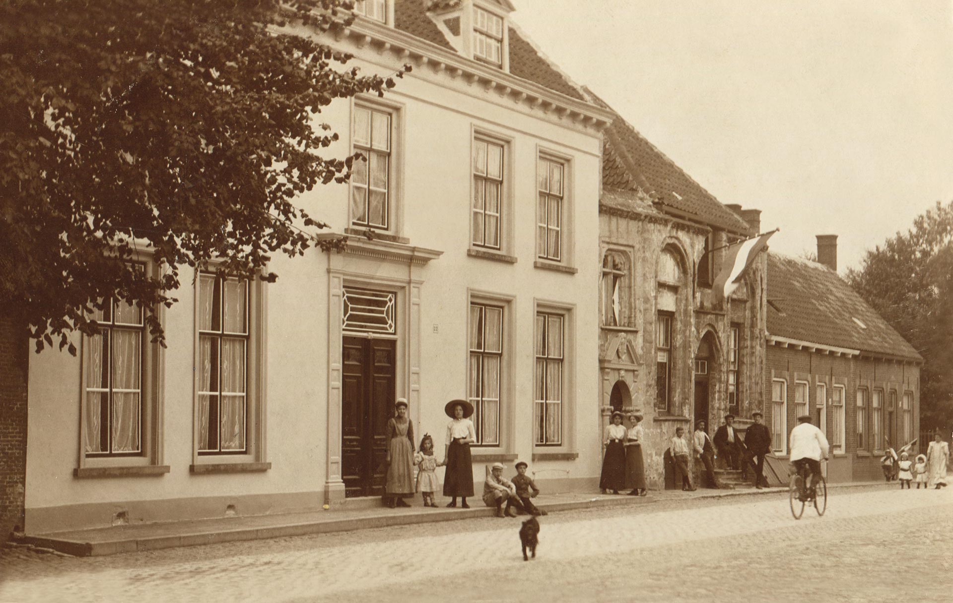
The presbytery of the Dutch Reformed Church around 1910 with the St Peter’s Chapel next to it. The public school was opposite the street.
De Nederlands hervormde pastorie omstreeks 1910 met ernaast het zogenaamde Kapelletje of Sint-Pieterskapel. Tegenover de pastorie stond de openbare school.
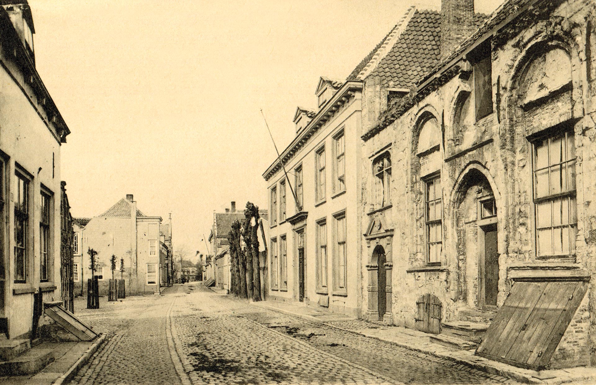
On the right, the St. Peter’s Chapel adjoining the presbytery of the Dutch Reformed Church. Rozenoord is in the background. Before the Second World War, The 15th-century St. Peter’s Chapel was the oldest building in Sluis. Initially, the building was perhaps broader and higher. It has clearly been renovated. Despite the name, it is most likely a merchant’s residence. In 1895 it was bought during a public auction by Victor de Stuers, widely regarded as the father of historic preservation in the Netherlands. His daughter donated the building to the Hendrick de Keyser Society in 1932. During the bombing of Sluis in October 1944, St. Peter’s Chapel was heavily damaged and was subsequently demolished.
Rechts de Sint-Pieterskapel, daarachter de Nederlands hervormde pastorie. Op de achtergrond Rozenoord. De Sint-Pieterskapel was voor de Tweede Wereldoorlog het oudste gebouw van Sluis. Het dateerde uit de vijftiende eeuw. Wellicht was het pand oorspronkelijk breder en hoger. Er is duidelijk het nodige aan verbouwd. Ondanks de naam is het hoogstwaarschijnlijk een koopmanswoning geweest. In 1895 werd het tijdens een openbare veilig gekocht door Victor de Stuers, de grondlegger van de monumentenzorg in Nederland. Zijn dochter schonk het pand in 1932 aan Vereniging Hendrick de Keyser. Tijdens het bombardement op Sluis in oktober 1944 raakte de Sint-Pieterskapel zwaar beschadigd en werd daarna afgebroken.
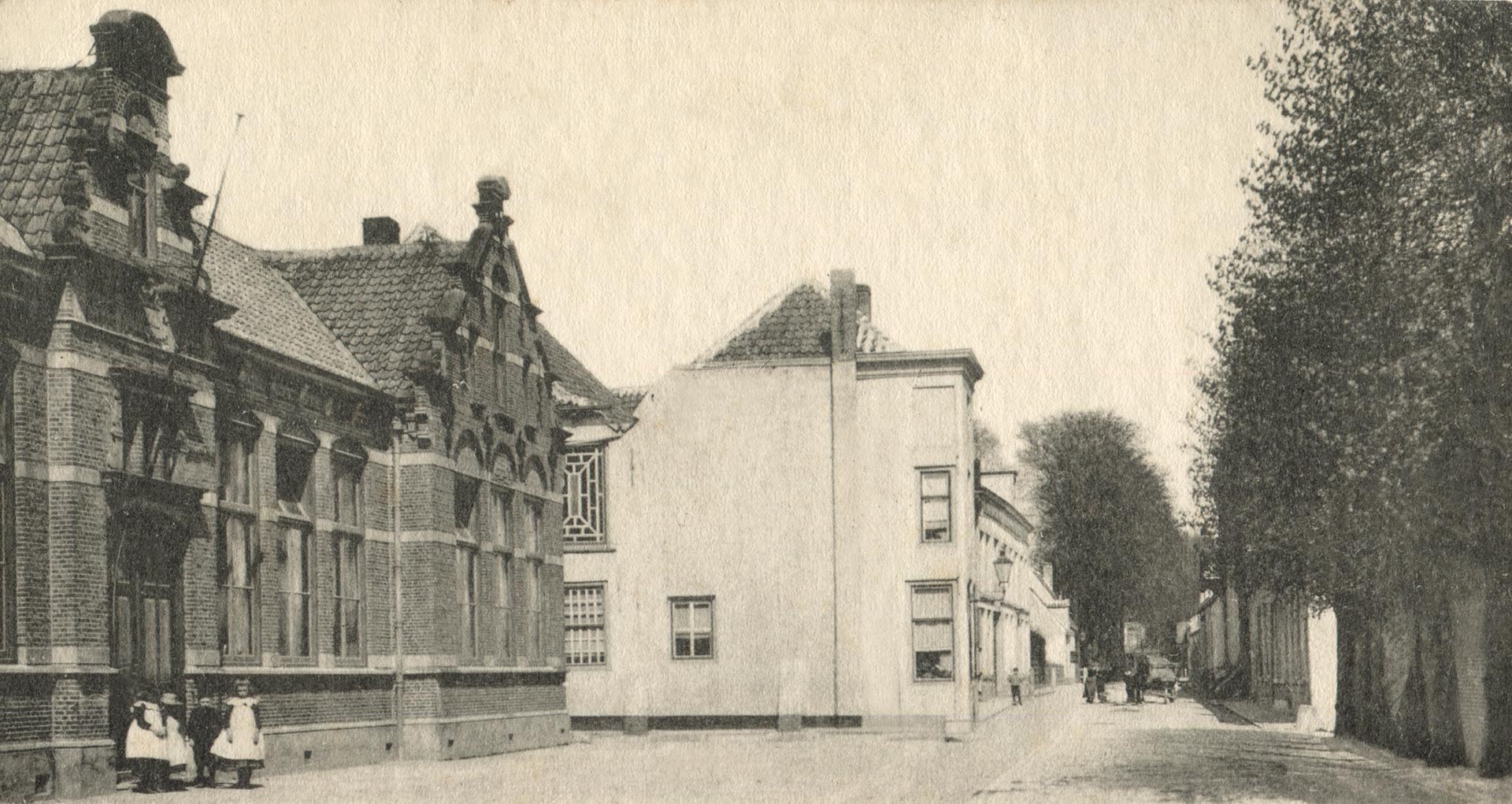
On the left the public school on Hoogstraat shortly after 1900. The L-shaped school of 188, in Neo-Renaissance style, contained four classrooms. Also, note the house behind the school with an atypical window at the top left.
De openbare school aan de Hoogstraat kort na 1900. In deze L-vormige school in neorenaissancestijl, gebouwd in 1883, waren vier klaslokalen. Let ook op de woning achter de school met linksboven een bijzonder venster.
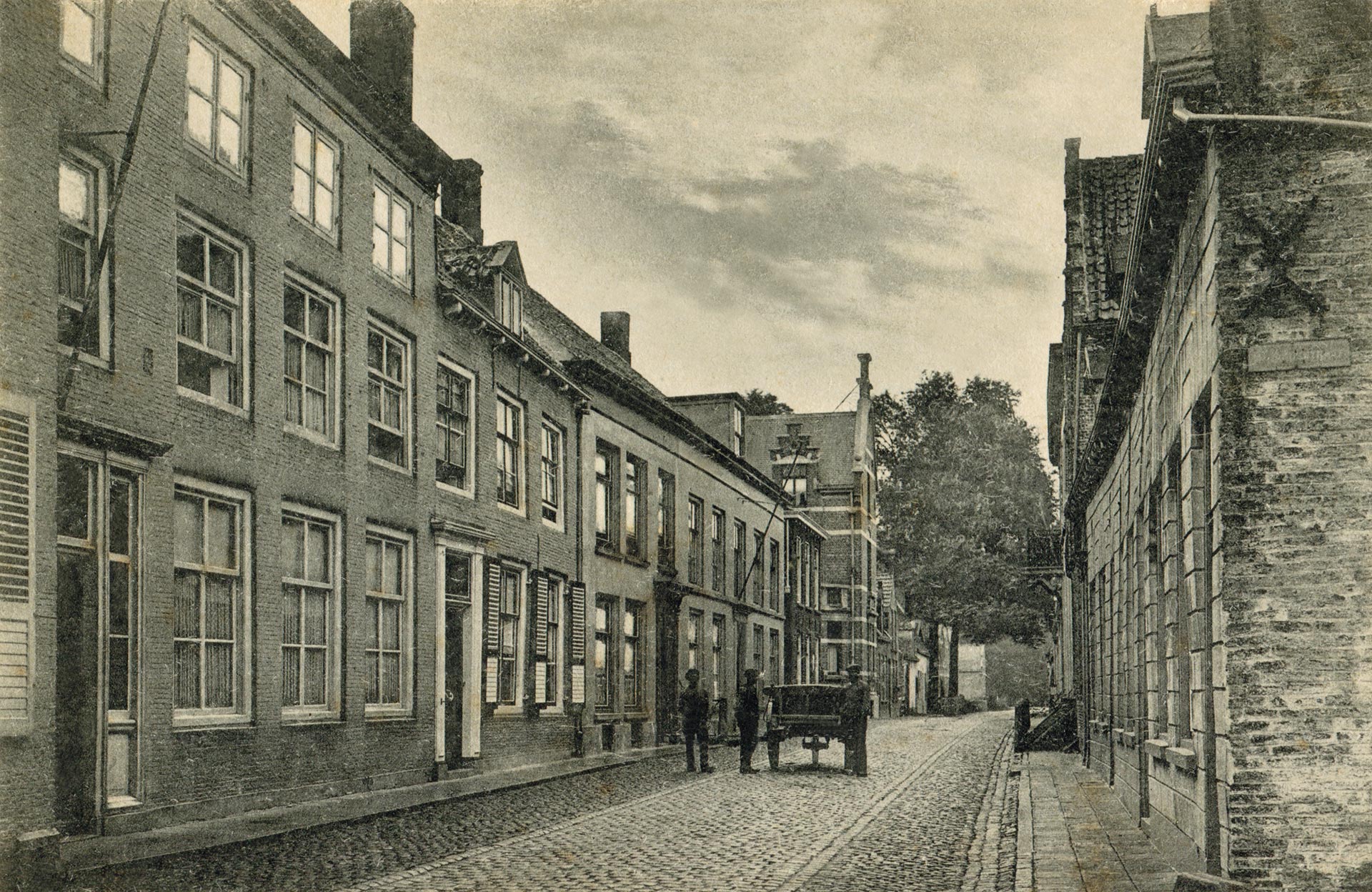
The Hoogstraat around 1920 with the public school in the background. The headmaster of that school, Mr Kerpestein, lived in the house on the left with the white door frame.
De Hoogstraat omstreeks 1920 met op de achtergrond de openbare school. Het hoofd van die school, meester Kerpestein, woonde in het huis links met de witte deurpost.
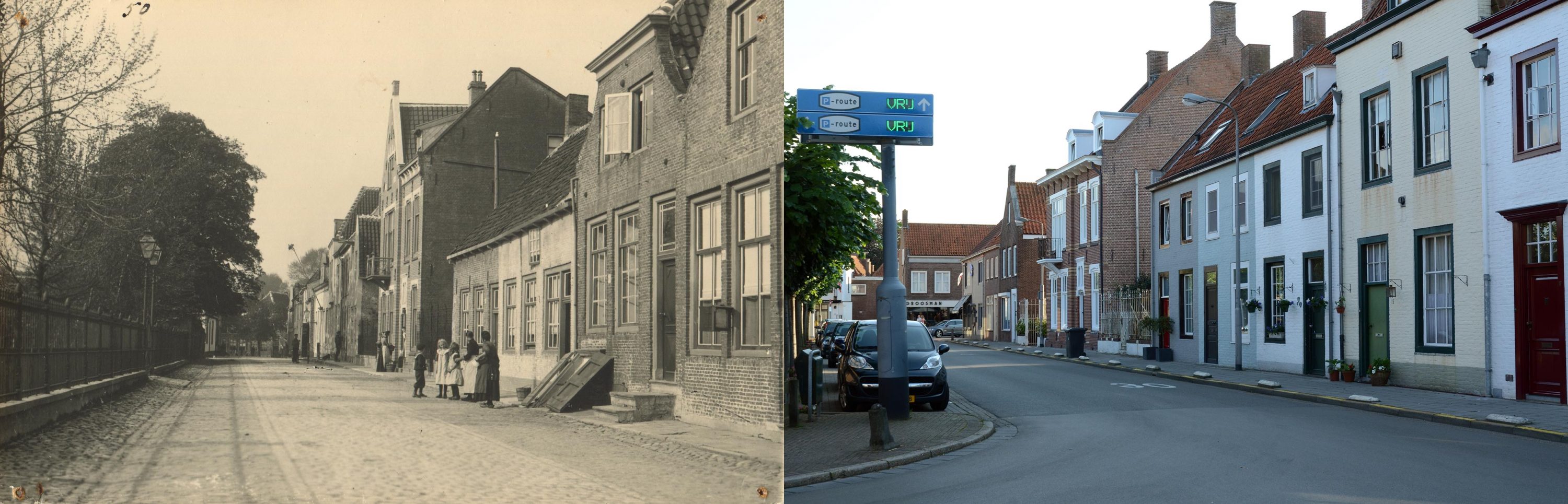
(EN) The Hoogstraat from the corner with the Lange Wolstraat in the direction of the Kaai around 1910. On the left is the fence that surrounded the grounds of the Dutch Reformed Church. The house on the far right has a gossip mirror, a mirror with angled panes for mounting on the outside of a window, for viewing the street to the left and right of the window from inside, which were common at the time. There is a cellar trap door in front of the next house, one of the many in Sluis at the time.
(NL) De Hoogstraat vanaf de hoek met de Lange Wolstraat in de richting van de Kaai omstreeks 1910. Links het hekwerk dat het terrein van de Nederlands hervormde kerk omzoomde. Aan de woning uiterst rechts hangt een spionnetje bij het raam. Dergelijke spiegels, waardoor de bewoners van een huis konden zien wie er kwam aanlopen of wie er voor de deur stond, waren toentertijd gebruikelijk. Voor de volgende woning ligt een kelderval, een van de vele die Sluis toen rijk was.

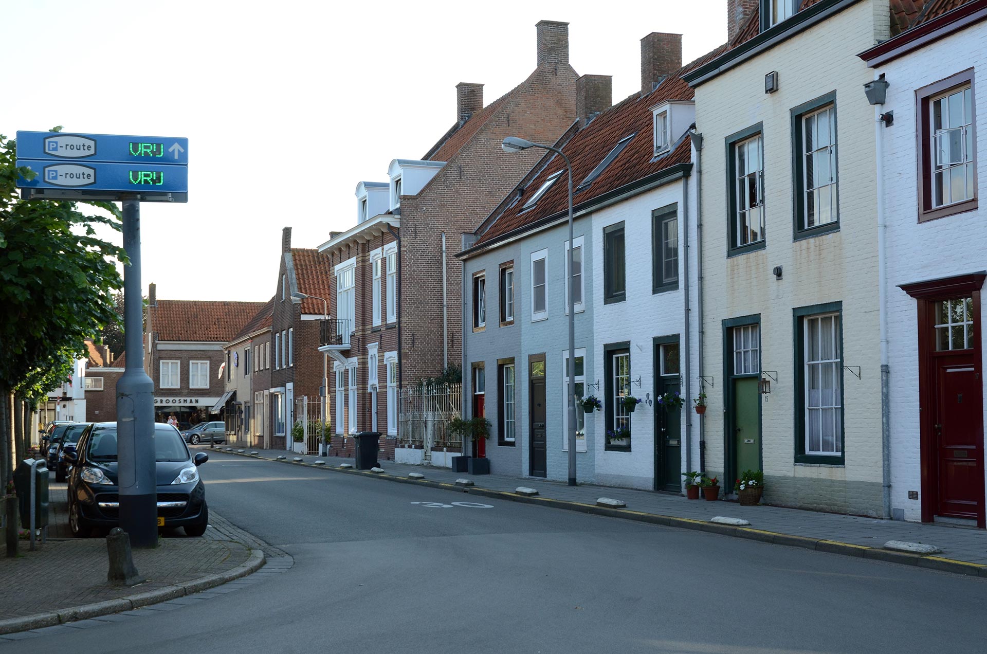
Then – The Hoogstraat from the corner with the Lange Wolstraat in the direction of the Kaai around 1910. | Now – The south end of Hoogstraat in 2013.
Toen – De Hoogstraat vanaf de hoek met de Lange Wolstraat in de richting van de Kaai omstreeks 1910. | Nu – De Hoogstraat in 2013.

View of a part of the Hoogstraat that has disappeared. The photo dates from around 1918. It shows the street from the corner of the Kaai toward the Dutch Reformed Church. Initially, the Hoogstraat continued to the Kaai. After the liberation of Sluis in 1944, for traffic reasons, it was decided to direct traffic from the Hoogstraat by a new road and Walplein in the direction of the Kaai to drive to Sint-Anna ter Muiden. On the left are the adjacent bakeries of Almekinders and Leijsennaar.
Zicht op een uit het straatbeeld verdwenen stukje Hoogstraat. De foto dateert van omstreeks 1918. Het toont de straat vanaf de hoek met de Kaai in de richting van de Nederlands hervormde kerk. Oorspronkelijk liep de Hoogstraat door tot op de Kaai. Na de bevrijding van Sluis in 1944 werd om verkeerstechnische redenen besloten het verkeer vanuit de Hoogstraat via een nieuwe weg en het Walplein in de richting van Sint-Anna ter Muiden of de Kaai te leiden. Links woonden naast elkaar de bakkers Almekinders en Leijsennaar.
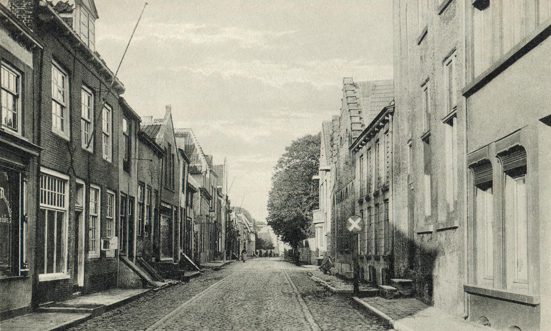
The same part of the Hoogstraat around 1905. On the left are several cellar trap doors. The street sign on the right warns that a tram could come from the Vrijstraat.
Hetzelfde stukje straat omstreeks 1905. Links een aantal keldervallen. Het bord rechts maant tot voorzichtigheid. Er kon vanuit de Vrijstraat een tram komen.
More pictures
Click on the thumbnails to enlarge / Klik op de miniaturen om te vergroten
For both places, a book was printed. The book about Aardenburg is sold out. You can still buy copies of the book about Sluis, which is available from the publisher Durenkamp Grafimedia. Contact us.
Over beide plaatsen werd een boek gepubliceerd. Het boek over Aardenburg is uitverkocht. Het boek over Sluis is nog steeds te koop via de uitgever Durenkamp Grafimedia. Zo was het | Zo is het Sluis kost € 17,50. Verzendkosten (in Nederland € 7,50) . Stuur een bericht voor meer informatie.