Photographer and historical researcher Estelle Slegers Helsen has been wandering around Lochaber in the footsteps of the Scottish photographer W.S. Thomson MBE (1906-1967). Since 2021, she has taken photographic remakes for roughly 75 years after Thomson initially captured the landscape and has talked to local people along her journey. This page combines articles #13 and #22.
Ormsaigbeg

More than a year after my last visit to Ardnamurchan, I still vividly remember my search for Thomson’s black-and-white photograph, Kilchoan from the West, published in Let’s See Ardgour and Ardnamurchan.
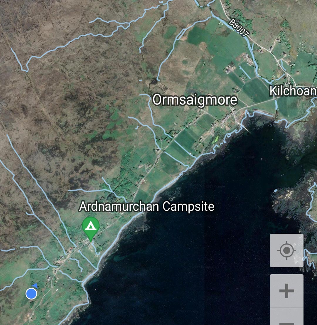
In June 2022, my tent is pitched in the heart of Ormsaigbeg, only half a mile from where Thomson took his photo. Nevertheless, I drive up the road to Cuingleum at the end of the hamlet. On my way, I have to wait patiently because a man in a bright yellow truck with a hydraulically-operated boom is repairing potholes in the single-track road.
After parking on a small vacant piece of land, I climb up the hill through a maze of old dry stone walls. To my surprise, the rocks in the foreground of Thomson’s photograph are still there. Only one, on the far right, has tumbled down the hill. A bright sun is shining on the lovely green, blue and brown colours. I count many more houses and sadly, the crofting landscape has disappeared.

Back at the Puffin Cafe on Pier Road, I meet Helen Sonachan to talk about the old photograph and the present-day view. She identifies herself as indigenous, her family having lived in Ardnamurchan for generations. “Most of the people who arrived in Ormsaigbeg came from Bourblaige, a settlement on the south-east flank of Ben Hiant, brutally cleared in 1828 by the Riddell Family, who owned the peninsula.”
Originating from the Middle Ages, Ormsaigbeg clachan was situated uphill between the Ferry Stores(closed since October 2025) and Greadal Fhinn, a neolithic chambered cairn. The hamlet consisted of about a dozen buildings, organised as a nucleated structure, and was abandoned entirely in the early 1800s. In the 19th century, Sir James Riddell, 2nd Baronet of Ardnamurchan and Sunart, created the new township of Ormsaigbeg at the southwest end of Kilchoan.
Helen explains: “The neatly separated Ormsaigbeg crofts ran in strips from the dry stone wall of the common grazings up the hills, down to the sea. It was – and still is – impoverished land. Only at the end close to the sea was the land good for crops. A cow provided milk, and sheep were kept on the common grazings. Additionally, the tenants collected kelp for the phosphate industry and went out into the Sound of Mull to fish.”
“The women and children worked the crofts. The men would have to go away to work, to pay the rent,” Helen adds. “A lot of my family worked as railway porters in Glasgow. My great-grandfather and grandfather were sea captains on the Irish ships, ferrying between Glasgow and Dublin. Whenever possible, about every three months, they came home to work on the croft.”
“My granny used to say that after the war, the local women and the land girls from the cities had rallied together and created a strong bond. They were proud of their efforts to produce food and help win the war. When the men returned, the women were resentful of their situation. It was hard for them to adapt to the fact the men were the boss.”
After the Second World War, men who had fought received grants from the government to upgrade their low thatched houses by adding a second floor and corrugated roof, as you can see in Thomson’s photograph. When he roamed the peninsula at the end of the 1940s, crofting was still the way of life in Ormsaigbeg.
Helen continues: “In the 1940s and 1950s, most crofting people were still poor. That started to change when tourism came in the early 1960s. In May, the houses were cleaned out for the holidaymakers. We lived in the outhouse, which we called The Hut, until October. Then we returned to the house for the long winter.”
In the 1980s, a lot of houses were abandoned. For the owners, their properties were seen as just cash. “Blow ins, people from outside Ardnamurchan, Lochaber and even Scotland started buying houses. They stayed in or rented out their properties for the summer months. In winter, Kilchoan was deserted.”
“The next thing to happen was that people bought houses as a business, sending prices sky high and local people couldn’t afford to buy them. Indigenous people still live in the village because of specific crofting legislation that has been in place since 1886, ensuring security of tenure, fair rents and compensation for permanent improvements.”
Thomson’s black-and-white photo and my remake span the whole length of Kilchoan, from nearly the last house in Ormsaigbeg to the last house on Pier Road tucked in between the wide and shallow Kilchoan Bay and a part of the Ardnamurchan Ring Complex.
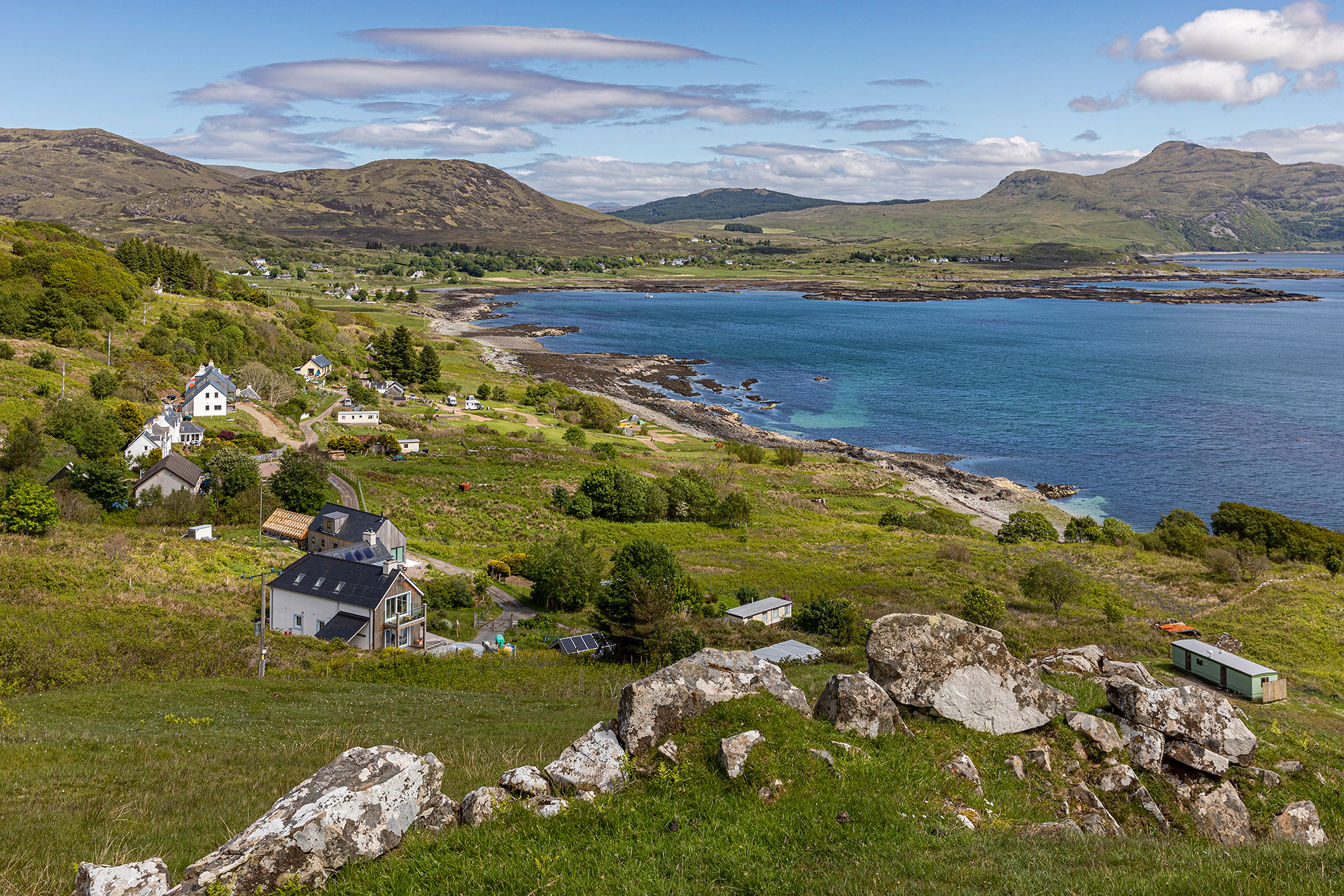
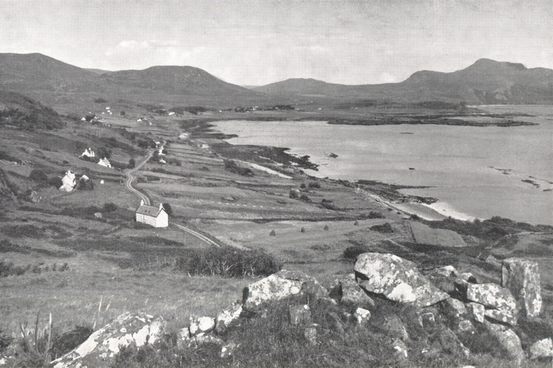
Move the slider to discover what changed.
Then (left) – Late 1940s © W.S. Thomson – Kilchoan from the West. Published in Let’s See Ardgour and Ardnamurchan, p. 17.
Now (right) – May 2022 © Estelle Slegers Helsen – Kilchoan, Kilchoan Bay and Ben Hiant from Ormsaigbeg. Published in Travel in Time. Lochaber, Scotland (New Traces, 2022), p. 37.
On my journeys to Kilchoan, I have noticed that indigenous and blow ins work together, creating a tight-knit community where most do their fair share of volunteering, helping to advance the community. In the past, locals got used to working together, crofting being the backbone of their way to survive. Even in 2023, the local community is prepared for times when they are cut off by landslides nearby and foot passengers-only ferry services.
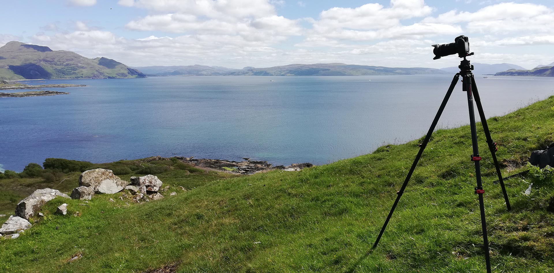
Where I stood for the remake
Mingary Pier

Film footage held in the Moving Image Archive collection of the National Library of Scotland shows a series of images on Mingary Pier, starting with a shot of a Royal Automobile Club signpost pointing to the pier and indicating only ¾ miles to go. At the pier, a group of people are waiting for the boat from Tobermory, the principal town of the Isle of Mull. The boat arrives at speed with Ben Hiant and Mingary Castle in the background, and then moors at Mingary Pier. A handful of men, women and children and a load of supplies are on board. Burlap sacks and wooden crates are landed with a steel-framed hand crane.

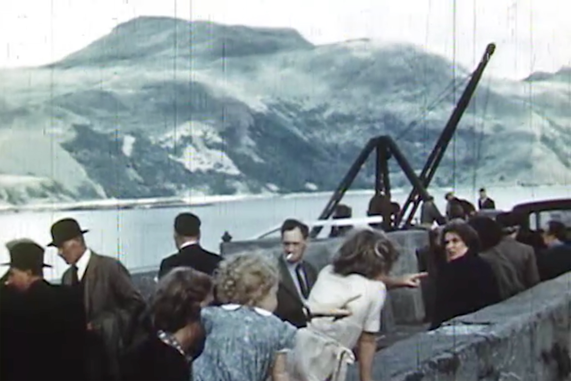
Shotlist for the Mingary Pier sequence
(08:55) Signposts for Mingary Pier and Salen
(09:02) Shot of the pier
(09:10) Group of people on the pier
(09:19) Approaching launch, loaded with supplies
(09:48)The supplies are landed
Screenshots © NLS Moving Image Archive – Film 0932 – Ardnamurchan
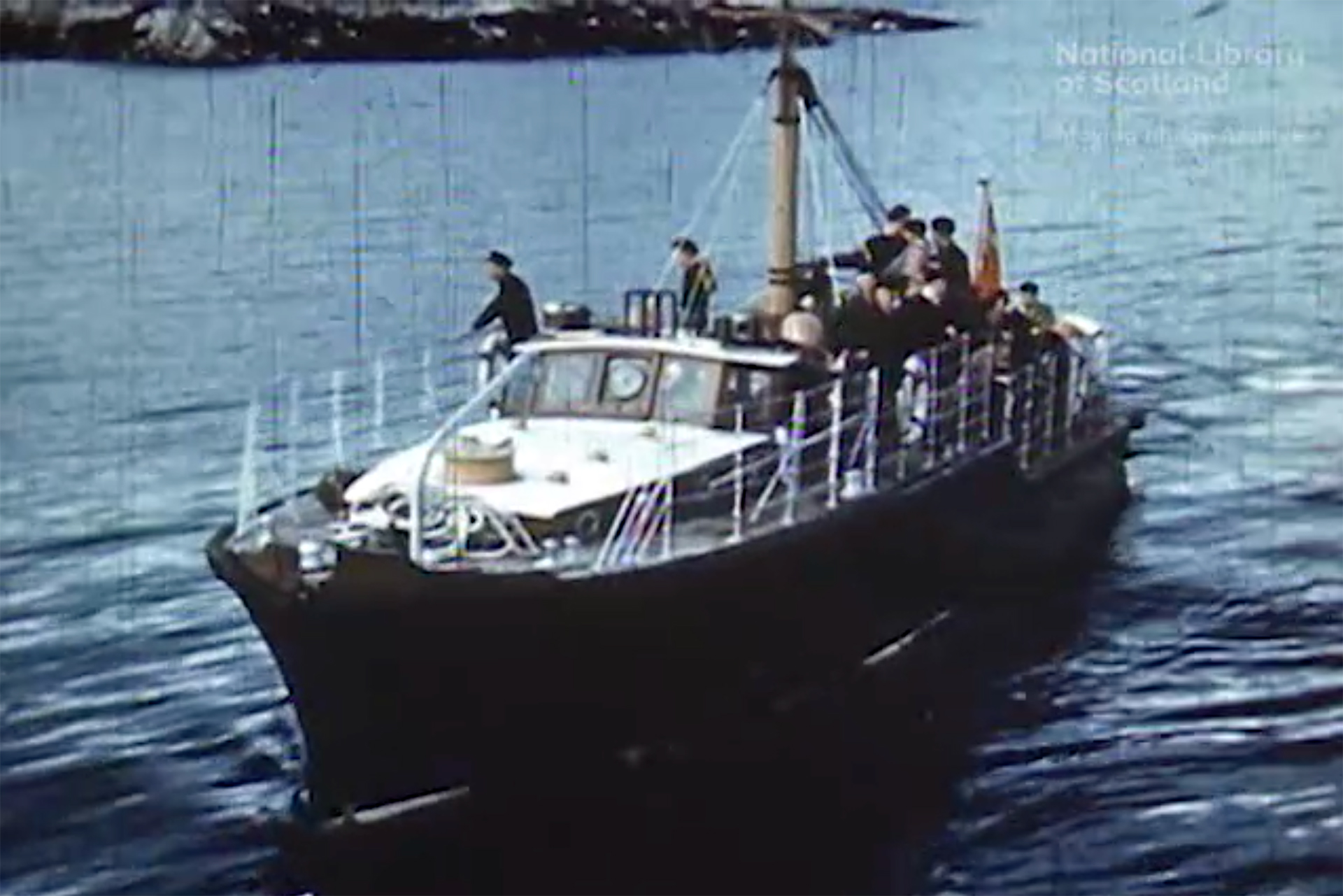

The scenes are part of a film about life in the crofting community on the Ardnamurchan peninsula, made in 1949 or 1950 by the Scottish documentary maker Dr Iain Dunnachie, who won a prize at the 1951 Scottish Amateur Film Festival.
At roughly the same time that Iain Dunnachie recorded his Ardnamurchan film, W.S. Thomson also visited Ardnamurchan, taking a black and white photograph of a deserted Mingary Pier with the mighty Ben Hiant and the ruined Mingary Castle as a backdrop.
A colour remake, taken in May 2022, more than 70 years later, shows almost a duplicate of Thomson’s old photograph. Only the fence in the foreground has changed, the hand crane is gone, and the remains of the 13th-century Mingary Castle have been turned into a high-end “restaurant with rooms”, painted white.
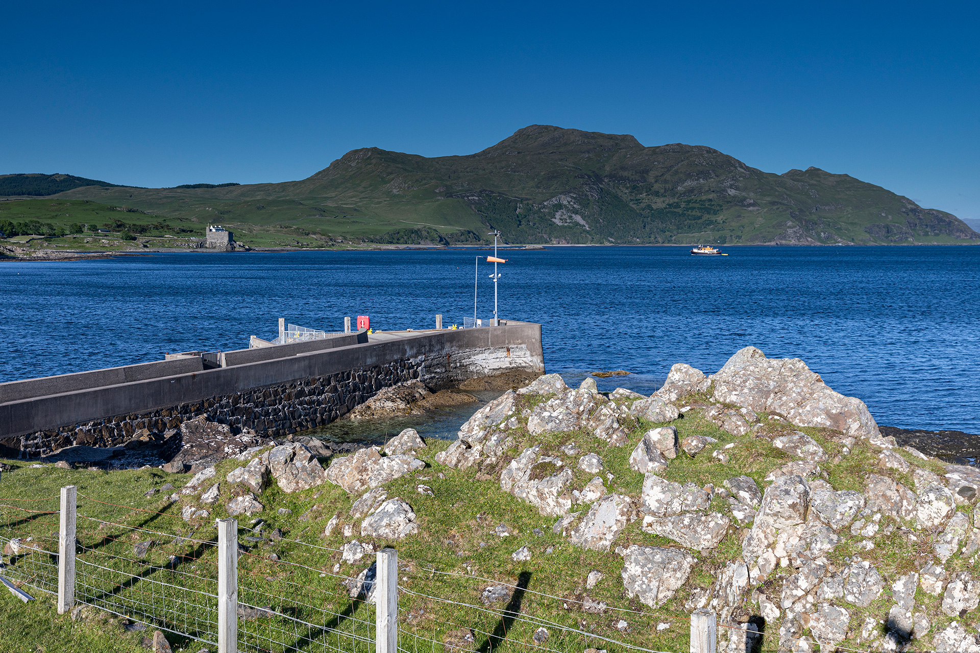
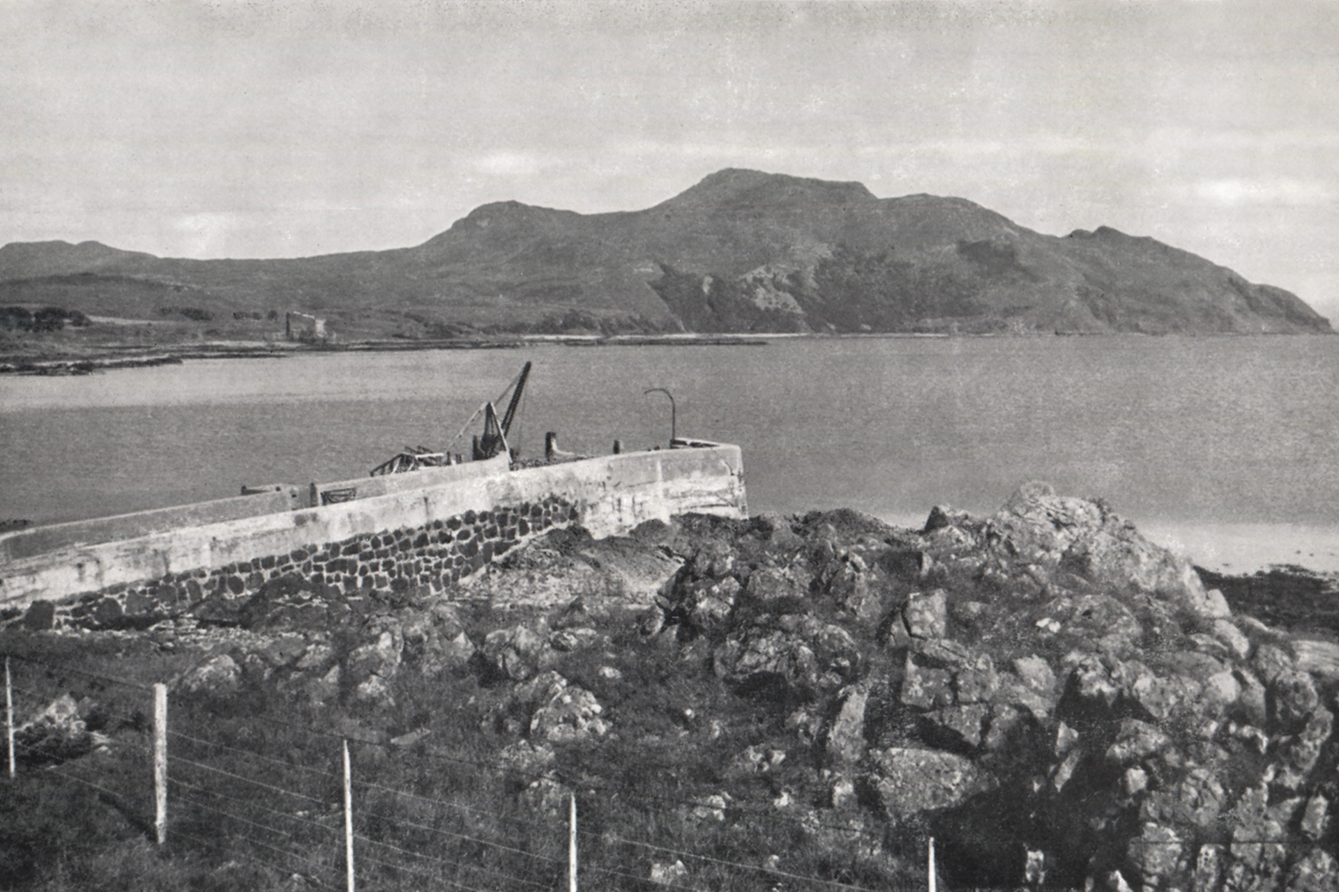
Move the slider to discover what changed.
Then (left) – Late 1940s © W.S. Thomson – Ben Hiant from the harbour at Kilchoan. Published in Let’s See Ardgour and Ardnamurchan, p. 18.
Now (right) – May 2022 © Estelle Slegers Helsen – Ben Hiant and Mingary Castle from Mingary Pier.
Getting to the west of Ardnamurchan has always been a challenge, and remains so today because once you cross Loch Linnhe via the Corran Ferry, you still have a two-hour drive or roughly 45 miles ahead of you. For many West Ardnamurchan residents, the year-round CalMac ferry between Tobermory and Kilchoan, which takes 35 minutes, gives them access to services not available on the peninsula.
When I make a surprise visit to Alasdair ‘Pinky’ Cameron, one of the Kilchoan villagers on my interview list, he asks me to return the next day. While brushing his hand through his hair, he explains: ‘I have to catch the 10:15 to Tobermory for my monthly haircut. The hairdresser used to come to Kilchoan from Tobermory for a day, but since Covid there have not been enough customers, so we have to cross the Sound of Mull.’
I meet Roddy, who runs Puffin Coffee at Pier Road, when he disembarks the ferry with his two young kids. He says: ‘For a day out, Tobermory is great, and also, some of our supplies, such as our ice cream, come from the Isle of Mull.’ Several Kilchoan parents send their teenage children to Tobermory High School, not Ardnamurchan High School in Strontian.
Delving deep into the past, the earliest Kilchoan ferry ran in the 1730s. Black cattle from the isles of Barra, South Uist and North Uist crossed the Little Minch and landed at Kilchoan on their way to cattle markets held in Strontian. On board were also local inhabitants, drovers and goods. L.M.W. Weir unveiled this snippet of information in his PhD, Ferries in Scotland between 1603 and the Advent of Steam, published in 1985 at the University of Edinburgh.
The more recent history of the Ardnamurchan-Mull ferry connection is complicated. From the late 19th century, passenger-only services were provided between Fishnish and Kilchoan or Tobermory and Kilchoan. The crane in Thomson’s photograph, which was mounted on a wooden pier, was dismantled in the late 1980s. Only in 1991, after slipways were built in Tobermory and at Mingary Pier, where the wooden pier was, could larger ferries carrying vehicles land.
But the winter ferry service was withdrawn in the winter of 2003-2004. ‘We set up a private ferry for several years,’ says Michael Foxley, then Highland councillor for Ardnamurchan and Morvern, ’to get the children to the high school. The nearest vet was in Tobermory, and the dentist was in Tobermory, so many people from Kilchoan and the wee townships on West Ardnamurchan used the ferry in the winter. The state-owned ferry company decided to make savings. They were only interested in the tourist traffic just like they are these days, and they withdrew it. So for five years, we ran a private service with funding from six different bodies and showed it was needed, and then CalMac took it on again.’
Twenty years on, I enjoy the passage from Kilchoan to Tobermory on my way to catch the Fishnish to Lochaline ferry. The story continues…
Links
- Trove Scot – Mingary Pier
- Heritage Ardnamurchan – Mingary Castle and Clan Maclain
- National Library of Scotland – Moving Image Archive – Film 0932 – Ardnamurchan
- Undiscovered Scotland – Tobermory to Kilchoan Ferry
- Ships of Calmac – Tobermory to Kilchoan Ferry
- Walk Highlands – Ben Hiant, Ardnamurchan

Travel in Time – Lochaber Series is supported by the West Highland Museum and the Year of Stories 2022 Community Stories Fund.
Estelle has published a 64-page book with 30 side-by-side then-and-now pictures, which you can find in local shops or buy online. More information available here.
