
For a year, photographer and history researcher Estelle Slegers Helsen has wandered around Lochaber in the footsteps of W.S. Thomson MBE (1906-1967). Estelle has made a series of remakes roughly 70 years after Thomson originally depicted the landscape. She has talked to local people along her journey and now Estelle will be taking you to the different places in Lochaber. This is article #12.
Scotstoun lead mines
‘I often wonder what life was like for previous generations who had to endure the hardships of living in some of the most remote areas of Scotland,’ says John ‘Jock’ Allan Menzies when I meet him on one of his regular trips to the West Highlands. In the 1960s, Jock spent family summer holidays with his maternal grandparents in Lochaber.
‘My grandfather had many stories relating to the Kirsop family of Strontian, including unconfirmed links to the North of England and Wales. It was only more than 50 years later that I realised I should have paid more attention to his many old folks’ tales,’ he adds.
Jock is not the only person to start researching his ancestors upon entering retirement. For the past few years, he has been digging into archives and unearthed the story of the Kirsops, with a direct link to the Strontian mines. He says: ‘My ancestors left their mark on the landscape.’
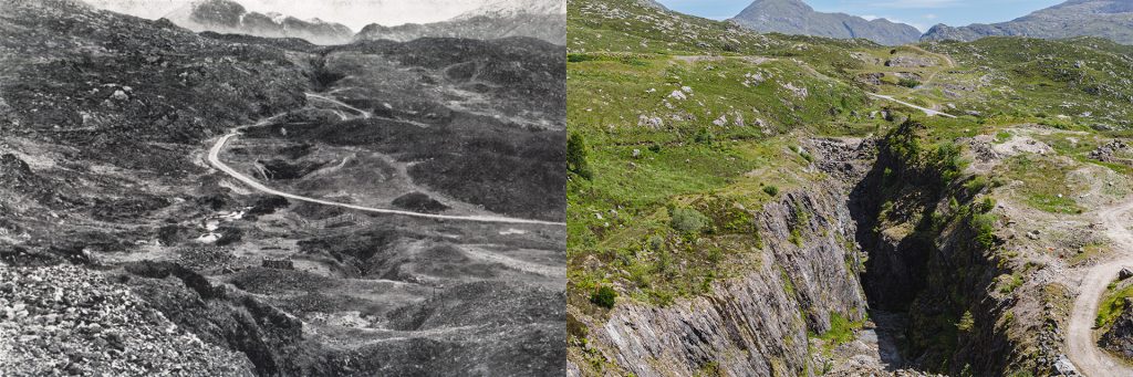
A good example is W.S. Thomson’s photograph, entitled Scotstoun, Strontian, site of the former lead mines, which he took at the end of the 1940s, and was printed in his booklet Let’s See Ardgour and Ardnamurchan. The black and white picture depicts a landscape randomly excavated by manual labour and shows several fenced mining pits. Also, the road from Strontian to Polloch snakes through the scene.
‘Mining north of Strontian started early in the 18th century,’ says Alistair Macintyre of Dualchas – Sunart Heritage Group, ‘and lasted until 1991, when Strontian Minerals Ltd ceased their search for baryte. Lead was the main resource, but the mines were immortalised by the discovery of the mineral strontianite in 1761, in which the element strontium was identified in 1791, named after Strontian.’
Scotstoun, as mentioned by Thomson, is the hamlet Scotstown. Alistair adds: ‘In the past, there were more settlements along the road from Strontian to Polloch. I was told that one of these was called New York, a reference to the York Buildings Company who worked the mines between 1730 and 1775.’
Articles in British Mining
Download here J.G. Landless article Strontian Lead Mines published in British Mining No.1 (1975), p. 51-62. It gives a brief historical overview starting with the discovery of the mines by Sir Alexander Murray of Stanhope, Co. Durham in 1722, and detailed descriptions of the Corrantee mine, the Whitesmith mine (where the then-and-now photographs were taken), the Middleshop mine, the Belgrove mine and the Fee Donald mine.
A more recent article The Strontian Mines of Argyll, written by R.M. Callender, was published in British Mining No.96 (2013), p. 58-68.
British Mining No.105 is a full issue of 98 pages titled The Lead Mines of Strontian. Stephen Moreton and David L. Green wrote the exhaustive history from the mines’ first recorded exploitation in 1714 to the baryte mining of Strontian Minerals Ltd in 1991. The research includes information from the documents of Sir Alexander Murray, the Mackenzie of Delvine papers and the archives of Minworth Ltd, who carried on the last of the mining. You can order a copy here.

When heading out to take my remake, Alistair advises me to drive past Bellgrove Lodge and explore the landscape around the old Whitesmith Mine (NM 82296 65972) on the slopes of Beinn Ruighe Raonuill. Whitesmith Mine is named after John Whitesmith, an English miner who worked at Strontian in the early eighteenth century.
My first attempt to find where Thomson stood fails because of the bad weather, making the landscape even more barren than it looks in Thomson’s photo. It is another month before I return. On my second try, the sun is bright, creating dark shadows in the shafts.

Source: Website National Library of Scotland Side by side georeferenced maps viewer
In Thomson’s time, the heydays of great mining activities were long gone. I don’t know whether it’s a coincidence or not but he focussed on the main ore vein, which runs from bottom to top in the centre of the photo. And, accidentally, this is also where in 1983, Strontian Minerals Ltd began mining the main vein for barytes, creating a large open cut and destroying the eastern remains of the old lead mine. The remake looks dazzling because I am standing a few feet from the edge, safe enough to give it a go.
There is another prominent difference 70 years later. The road was diverted because of the baryte mining. Looking closely at the remake, you can still see where the old road ran. The new road follows an old footpath marked on old Ordnance Survey maps.
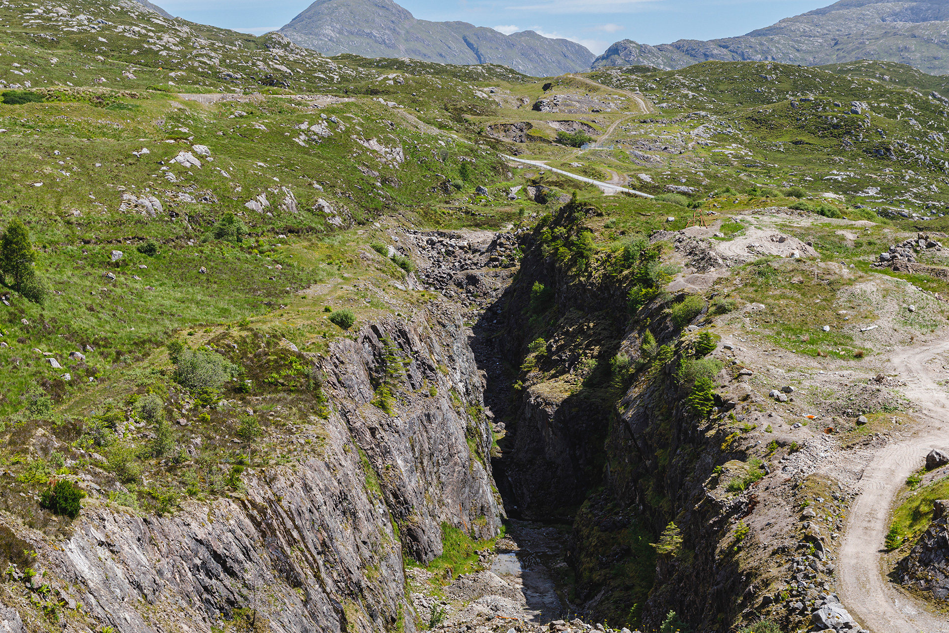
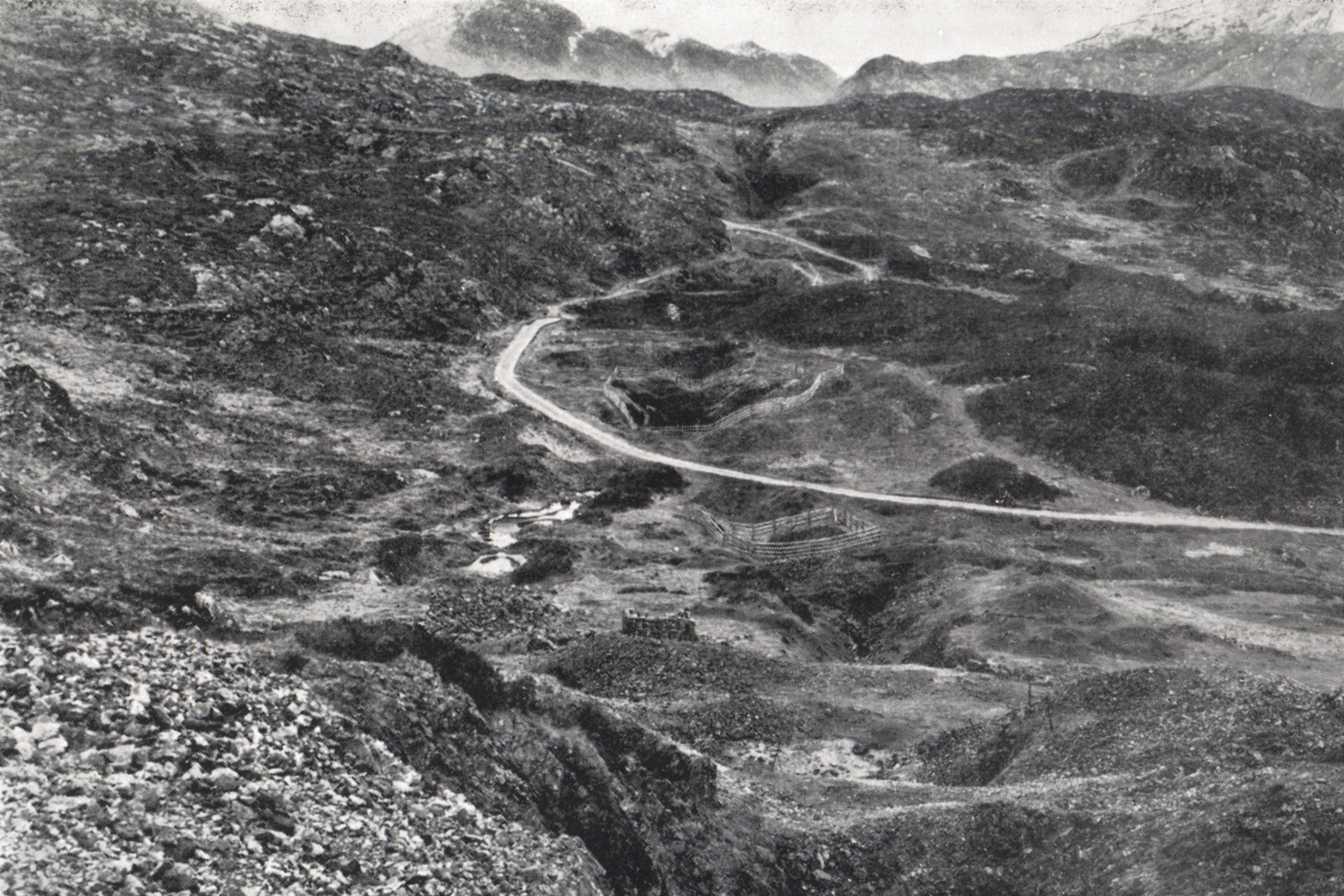
Move the slider to discover what changed.
Then (left) – End 1940s © W.S. Thomson – Scotstown, Strontian, site of the former lead mines. Published in Let’s See Ardgour and Ardnamurchan, p. 11.
Now (right) – June 2022 © Estelle Slegers Helsen – Ruigghe Raonuill and Whitesmith Lead Mines, north of Scotstown. Published in Travel in Time. Lochaber, Scotland (New Traces, 2022), p. 41.


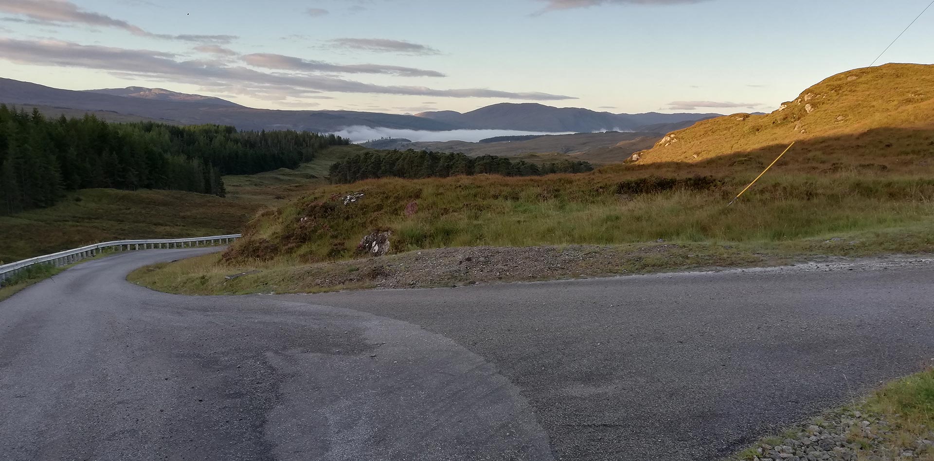
- Picture 1 and 2 : view on the old Whitesmith mine and the old road from the new road.
- Picture 3: view on the new road in the direction of Polloch.
- Picture 4 and 5: view on the entrance of the old Whitesmith mine and the old road from the new road
Back home, Jock sends me an update on his ancestry research. This is the result so far…
The Kirsops of Strontian
The story of Jock’s family in Strontian began with Edward Kirsop, (born in the Alston area of Cumberland in 1781), who became a lead miner and moved to Strontian in the late 1700s or early 1800s. In 1805 he married Margaret Cameron, a Strontian girl. By 1814, Edward held the position of Overseer of Mines. One of their at least eight children was Thomas Kirsop.
Thomas Kirsop (born at Scotstoun in 1811) also became a miner and later worked as a stonemason. He married Anne MacPherson in 1856. They raised a large family. One of them also named Thomas
Thomas Kirsop (born in 1863) became a stonemason and crofter, marrying Euphemia MacPherson in 1893. They were tenants of a croft, house and hill pasture in Scotstoun. Jock’s grandfather Allan was their third eldest son and one of nine children.
Allan Kirsop (born in 1903) left Strontian as a teenager to become a gardener at Achnacloich, a large country house and gardens near Oban. He spent most of his working life as a gardener, with periods as a Stonemason, Ghillie and as a policeman from the early 1930s to the end of World War Two. Allan married Christina MacPherson at the Highlanders Institute, Glasgow in 1934. Christina was born at Port Henderson, Gairloch in 1896 and was from a family, who for many generations had been crofters and fishermen. Alan and Christina moved with their four children (Annabelle, Phemie, Ian and Tom) on a regular basis during the 1940s to 60s.
Jock was fortunate to be able to visit Allan and Christina at Ard Rhu Onich, where Allan was a gardener and caretaker for the Railton family.
——
If you have more info on the Kirsops, please send a message through the contact page. The info will be forwarded to Jock.
Meeting Jock was pure coincidence when I revisited Mairi Kirsop, who told me about Onich, a story I wrote a while ago. They happen to be related.
Jock and Mairi visited the Drimnatorran Burial Ground, overlooking the crofts of Scotstown, which is the final resting place of Allan and Christina Kirsop. They also researched the nearby Annaheilt Churchyard in Strontian.
Jock concludes: ‘This visit revealed headstones bearing the names, Kirsop, MacPherson and many others who all played their part in the shaping of the landscape and the history of Scotsto(u)(w)n, Strontian.’
Loch Sunart
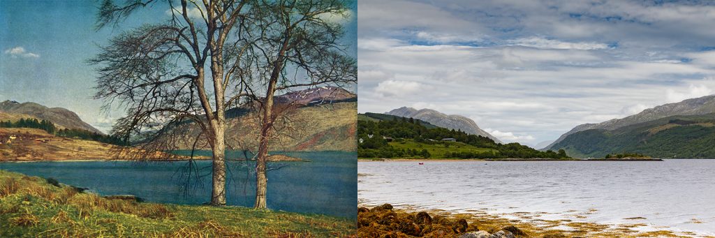
Driving multiple times up and down the main road from Strontian to Salen, I try to find a gap in the massive amount of trees growing on the slope of the Loch Sunart south shore. It seems impossible to locate the two birch trees Thomson depicted in his early 1950s photograph. Also, there is a slight chance that one of the full-grown trees would still be alive because birch trees don’t live that long.
I decide to walk the shore of Loch Sunart and park my car opposite Ben View Hotel, on a minor road uphill from the main road. At the main road is a footpath going through the scrubs and trees where I reach the old jetty, with a view of Eilean a’ Mhuirich, the small island to the right of the two birch trees in Thomson’s photograph. Walking to the west, just above the water level of Loch Sunart, is tricky, with wet rocks covered with seaweed and small creeks hidden by high grass. On the left is Loch Sunart, and on the right is, most of the time, a steep slope covered with trees, which have been growing there for the past 50 to 70 years. Sometimes I have to climb several feet up the rocks and try to find a path through bracken, scrub and trees.
After a third of a mile, I settle on a small flat area, with in my back a steep uphill platform grown with trees. There is no way to climb these rocks, about 20 to 30 feet high, but I am convinced Thomson was standing there to take his photograph. He probably reached that area walking downhill from the main road
I have found two photographs Thomson took from this location: one in colour and printed in his book The Highlands in Colour, and another, in black and white, printed on page 12 of his booklet Let’s See Ardgour and Ardnamurchan.
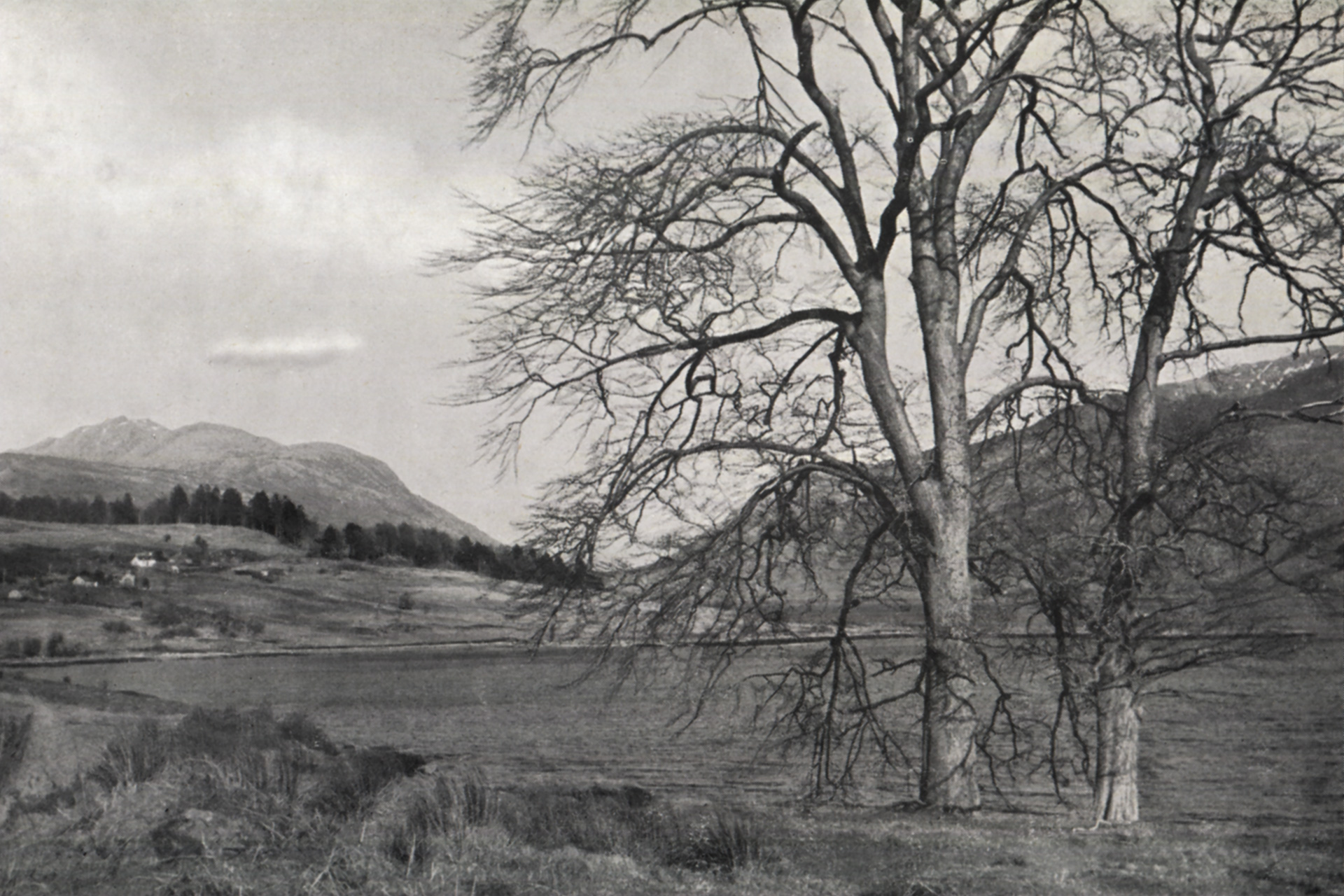
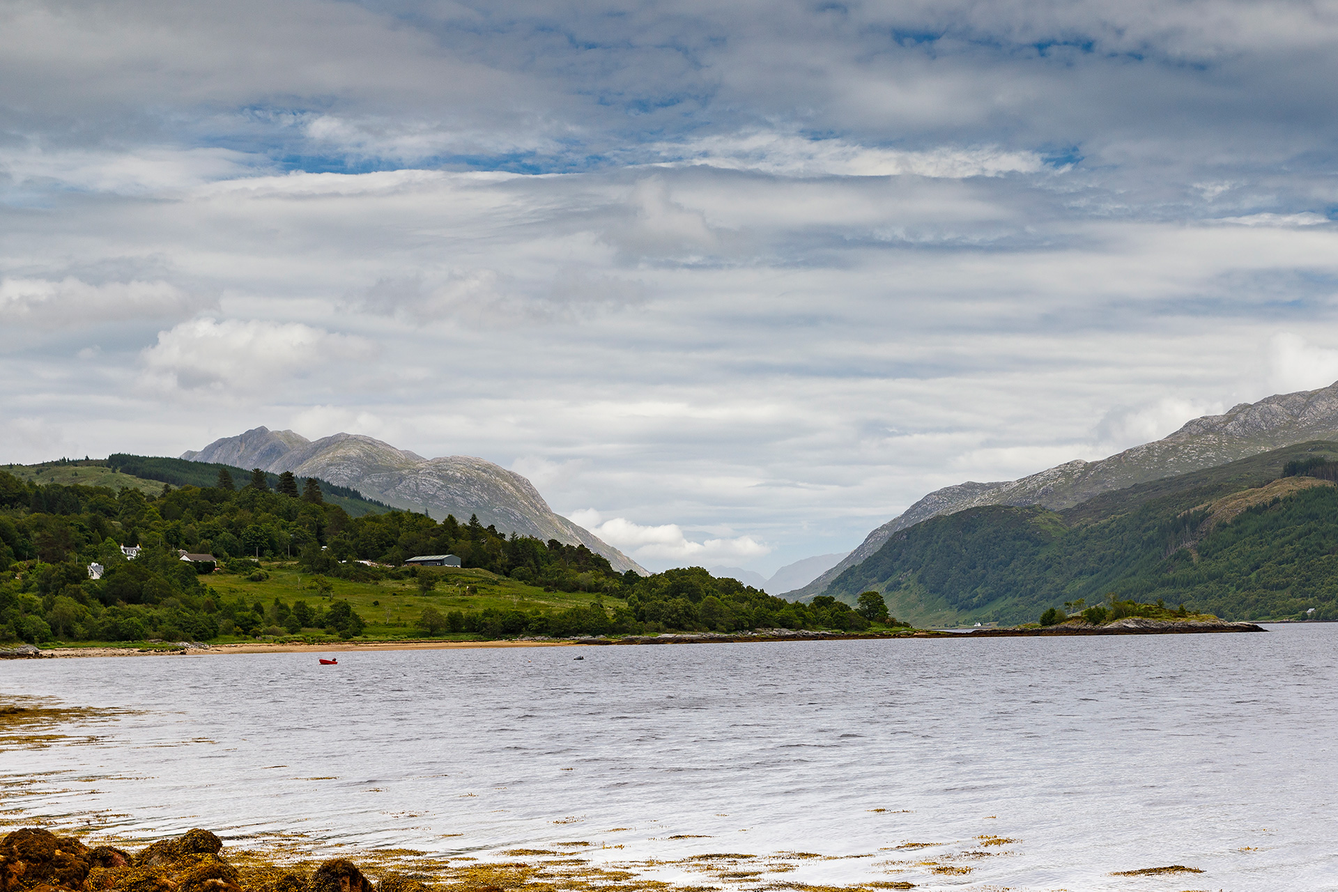
Move the slider to discover what changed.
Then (left) – Late 1940s © W.S. Thomson – Garven and Loch Sunart near Strontian. Published in Let’s See Ardour and Ardnamurchan ([1951]), p. 12
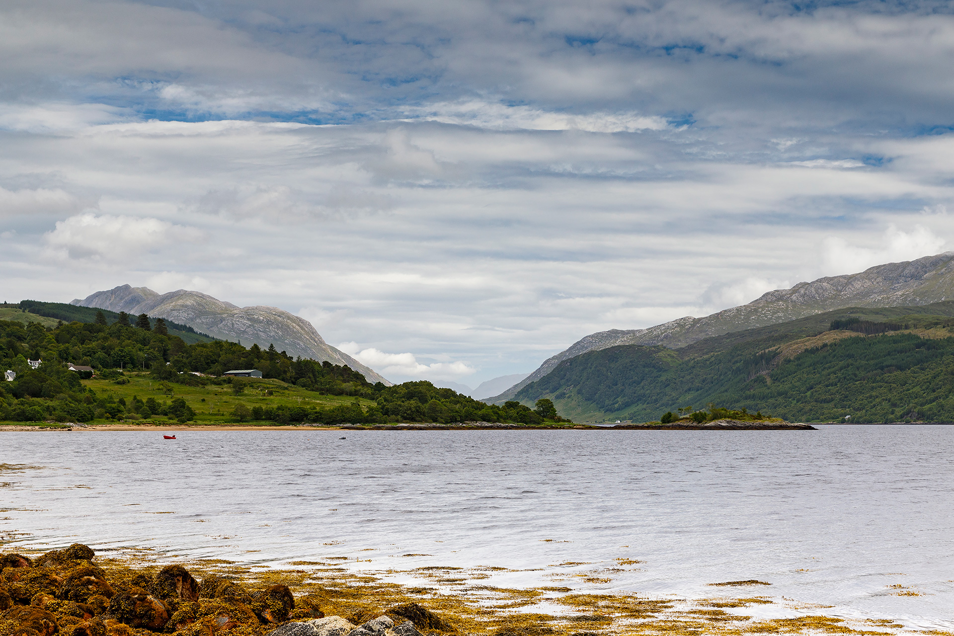
Now (right) – June 2022 © Estelle Slegers Helsen – Garven and Loch Sunart near Strontian.
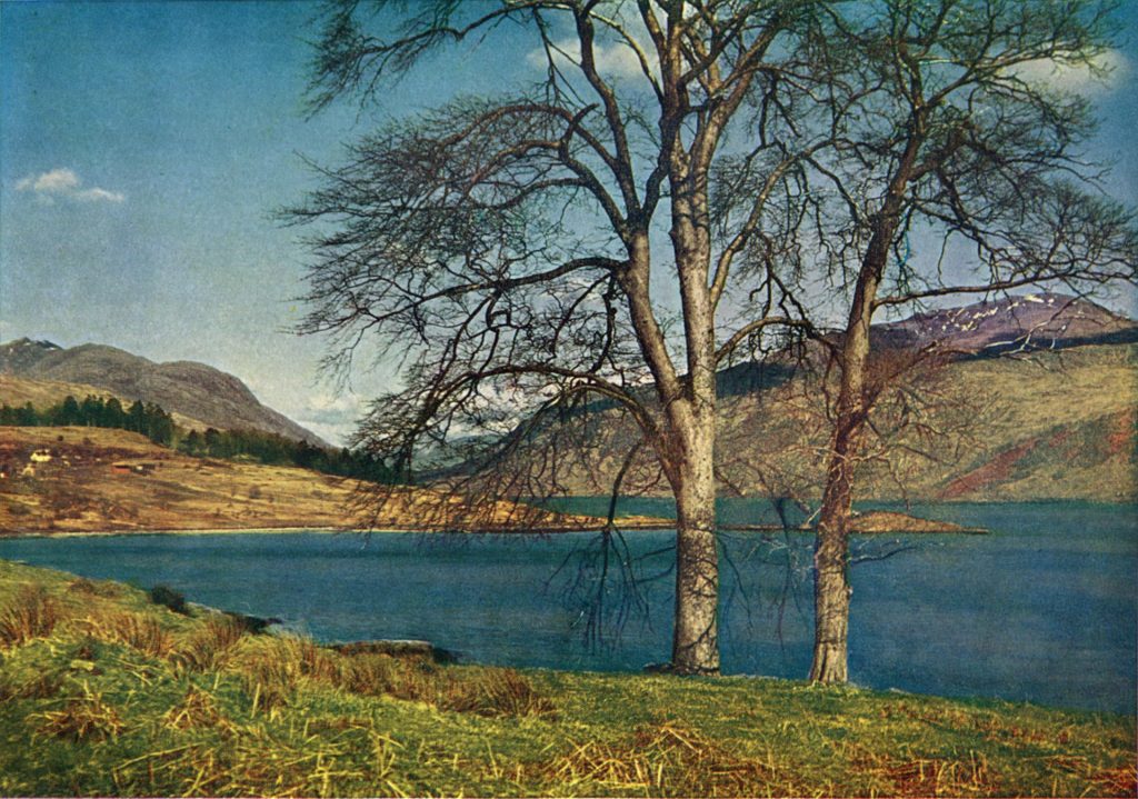

Move the slider to discover what changed.
Then (left) – Early 1950s © W.S. Thomson – Garven of Ardgour from Loch Sunart at Strontian. Published in The Highlands in Colour (1954), p. 36.
Now (right) – June 2022 © Estelle Slegers Helsen – Garven of Ardgour from Loch Sunart at Strontian.

Source: Website National Library of Scotland Side by side georeferenced maps viewer.
This view on Loch Sunart’s Arnastang Bay triggers Alistair Macintyre of Dualchas – Sunart Heritage Group to tell the story of the Strontian ‘floating church’, also known as the Iron Church.
Alistair says: ‘The Patronage Act of 1712 allowed the local landowner to choose the minister of a church. This led to a schism in 1843. About 500 ministers left the Church of Scotland General Assembly to form the Church of Scotland Free, later known as the Free Church of Scotland.’
‘But the Free Church had difficulties providing churches, manses and schools because many local landlords refused to grant the new church land to build. The local Strontian landowner Sir James Riddell wrote: “I find it impossible, conscientiously, to grant sites for churches, manses, and schools, which would imply a sanction on my part, and give a perpetuity on my estates, to a system which I believe to be anti-social and anti-Christian.”‘
‘The solution for Strontian would be a floating church. Money was raised, and a floating church to hold 400 souls was built at a Clyde shipyard by Robert Brown of Fairlie. The cost? £1,400.
In June 1846, the Iron church was towed to Loch Sunart by two tugboats and moored at Arnastang Bay on the loch bed about 150 yards from the shore.

Worshippers had to reach the church by boat, probably from the jetty where I started my walk along the shore.
Alistair continues: ‘In September 1848, a storm caused the Iron Church to break its moorings, and it was blown ashore. Settling itself between high and low tide, anchored between the rocks, the worship services continued until the Strontian Free Church was finally provided on land in 1870.’
The church on Longrigg Road, where I parked my car, is now a private dwelling.
Links
- British Mining No 105 – The Lead Mines of Strontian Stephen Moreton and David I. Green
- British Mining No 96 – Memoirs 2013 – Article The Strontian Mines of Argyll, R.M. Callender
- Canmore – National Record of the Historic Environment – Lead Mines, Strontian
- Trove Scot – Lead Mines, Strontian – Archaeology Notes
- Canmore – National Record of the Historic Environment – Whitesmith Mine, Strontian
- Scottish Cave and Mine Database Search – Whitesmith Mine
- Steetley Minerals – Strontian Mines

Travel in Time – Lochaber Series is supported by the West Highland Museum and the Year of Stories 2022 Community Stories Fund.
Estelle has published a 64-page book with 30 side-by-side then-and-now pictures, which you can find in local shops or buy online. More information available here.

One response to “Strontian”
Indrukwekkend. Dat was zeer interessant, zeker als je daar leeft.
Schitterend werk.