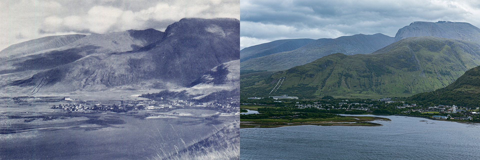
For a year, photographer and history researcher Estelle Slegers Helsen has wandered around Lochaber in the footsteps of W.S. Thomson MBE (1906-1967). Estelle has made a series of remakes roughly 70 years after Thomson originally depicted the landscape. She has talked to local people along her journey and now each week Estelle will be taking you to a different place in Lochaber. This is the second article.
Ben Nevis and Inverlochy village
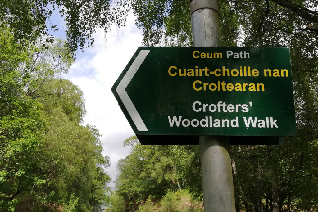
Michael Foxley and I meet at a small layby on the road from Camusnagaul to Achaphubuil, where one of the trails into the Crofters’ Woodland starts.
Michael, who helps me find the places where Thomson took some of his photographs, is knowledgeable about the area. He is also well-known in Lochaber as a retired GP and former leader of the Highland Council (in the past elected as the councillor for West Lochaber – Ardnamurchan, Mallaig and the Small Isles), and has been living in nearby Achaphubuil on a croft he inherited from his mother’s family, the MacDonalds.
Michael about his MacDonald and MacNaughthan roots
My mother was from here. She was a MacDonald, one of eight children. She grew up in the adjoining croftship of Treslaig, which is just around the corner. There were two family crofts in the family: the one that she grew up on, and the other one was a MacNaughtan croft, which was my grandmother. One of my mother’s brothers, had gone to Australia when he was young and he never come back, and he passed the croft on to me, which is where I live.
My aunt had sheep, and my uncle had sheep on the hill. When I took over the croft, I used to help my uncle and then I got some for myself. After he died, friends of mine in Trilaig, the three of us ran this flock on the hill. We only stopped two years ago because of the extent of the bracken – you are gathering through tick gorse and bracken, which is all but impossible. Driving sheep through this…
“Crofters’ Woodland is an ancient wood, owned by the local crofters,” says Michael. “I organised a buyout with the local crofters in the mid-1990s. It was going on the open market, and we were sponsored by Scottish National Heritage to buy the lot. Last year, in 2021, we came second, highly commended in Scotland’s Finest Woods Awards, in the small community woodland group category.” The Oban Times published an article on the awards on 7 October 2021.
We start our hike uphill following the Crofters’ Woodland Walk path.
While walking on a track, which is about 25 years old, Michael explains: “This woodland is primarily oak and birch. This old track needs a bit of clearing. Three friends and I put in major extensions 18 months ago.”
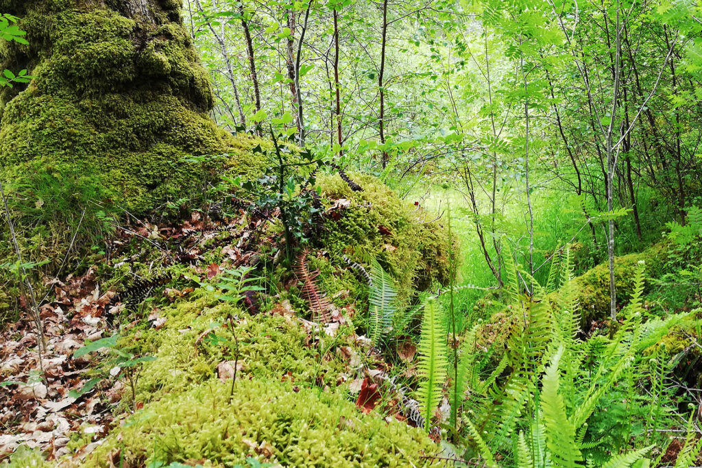
“This is our star exhibit,” says Michael after ten minutes. We gaze at the Camusnagaul Pollarded Oak, some 400 years old and one of the few ancient oaks remaining from a magnificent ancient woodland composed mainly of downy birch and sessile oak with both shrubby and moss ground flora.
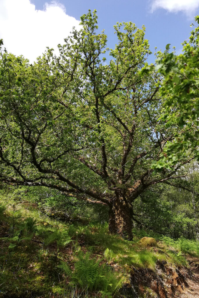
“It is a stunning wood. This was a managed woodland for timber and bark. In the past, they cut the oaks’ branches to make charcoal and used the bark for tanning.”
Queen Elizabeth II – she was still on the throne when we made this expedition in June 2022 – wanted 70 ancient trees in the UK to represent her reign. Michael adds: “The pollarded oak was selected as the only one submitted by a community group, which makes us proud. All the others are next to a castle, a mansion or a big estate. When we submitted the application, I wrote a little story about what the tree has been seen across the loch in the last 400 years of local history, which is extensive, let’s put it that way.”
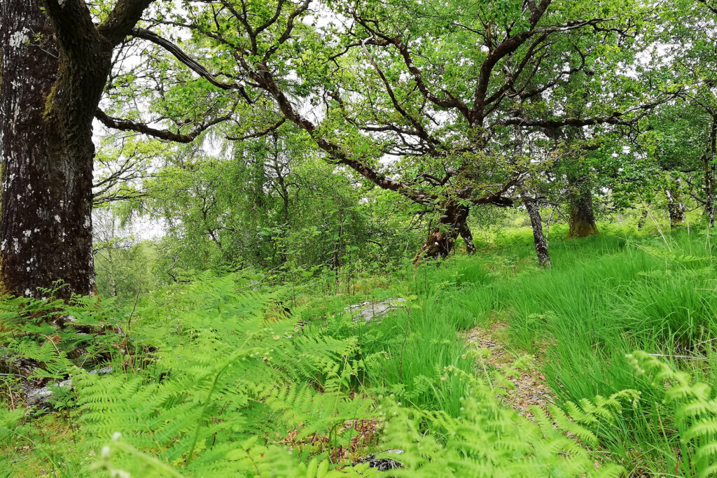
Another part of the story focused on the natural aspects. Like, when the caterpillars come to eat the oak leaves, that is when the blue tits have their young so that they can catch the caterpillars for their young.
Michael: “The pollarded oak is lucky it survived. In the 1950s a man called George Wood had the contract to cut a lot of the old oaks down. So most of them just got cleared like a lot of ancient woodland.”
Scotland’s ancient woodland
After the retreat of the ice some 11,000 years ago, Britain was colonised first by boreal species and later by more temperate vegetation. Birch was the first dominant tree, followed by hazel, pine and oak. Woodland cover around 5,000 years ago reached Shetland and the Western Isles.
Woodland cover then began to decline, largely due to early agriculture. By the time the Roman legions of Agricola invaded Scotland in AD 82, at least half of our natural woodland had gone. Much of it was replaced by peatland, partly as a result of the cooler, wetter climate and partly because of human activities.
In the 17th and 18th centuries, many of the remaining woods were heavily exploited for timber, charcoal and tanbark. But this probably also secured their continued existence.
By the 19th century, interest in native woods was in decline. By 1900, woodland covered only about 5% of Scotland’s land area, as many small and isolated blocks. This led to the loss of species requiring larger, unbroken blocks of native woodland – especially larger mammals and predators.
Almost all of our remaining fragments of native woodland have, at some time, been modified by man’s activities. Traces of all these actions can be viewed in the surviving woodland.
Today, native woodland covers just 4% of the total land area.
Source: NatureScot
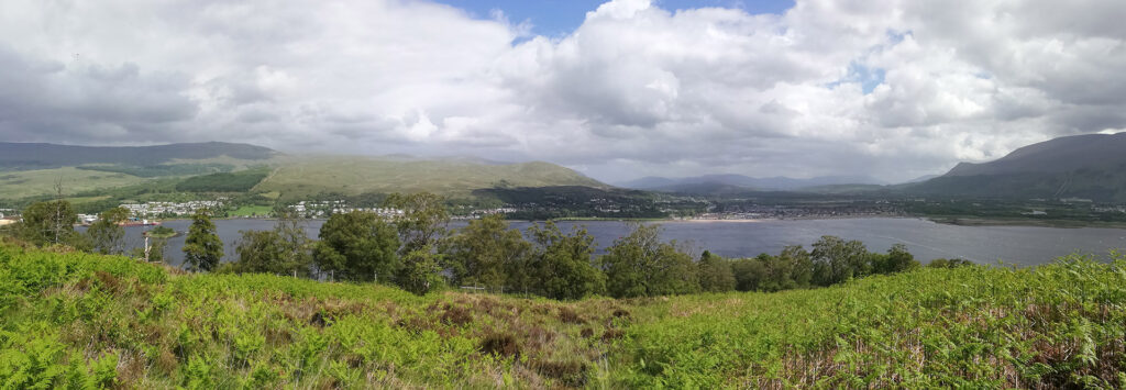
At a deer fence, we leave the woodlands, scrambling through bracken, Michael’s yellow fluorescent raincoat matching the gorse’s flowers. “This is Treslaig common grazing,” he explains, “and we have to go well up the hill.” The weather is fine enough to talk about the past and the present, but I have doubts about taking the remakes during this trip.
From the start of our walk, it rains. Michael asks about the photos I have selected for this search. The prints are tucked away in my raincoat pockets, shielding them from getting too wet.
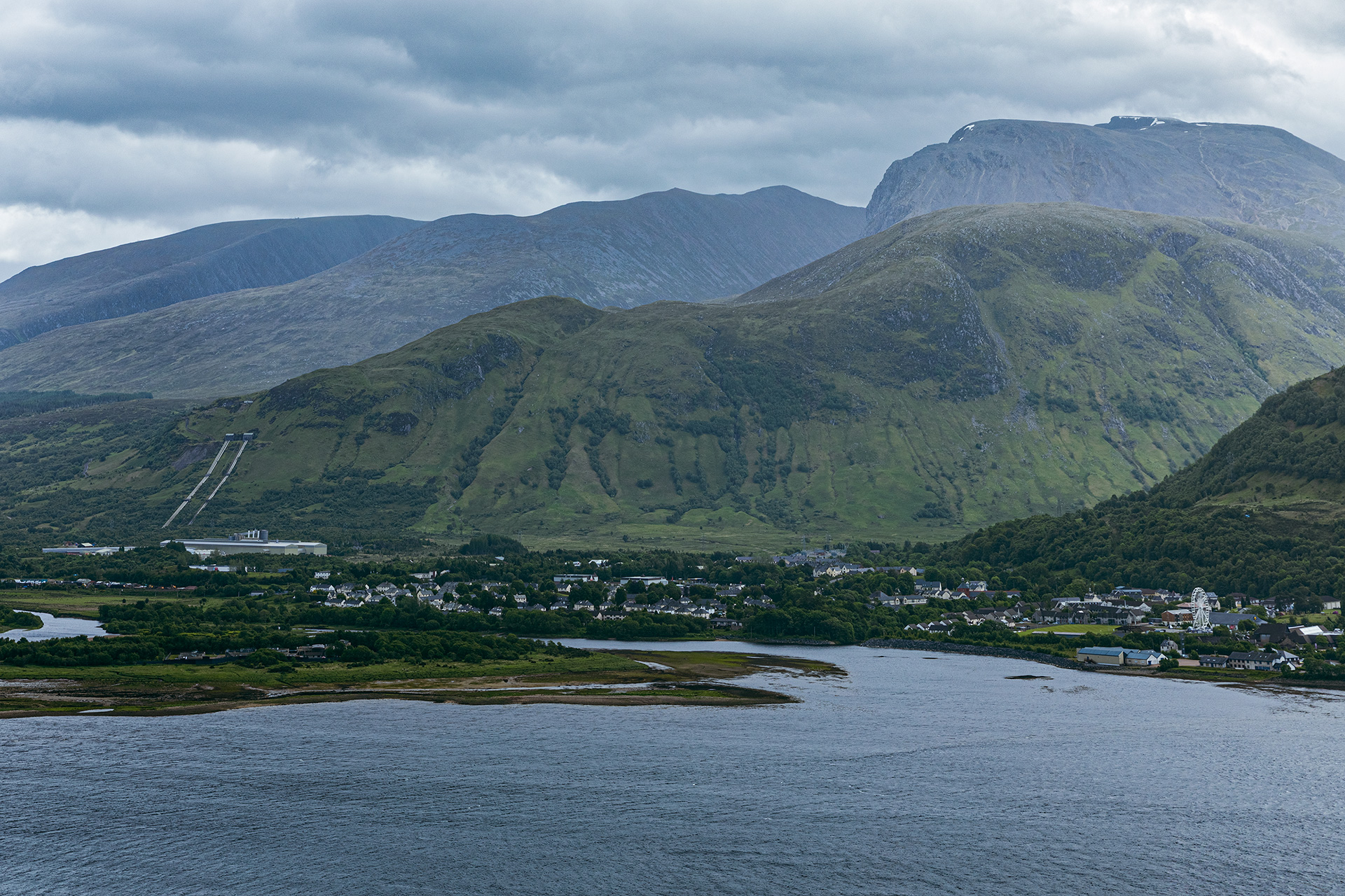
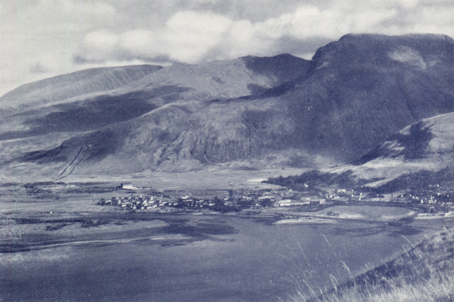
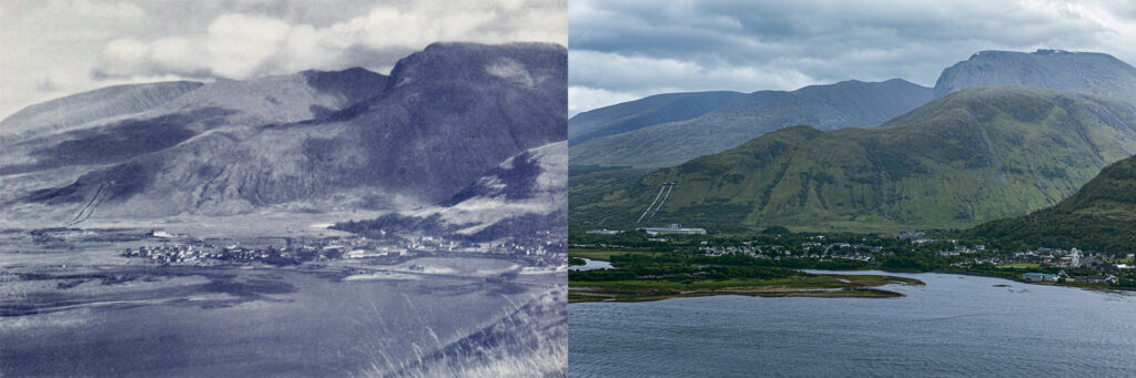
Move the slider to discover what changed.
Then (left) – End 1940s © W.S. Thomson – Ben Nevis and Inverlochy village. Published in Let’s See Fort William and Lochaber (Cameron Square edition), p. 4
Now (right) – June 2022 © Estelle Slegers Helsen – Ben Nevis and Inverlochy village.

We focus on the mouth of the River Lochy, which has changed over time and was barren in the late 1940s. Michael points out: “Now, at the front left of the river mouth, you see the green buildings, which are the sewage works of Fort William.”
Features in both the old photograph and the remake include the Lochaber Aluminium Smelter, the third hydro-electric plant belonging to the British Aluminium Company, which went into production in 1929, the first being at Foyers (1896) and the second at Kinlochleven (1907).
“A very forward-thinking project because British engineers built an entire system of lochs and hydro schemes to bring the water in from the north and the east, with tunnels linking the various lochs together,” Michael explains. “Also, the generators were a remarkable feature of good British engineering. Although still working perfectly, the company replaced them with modern Chinese ones.”
As part of the Alvance Aluminium Group, the smelter is the smallest aluminium plant in the world. “The only reason it is viable is that it has free electricity through the hydro schemes,” continues Michael. “The current owner, the Indian businessman P.K. Gupta, and his companies came in great promising hundreds if not thousands of jobs. It has not materialised, partly due to Brexit, but the plant is still working and employs about 200 people locally.”
If the plant isn’t viable anymore, it will be there to generate electricity, as in Kinlochleven in 2000.
The village of Inverlochy, within walking distance of everything in Fort William, seems exposed in the landscape 70 years ago and is now tucked away and covered in green. The village was purpose-built in the 1920s by the British Aluminium Company to house workers.
Michael reflects: “It had solid three-bedroom, semi-detached houses with slate roofs. Tenants about 20 years ago had the right to buy at a fraction of their value. Some were keen to have it designated as a model village, but we failed because people wanted to turn their front garden into car parks.”
On the right of the mouth of the River Lochy, we spot the Underwater Training Centre and the West Highland College.
I ask Michael what the old pollarded oak down in the ancient woodland would have seen from its vantage point gazing over the landscape and waters where Loch Linnhe and Loch Eil meet. He responds: “It would have seen MacIain of Glencoe trying to give his oath of allegiance to the Crown on 1st January 1692, failing to do so and the ensuing Glencoe Massacre. It would have seen hundreds of clansmen going off to Glenfinnan to raise the standard in the ‘45 rebellion and then coming back after the defeat of Culloden in 1746. It would have witnessed two battles of Inverlochy, in 1431 and 1645. The Campbells ploughed the fields with the Campbell blood. It was there all the way through the Luftwaffe bombing the aluminium plant in the Second World War, and there was a big motored torpedo boat stationed here, one of them blew up in the bay. It would have seen Queen Elizabeth II visiting Fort William on two occasions during her reign.”
I returned two days later for the remake, the weather being a bit better but far from cloudless. Ben Nevis and its adjourning hills are covered in a pale grey blanket.
During our walk, Michael also talked about more recent topics. Listen to the audio clip.
Maps of the area of 1904, 1949 and 1959. Click on the thumbnails to enlarge.
Banavie, the Caledonian Canal and the Great Glen
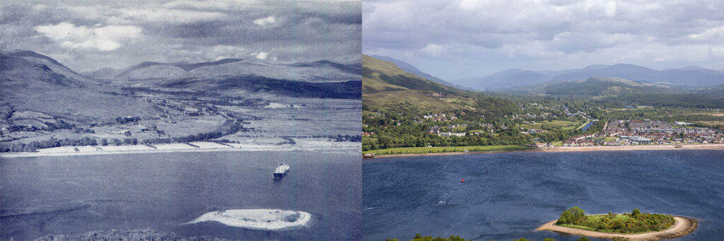
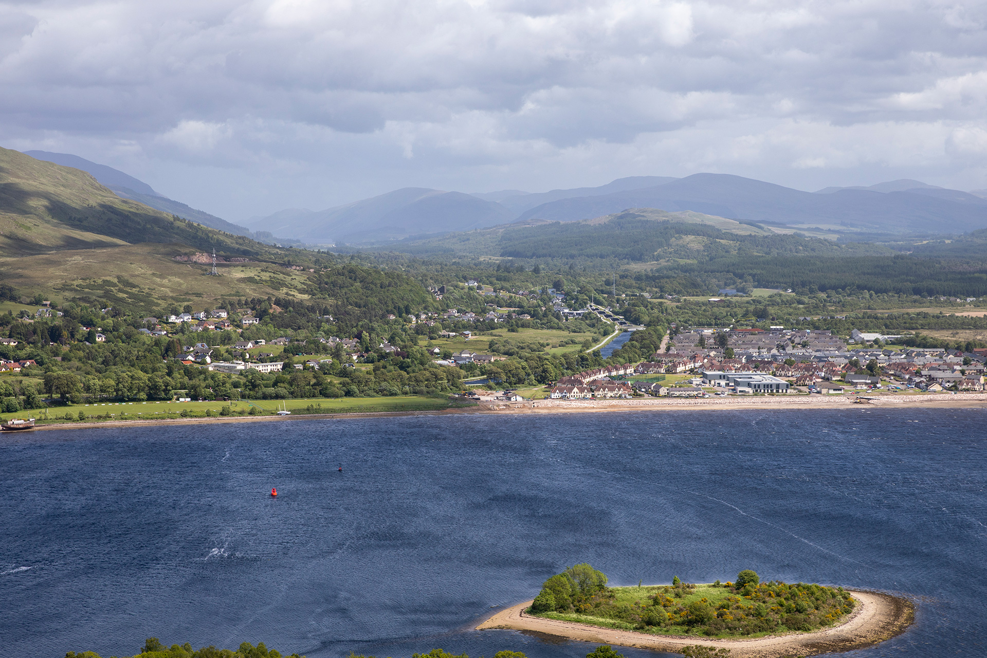
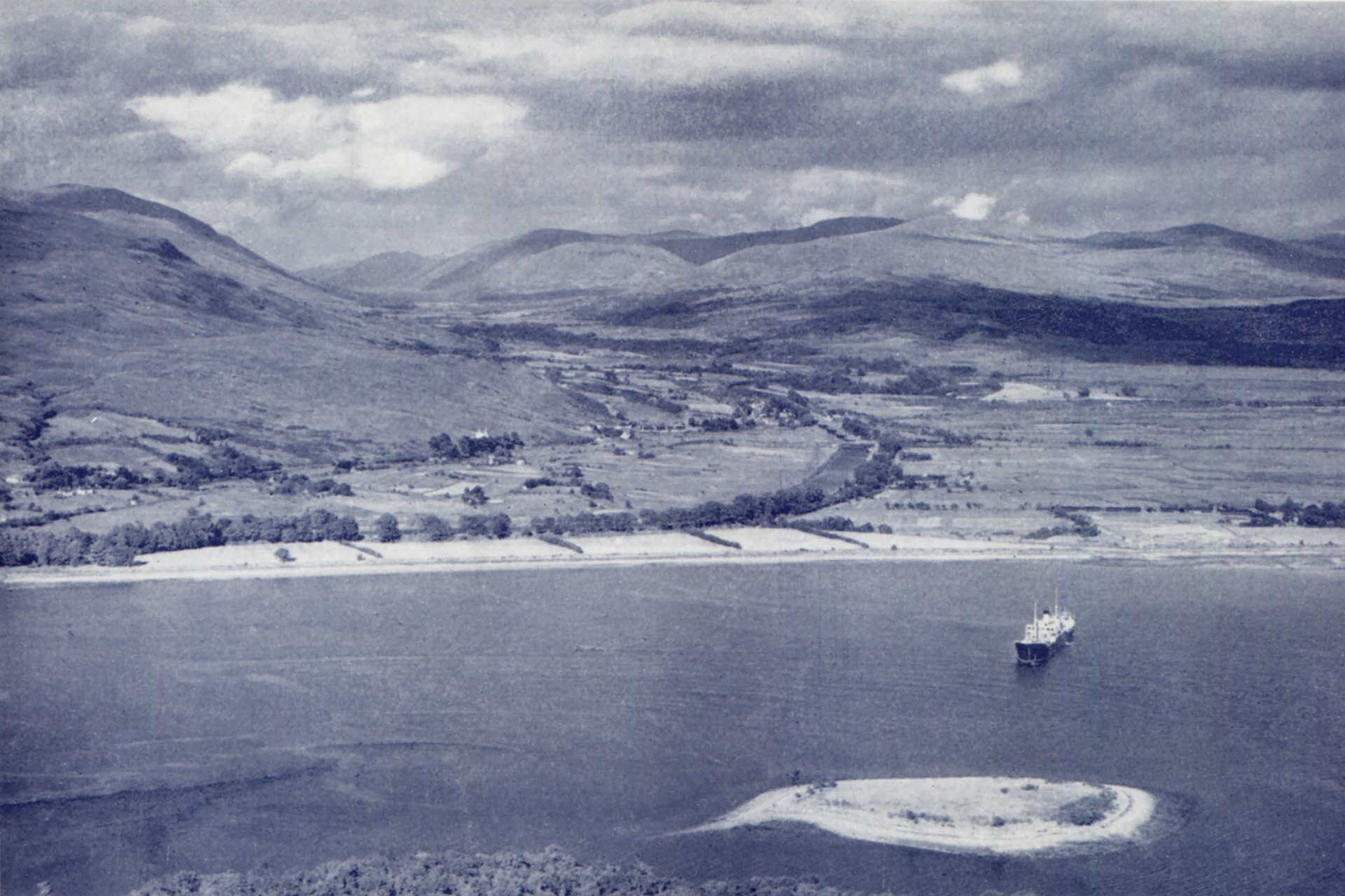
The view north into the Great Glen changed dramatically. The island in the foreground is Rudha Dearg, which is grown through the years. At the end of the 1940s, it was more barren than in 2022.
The northern shore of Loch Eil looks beachlike, with the famous shipwreck visible at the left of the new picture. Located in Corpach, the Old Boat of Caol sits proudly on the stony beach of Loch Eil, with Ben Nevis as a backdrop.
A treeline marks the course of the Caledonian Canal, with its entry more to the left, out of frame. Neptune’s Staircase is clearly visible in the centre with to the left the village of Banavie. The impressive series of eight locks is an excellent engineering feature and raises the canal by 19m (62ft) over a quarter of a mile of continuous masonry. Travelling up or down with a boat takes around 90 minutes. It is the longest staircase lock in Scotland and was built by Thomas Telford between 1803 and 1822.
The pastures on the east side of the Caledonian Canal are primarily built with houses at the east side of Corpach, all the way up to Banavie, leaving lots of green spaces in between and richly covered with trees.
On the right, at the Loch Eil shore, the village of Caol (Gaelic for ‘narrow’, in this case, the narrow water between Loch Linnhe and Loch Eil) was developed from scratch. More houses were needed after the Second World War, and the first houses in Caol were constructed on Clunes Avenue in the late 1940s. The village constantly grew in the 1950s and became even more significant in the 1960s, following the establishment of the pulp and paper mill. Coal more than doubled in size in about 15 years and is still primarily residential.
Further up the Great Glen, many more trees cover the landscape, partly conifer plantations, partly woodland regeneration.
Move the slider to discover what changed.
Then (left) – End 1940s © W.S. Thomson – Banavie, the Caledonian Canal and the Great Glen with Loch Eil in the foreground. Published in Let’s See Fort William and Lochaber (Cameron Square edition), p. 9
Now (right) – April 2022 © Estelle Slegers Helsen – Corpach, the Great Glen,Banavie, the Caledonian Canal and Caol with Loch Eil in the foreground. Published in Travel in Time. Lochaber, Scotland (2022), p. 9

Travel in Time – Lochaber Series is supported by the West Highland Museum and the Year of Stories 2022 Community Stories Fund.
Estelle has published a 64-page book with 30 side-by-side then-and-now pictures, which you can find in local shops or buy online. More information available here.