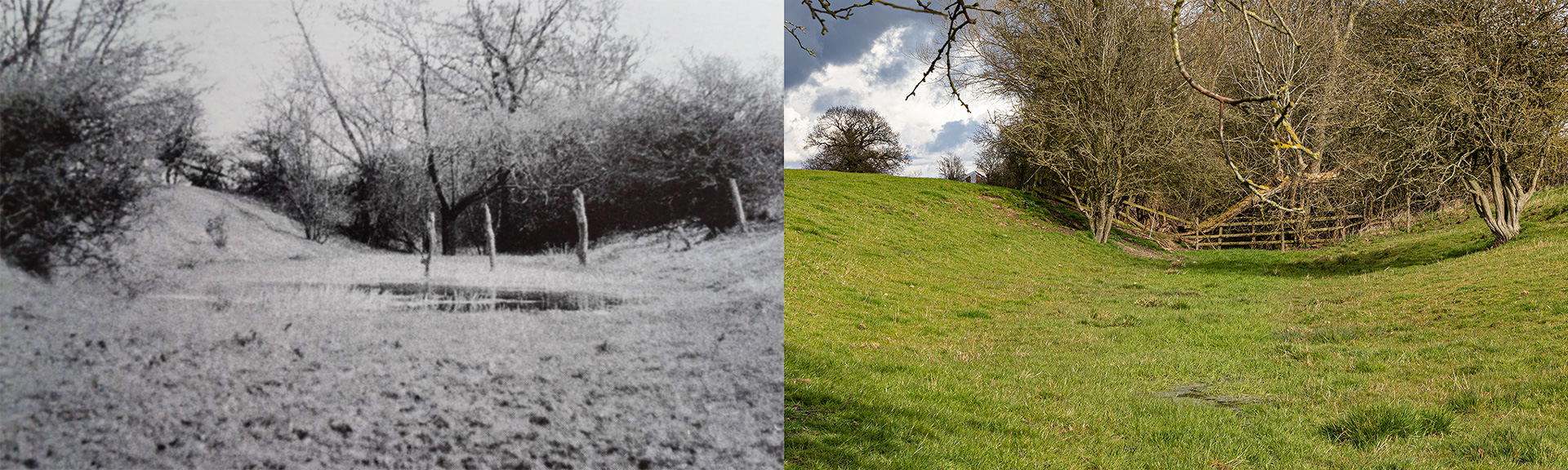
Lock 7, Melton to Oakham Canal – 1967
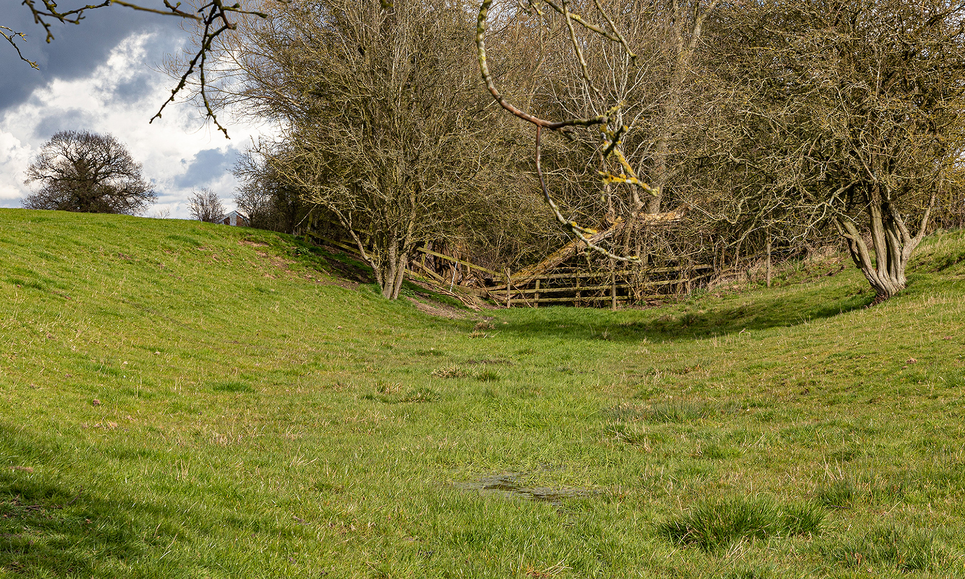
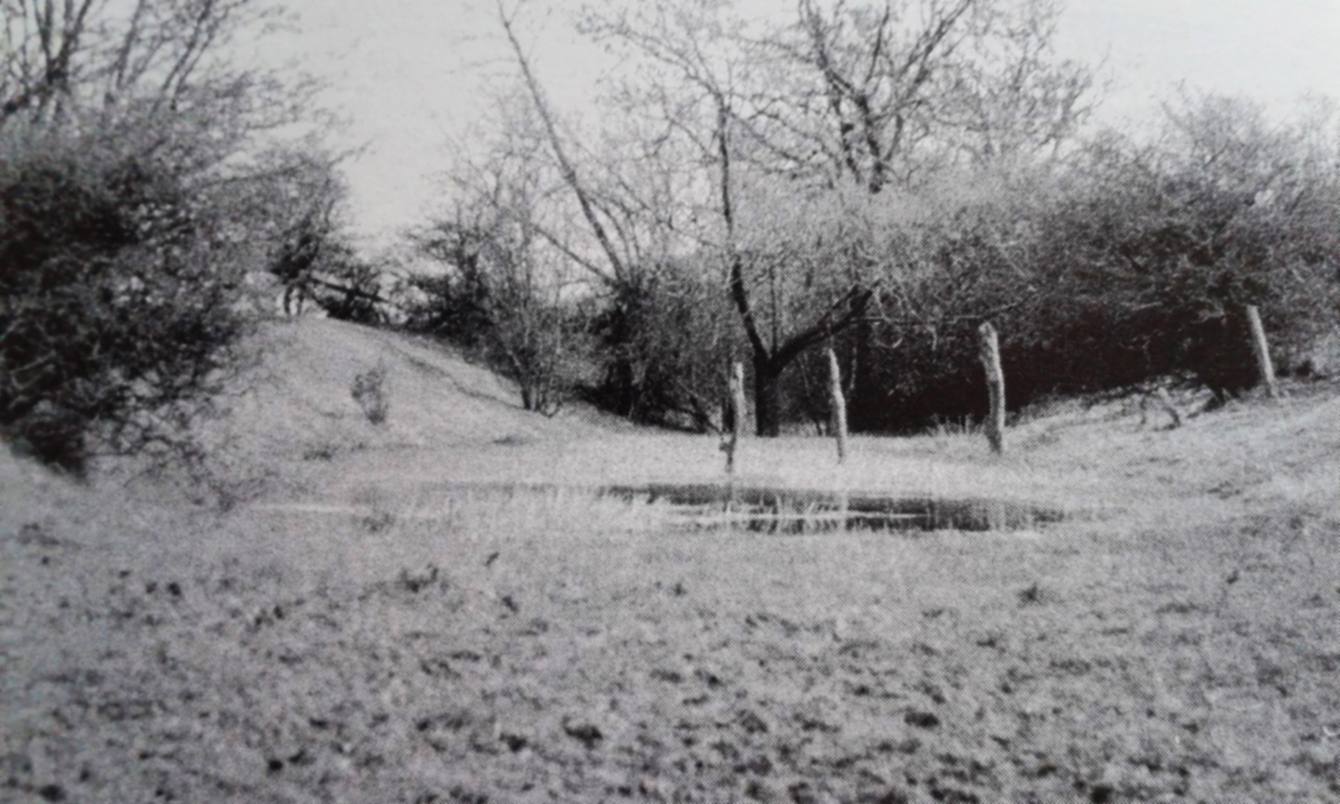
With a photograph from David Tew’s book The Oakham Canal, first printed in 1968, I headed for Wyfordby, a few miles east of Melton Mowbray, in the valley of the River Eye. Paul Dadford of the Oakham Canal Green Corridor Project gave me some instructions to start: “There is a public footpath to the west of Wyfordby Church which leads you down to the canal over the railway line. I suspect that this is the area where the picture was taken.” The LiDAR (Light Detection and Ranging) map gave a perfect image of the ground elevation and where Oakham Canal was before. Google Earth confirmed that some parts are overgrown with trees.
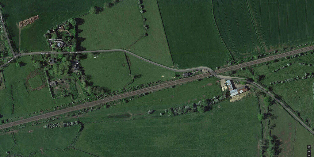
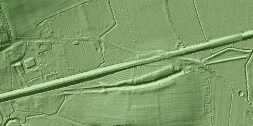
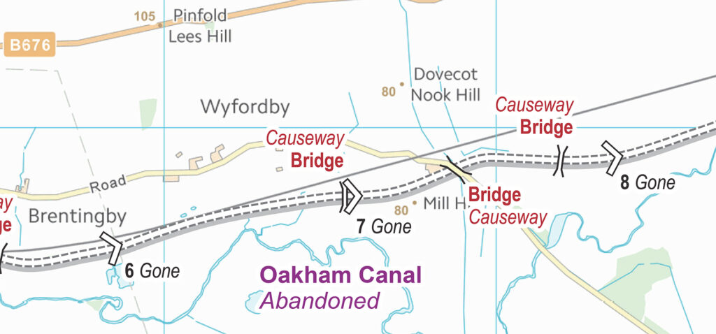
In between wintry showers, I walk through the churchyard and the forgotten orchard of the Old Rectory. “Stop Look Listen Beware of trains”, reads a sign along the railway line, where trains are easily spotted. A long linear depression cuts through the adjacent field and easily marks the route of Oakham Canal. Where the public footpath crosses the former canal, Lock 7 was located. David Tew went a bit off track for the old photograph, just as I did for the remake.
In the second edition of The Melton to Oakham Canal book, published in 1984, David wrote: “At Lock No. 7 no masonry remains although the two levels are clearly shown. The whole lock is indicated by grass covered mounds. Unfortunately a land drainage scheme has been carried out which involved the cutting of a trench through the whole length of the old lock; this has now drained the canal, although the situation of the land is such that it is difficult to see what has been gained by this work. Just before the Wyfordby-Stapleford road is reached, there is a small garden in the middle of the canal. Here there was a swingbridge known as Hicklings Bridge but no sign of it remains.”
“The Oakham Canal was completed in 1802 during the second part of the great age of canal building in the UK,” explained Paul. “The canal suffered from a lack of adequate water supply at the Oakham end. There were 19 broad locks along its 15.5-mile route. It was sold in 1847 to the Midland Counties Railway, who purchased the canal for its trade and provided land for the construction of some sections of the Syston to Peterborough Railway. The locks were dismantled, the land sold, and most of the canal drained after closure. You can still see much of its route in the landscape, and a section closer to Oakham remains in water.”
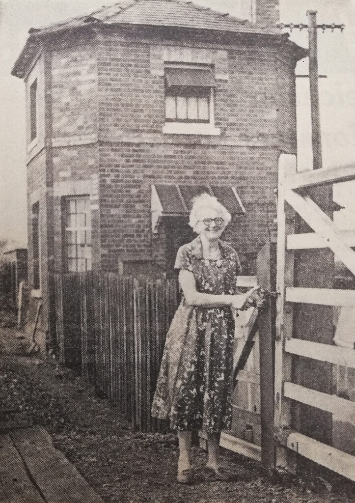
Continuing the footpath, I reach the single road track from Stapleford to Wyfordby and go left, passing a gated train level crossing. The gatehouse was demolished after a planning application was approved in 2003. A new dwelling has been built.
A 1960s newspaper article (no exact date) pictured Nellie Morris, the level crossing keeper at Wyfordby since 1927, when she retired. The article stated: “Mrs Morris has watched the local Belvoir and Quorn Hunts over the land near the crossing, and before the war, she saw Edward, Prince of Wales, and the Duke and Duchess of Gloucester, riding with the hunt on a number of occasions.”
The last crossing keeper was Michael Weston, who said in a 2003 interview: “As far as I’m concerned, it is the most isolated job in Leicestershire.” As a crossing keeper, Michael had to be ready to open the padlocked gates at any time of the day and night or stop people from when a train was due. In 2004 Michael’s job became a piece of railway history in itself.
Church of St Mary the Virgin
From here, it is only a few hundred yards to the church of St Mary the Virgin, a Grade 2 listed building. Over the past 200 years, there have been quite some problems with the ancient building. When the Leicestershire Archaeological Society visited Wyfordby in the second half of the 19th century, the members found the 13th century Church of St Mary sadly neglected. The report said: “The roof overwraps, and no provision is made to carry off the water, which is absorbed by the earth and must be doing considerable damage to the foundations.” The parish church, dated 13th and 14th centuries, was restored in 1869. Despite being declared redundant in the 1960s, St Mary’s was brought back in use in 1965. Initiators were two 12-year old schoolgirls, Susan Wildman (later Mabbutt) and Jenny Jones (later Stuart), who had sought shelter from the rain in the derelict church. Inspired by what they saw, they wrote to the Melton Times to plea for its reopening. The community swung into action, and the church reopened on 17 October 1965 for the harvest festival. With them was the newly-appointed vicar, the Revd Eric Brown.
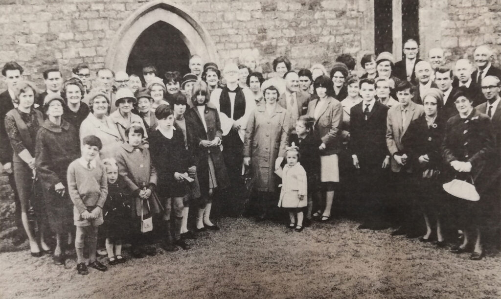
At the beginning of the 1980s, after some more years of neglect, the church and its churchyard became a model of care and attention.
But, the bad news kept coming. Gangs stripped lead from its roof in three raids in 2015 and 2016. Over the course of 18 months, lead thefts left Wyforby’s church on the At Risk register, with its future in doubt. The church was in a sorry state. Insurance only covered part of the cost. So a series of fundraising events followed. The church council also applied for a series of grants. Although the village only counts about 50 people, nearly enough money was collected, also with the help of the Follett Trust, linked to bestselling author Ken Follett. Since the end of March 2022, the badly damaged church has been reroofed with steel at the cost of £38,000. Another £10,000 is needed to finish the work, and the villagers hope to make the site a community hub.
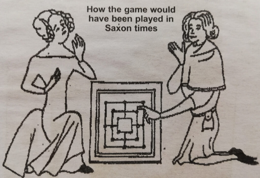
The interior is well worth a visit. Memorials include a marble and slate war memorial tablet, 1919, and a cross, 1907. A newspaper article dated 5 October 1973 mentioned the discovery of a Merrills or Wine Men’s Morris Stone discovered by John Richards, secretary of the Loughborough and District Archaeological Society. “It forms a windowsill in the south aisle, and the window itself dates back to the 14th century. The ancient game of Merrills was played throughout the continent as early as 2000 BC. It was introduced to Britain by the Vikings. They had camped in this area and were responsible for giving many villages the ‘by’ ending to their names, such as Brentingby, Freeby, Saxby, Welby and Wyfordby. It was the usual practice to etch the game on a flat piece of stone, although shepherds made markings in turf, as mentioned by Shakespeare in Midsummer Night’s Dream.”
Wyfordby wayside cross
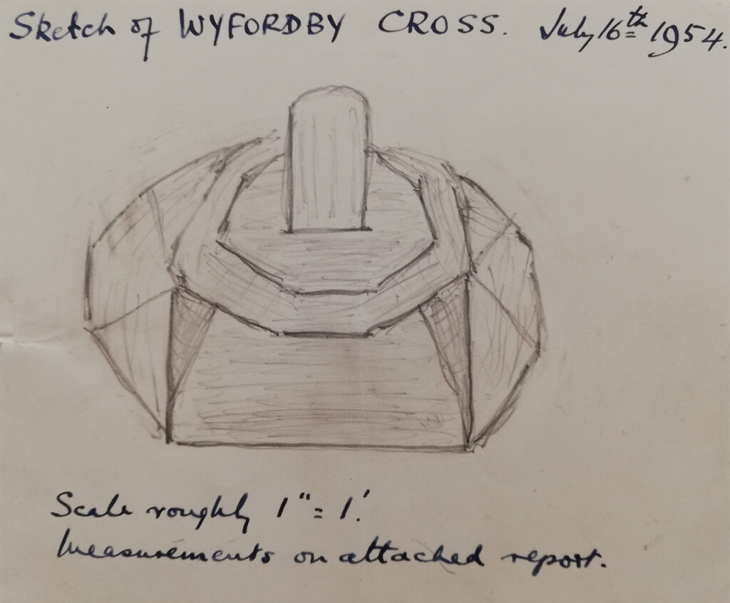
The 1955-edition of Transactions of the Leicestershire Archaeological and Historical Society mentioned a wayside cross, likely of 14th-century origin, 200 yards west of Wyfordby church on the north side of the road to Brentingby. The well-weathered shaft is set in a square socket. The shaft of the cylindrical section is well weathered. The remains of the cross were uncovered by a local archaeological society in 1954 and had been almost entirely covered by soil and undergrowth. A square brick enclosure was subsequently added to surround the remains of the cross.
The discovery of the stump of the cross on the grass verge of the Brentingby Road was declared in a letter dated 20 July 1953 from J.A. Daniell, Assistant Keeper of Antiquities of the Leicestershire County and chairman of the Vaughan College Archaeological Society. The letter was sent to Lt.Col. Sir Robert E. Martin after visiting society’s members in Wyfordby. “It is almost completely buried, but they were also able to ascertain that about twelve inches of the shaft exist and that it is set into a stone base. Not wishing to cause any ‘damage’ to the grass verge, they covered it up again, but it would seem a pity if this wayside cross, previously unrecorded, should be lost again.
On the village
Wyfordby is a settlement with nearly a thousand years of history. To the south of the church are a moat, which well survived time, some earthworks, and a now dry fishpond. Unusually for Leicestershire, it has a raised central island that remains undisturbed and will retain significant evidence of the buildings which occupied it. The moat comprises a rectangular 20 by 30 metres island raised by 2m above the surrounding ground surface. On the site stood the manor house which is said to have been built by the Chevercourt family, who held it for two centuries until, in the 14th century, the Mowbrays succeeded. They would be absentee landlords, and, from their succession, the old place gradually vanished, perhaps mainly through the shortage of local building materials. The old buildings around it no doubt contain some of its stones.
On moated sites – Historic England
Around 6,000 moated sites are known in England. They consist of wide ditches, often or seasonally water-filled, partly or completely enclosing one or more islands of dry ground on which stood domestic or religious buildings. In some cases, the islands were used for horticulture. The majority of moated sites served as prestigious aristocratic and seigneurial residences with the provision of a moat intended as a status symbol rather than a practical military defence. The peak period during which moated sites were built was between about 1250 and 1350, and by far, the greatest concentration lies in central and eastern parts of England. However, moated sites were built throughout the medieval period, are widely scattered throughout England and exhibit a high level of diversity in their forms and sizes. They form a significant class of medieval monuments and are important for the understanding of the distribution of wealth and status in the countryside. Many examples provide conditions favourable to the survival of organic remains.
Would you like to add your story and recollection? Leave a comment at the bottom of this page or send a message.
More pictures
Would you like to add pictures? Send a message.
Domesday Book
Wyfordby was a settlement in Domesday Book, in the hundred of Framland and the county of Leicestershire.
It had a recorded population of 45.1 households in 1086, putting it in the largest 20% of settlements recorded in Domesday (NB: 45.1 households is an estimate, since multiple places are mentioned in the same entry), and is listed under 3 owners in Domesday Book.
1. Land of Henry of Ferrers

Valuation
- Annual value to lord: 7 pence in 1086.
Owners
- Tenant-in-chief in 1086: Henry of Ferrers.
- Lord in 1086: Henry of Ferrers.
2. Land of Roger of Bully
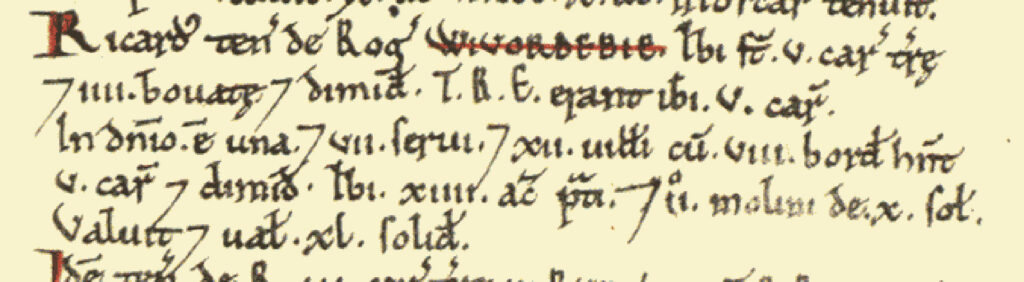
- Households: 12 villagers. 8 smallholders. 7 slaves.
- Ploughland: 5 ploughlands. 1 lord’s plough teams. 5.5 men’s plough teams.
- Other resources: Meadow 14 acres. 2 mills, value 10 shillings.
Valuation
- Annual value to lord: 2 pounds in 1086; 2 pounds when acquired by the 1086 owner.
Owners
- Tenant-in-chief in 1086: Roger of Bully.
- Lord in 1086: Richard.
3. Land of Geoffrey of la Guerche
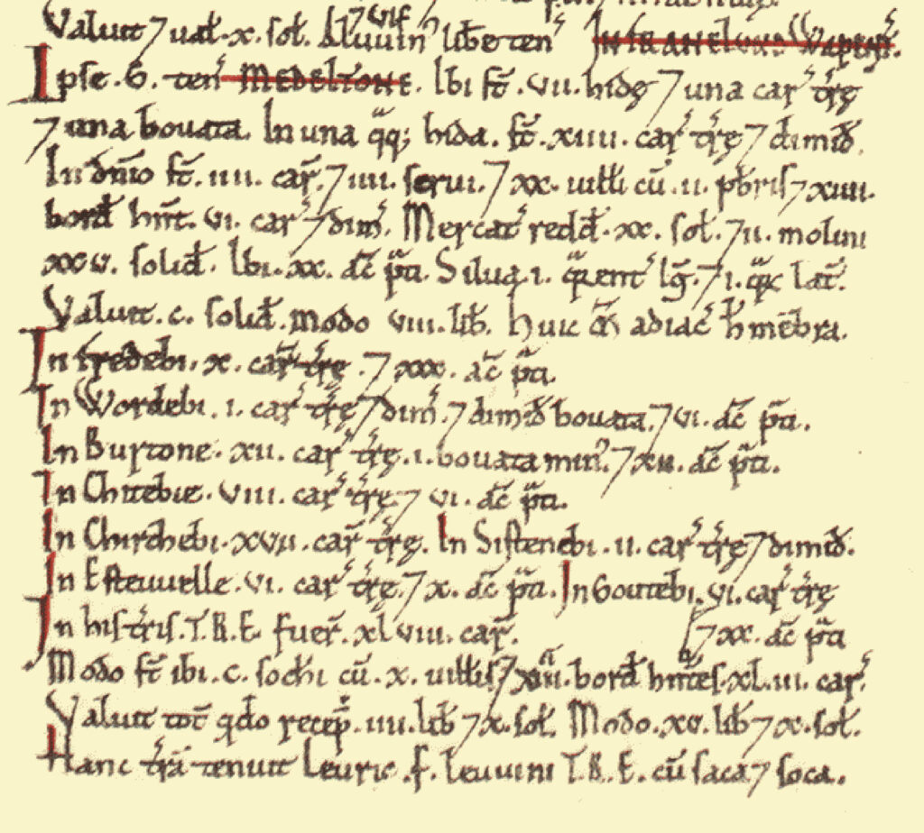
- Households: 30 villagers. 100 freemen. 27 smallholders. 4 slaves. 2 priests.
- Ploughland: 48 ploughlands. 4 lord’s plough teams. 49.5 men’s plough teams.
- Other resources: Meadow 104 acres. Woodland 1 * 1 furlongs. 2 mills, value 1 pound 5 shillings.
Valuation
- Annual value to lord: 23 pounds 10 shillings in 1086; 9 pounds 10 shillings when acquired by the 1086 owner.
Owners
- Tenant-in-chief in 1086: Geoffrey of la Guerche.
- Lord in 1086: Geoffrey of la Guerche.
- Lord in 1066: Leofric (the noble) son of Leofwin.
Links
Would you like to add a link? Send a message.