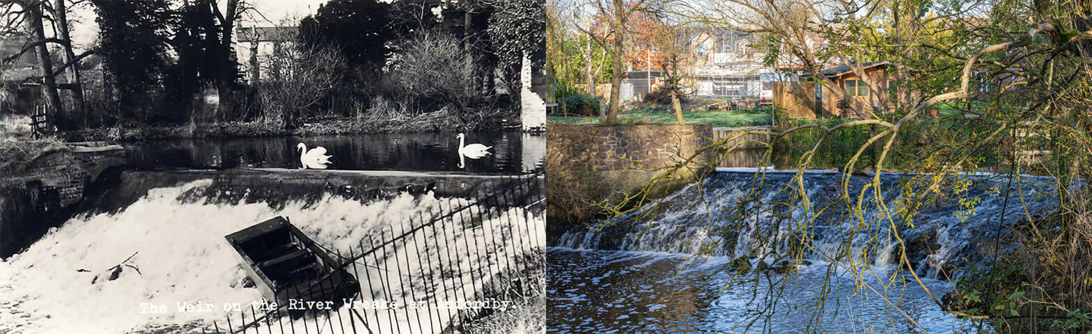
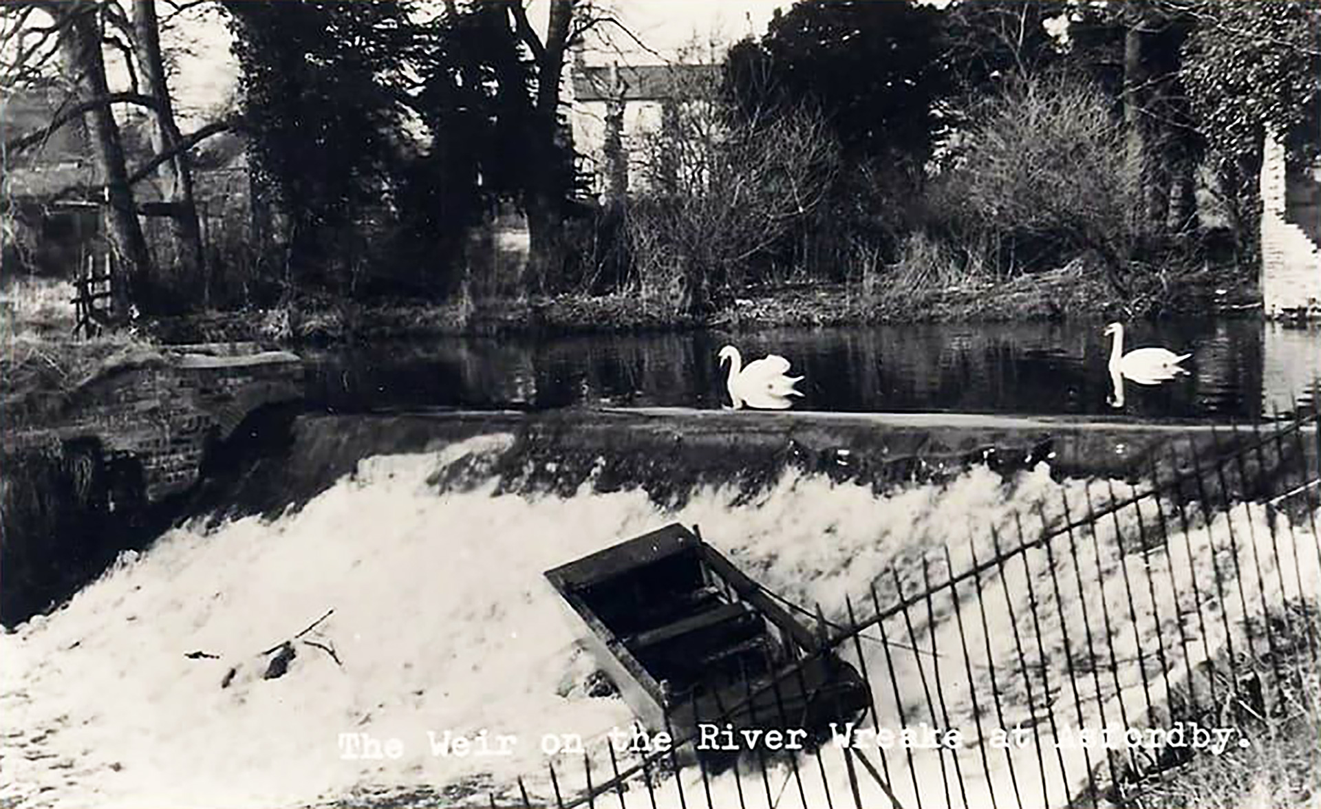
Weir on the River Wreake – 1950s
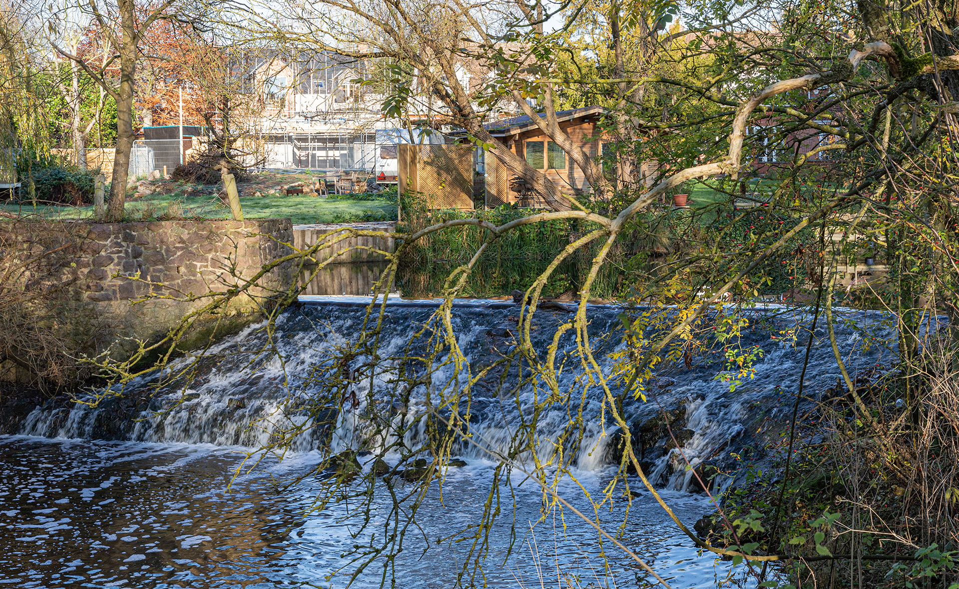
Melvyn Hudson gave clear directions to Asfordby’s weir on the River Wreake. “Going down on Mill Lane, at the end, you reach Mill House. Continue on a public footpath with a high brick wall on one side and cross an old iron green bridge.” So far, so good. “Then go left into the field where the late Ralph Toon, a former mayor of Melton Borough, grazed his cows …” There is no field, only a fenced woodland, planted about ten years ago. So the access is restricted, and a bit further along the footpath, nearly at Station Lane, there is a closed gate. Because trespassing is not my way of doing it, I first sought permission and hopped over the gate several weeks later. After a short walk through the woodland, there is a second gate and a pasture where sheep are grazing. I reach the river and the weir, following the border between the trees and the open field. Mission accomplished.
“The place along the river near the weir was called the Cataract. As children, we paddled in the water and had our fishing nets with us along the River Wreake,” told Melvyn Hudson. Jo Pearson recollected: “My partner has lived in Asfordby all of his life, and he remembers it well.” Sandra Lock showed a picture taken in 1948 and added: “Asfordby was my home village until I was 16, and I spent a lot of time with friends in the fields near the river. It was all grass then, with a shallow bit at the bottom of the cataract that was sandy where you could paddle. In the picture are my mum Eileen Edwards (on the left), her mum Evelyn Pymm (on the right), my great grandmother Wilhelmina Clarke and myself, Sandra Edwards. We all lived in Asfordby at the time the photo was taken.

On the right-hand side of the old picture are brick-layered foundations from a former boathouse in an orchard along the river.

The Wreake originates in Holwell and passes through Welby, joins the Eye south of Asfordby Valley as a smaller stream, and names to rest of the river downstream to Syston. “Why the River Eye changes its name to the River Wreake at Asfordby has always been thought-provoking,” wrote Gilbert King in his article Our Heritage, published on 13 May 1988 in the Melton Times. Wreake is an Old Norse word meaning ‘twisted’. An old Ordnance Survey Six-Inch map (1888-1913), published in 1904, gives a good view of how the water did flow and still does.
The original river did follow the blue line marked on the map. The weir was built, and the Mill Race was created to provide the mill further downstream with sufficient water.

“The weirs on the River Wreake have been there for a long time,” explained Mick Clowes, chair of the Melton & Oakham Waterways Society (MOWS). “Along the river, eight mills relied on a regulated water flow achieved by constructing weirs.”
Both streams, the original bedding of the river and the Mill Race, created an island. That island did become an area with allotments kept by the villagers. Melvyn explained: “As I mentioned, there is a long brick wall if you walk past Mill House, where the Charles family lived in the 1930s. An arched doorway went to big allotments at the back of Mill House, where some villagers used to grow their vegetables. And some footbridges led to the field where the late Ralph Toon’s cows grazed.” The allotments are also private property now. Melvyn continued: “Following the river round, it took you to the weir and the Cataract. Mr and Mrs Carver lived in the house in the back of the old picture. It was situated on Brook Lane. Mr Carver worked at Mr George Edward Dwyer’s coal business. Further on the river passed The Old Rectory, called Beechcroft, where the late Bruce and Doris Brotherhood lived. They ran a clothing shop in King Street in Melton Mowbray. Beechcroft was also the scene for the musical evenings organised by the Asfordby Methodist Chapel. There were also garden parties, boat rides and Tug of War competition with a team on each river’s shore. All Saints Parish Church and then the River Wreake keeps meandering upstream where it becomes the River Eye before reaching Melton Mowbray.”
On the Francis Frith website, Lyn Praed shared in 2008 the following memory: “It was December 1965, and my sister Ellen Blackham and I sailed to England, from Perth, Western Australia, to spend time with my sister Doris Whitby. Doris and her husband Roy had purchased The Old Rectory in the late 1950s. It was no longer required as a rectory and was therefore put on the market. I will never forget driving down Station Lane on that grey afternoon in December and seeing Beechcroft – my sister named it that because of the huge beech tree that was growing on the right of the building – for the first time. Christmas was approaching, and we were excited to be celebrating it here at Beechcroft with the possibility of a white Christmas as well. We walked through the village singing Christmas carols, and then people came back to Beechcroft, and in the huge kitchen, we had fruit mince pies and hot cocoa. Ellen and I stayed for 18 months. Summer days on the lawn with our nieces Jenny and Maureen, clearing out the old fish pond on the front lawn, our washing frozen stiff on the line, returning home from work and walking down Church Lane, coming through the gates and being greeted by this magnificent old building. We were told that it had a ghost, but unfortunately, we never had the pleasure of meeting it! Sadly Roy died not long after our return to Australia, and years later, Doris married Roy’s best friend, Bruce Brotherhood. Doris and Bruce sold Beechcroft in the 1980s.”
MOWS chair Mick Clowes: “During the ‘canal mania’ between 1750 and 1820, Britain was obsessed with creating canals to transport goods faster. Also, a lot of roads were in a terrible state and road charges surged.” In 1790 the River Wreake was surveyed by Christopher Staveley under the engineer William Jessop who built many other canals in Leicestershire. A year later, an Act was passed in Parliament allowing the Rivers Eye and Wreake to be made navigable to barges from the junction with the Leicester Navigation at Turnwater Meadow in Syston to Melton Mowbray. £25,000 was raised in £100 shares. By 10 January 1794, the Wreake was navigable as far as Rearsby. Full navigation to Melton probably began in 1797. The length of the canal was 14¼ miles. Twelve broad locks were built to overcome the rise of a bit over 70 feet. And about ten shortcuts were created. The total cost was about £45,000.”
“One of the shortcuts were created in Asfordby, south of the river, with a lock, built just before the canal ends up again in the river, and where Station Lane crosses the canal and the river. Before the canal was built, the millers along the Rivers Eye and Wreake opposed the plans for a canal because they were worried about losing the flow of the water. But once built, they found out there were only advantages such as the speed of transport of their goods,” added Mick.
In its heydays, coal went from Leicestershire to Melton Mowbray, and wheat, pork pies, Stilton cheese, and other agricultural products found their way downstream Leicestershire. There was much competition from other canals, principally the Grantham Canal, and there were price wars. Railways brought the decline of trade for the canals. A railway was opened from Syston to Melton on 1 September 1846. It directly affected traffic on the Melton Mowbray Navigation and began that company’s rapid decline. The Melton Navigation Company closed on 1 August 1877.
Many years later, a dysfunctional lock was dismantled, and a weir got in place to keep the water at its level. Diane Lightfoot remarked: “The only weir I know has got a bridge across it, and I have lived in Asfordby for 60 years.” The Melton and Oakham Waterways Society (MOWS) was formed in 1997 to campaign and actively work to preserve and restore the Melton Mowbray Navigation and the Oakham Canal. “It would be fabulous to make the River Wreake accessible again for boats,” said Mick Clowes of the MOWS. “There is one main obstruction. The Environment Agency administers the River Wreake and not the Canal and River Trust. The latter is pro restoring navigable canals and rivers. The first is against.”
Post Office – 1936

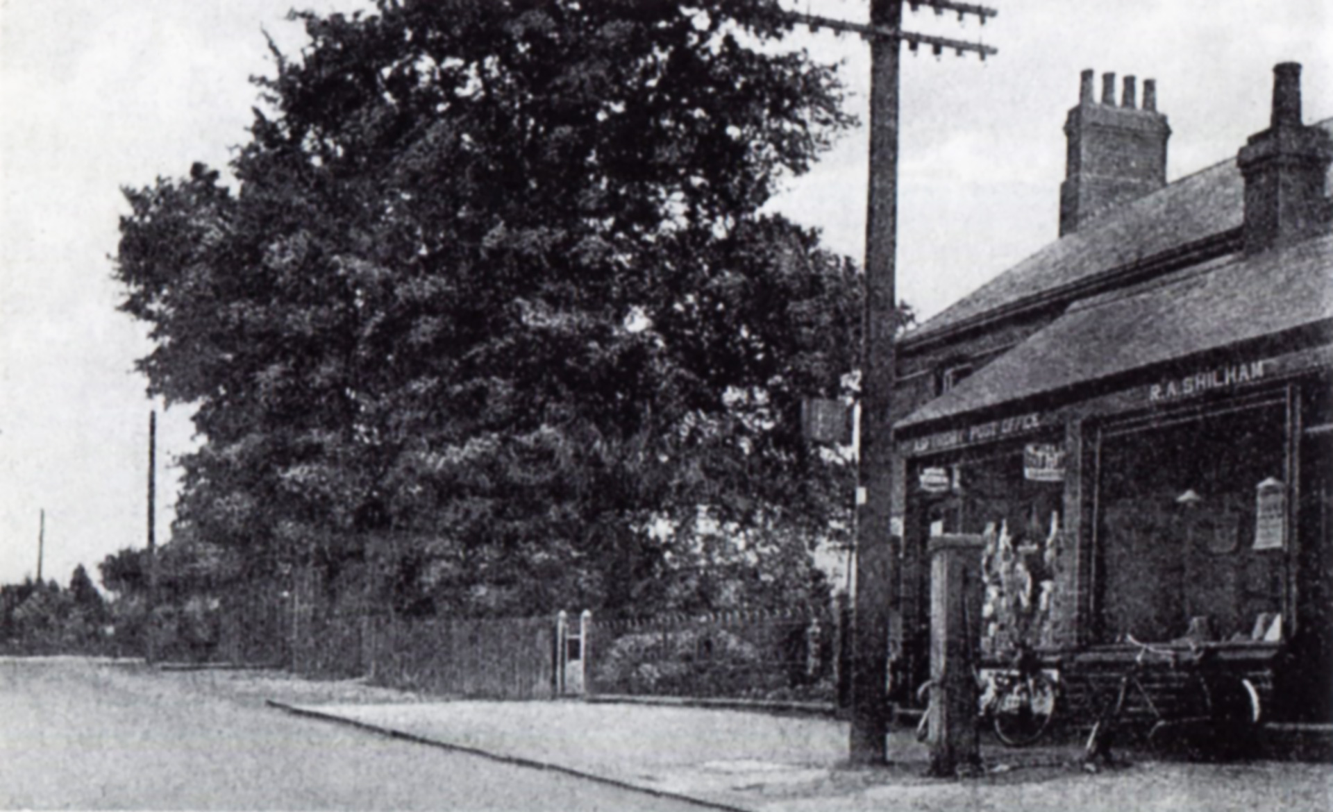
The small building in front writes a part of Asfordby’s history. On the left was the post office at the beginning of the 1930s, already run for 40 years by Mr R. Dowson. Melvyn Husdon recalled: “ From the 1930s until the 1960s, it was run by Charles Garland, from a well known Methodist family in the village. Charles had two sons and a daughter. Ken took over the post office and married an Italian girl named Adriana. Ken played solo cornet and bugle in the Melton Mowbray Town Silver Band.” “Ken taught us real music that the teachers from KEVII failed to do. I played the soprano E flat cornet mainly because I had young lungs to play the ear bursting instrument, and nobody else wanted to play it. Ken Garland played the solo B flat cornet. When I struggled to hit the top notes, Ken would often switch on his lower pitch cornet and produce the note for me. He was my hero,” Colin Duley remembered.
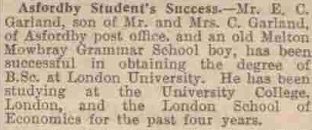
Melvyn Hudson continued: “Originally, the post office started in Ken’s parent’s home near where the bus stop is. My father told us when the Second World War had ended, Charles Garland came out of the Post Office and stood in the middle of Main Street shouting at the top of his voice, holding the official telegram from the War Office in London in the air: ‘Good news! Good news! The war has just ended!’” Charles daughter was Doreen, and his other son was called Edward. Edward was a Melton Mowbray Grammar Schoolboy and obtained in 1939 the degree of B.Sc at London University. The Leicester Daily Mercury wrote on 8 August 1939: “He has been studying at the University College, London, and the London School of Economics for the past four years.”
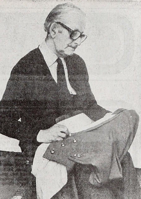
Melvyn Hudson: “On the left next door was Reginald Arthur Shilham’s tailor shop. Reg would sit with its legs crossed, a big light hitting his needle, sewing for the gentry people of the local hunt. He did some sewing of hunting boots for Rowels, the well-established shop in Melton Mowbray on the corner of Church and Leicester Street. Reg Shilham was also chairman of the Melton Mowbray Fur and Feathers rabbit club, with Len Beckett as secretary. They organised shows in the Asfordby Parish Hall. The tailor shop is now a hairdresser.”
In front was one of the village’s water pumps. The house at the back of the tailor shop and the post office was Roberts’ cobblers shop.
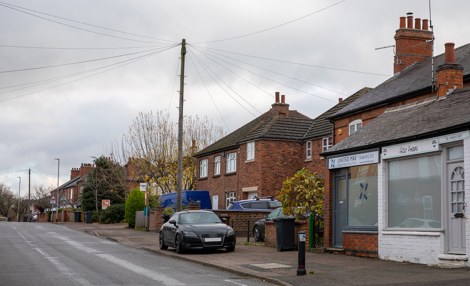
In the 1980s, the Post Office moved to its current location in a close-knitted community. “Asfordby has people who care about others,” wrote Quentin Clark at the end of December 1983 in the Melton Times, “and a number of them work through the village’s 21 Club.” That charity club was founded by 21 Asfordby villager’s in 1973 to raise money that could be used for the benefit of the parish. It was an all-male membership group. In 1980 women were allowed to join. The cash was raised by hoe-downs and bingo events which are very well attended. “Hospital visits are among the Club 21’s activities, and they also gave every old age pensioner a Christmas pudding, handed out when they went to the post office to collect their pensions.” “We are really a distribution point,” said Alan Batten, who has the village shop, which includes the post office. “As every pensioner comes in here to collect their money, we can ensure that nobody is missing out.” In 1983, when Allen Batten was for the first time involved in the scheme, the Post Office handed out 180 puddings. Previously Allen had community stores in the West Midlands. He moved to Asfordby to take over the shop from his brother Ted.
On the village
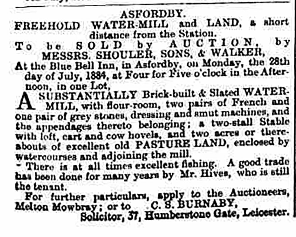
At the end of the 11th century, Asfordby had two mills. One was a water mill. Grantham Journal of 19 July 1884 gave notice, the Asfordby water mill and surrounding land, not far from the train station, will be sold by auction at the Blue Bell Inn on Monday 28th July 1884. It is described as “a substantially brick-built & slated watermill, with flour-room, two pairs of French and one pair of grey stones, dressing and smut machines, and the appendages thereto belonging; a two-stall stable with loft, cart and cow hovels, and two acres or thereabouts of excellent old pasture land, enclosed by watercourses and adjoining the mill. There is at all times excellent fishing. A good trade has been done for many years by Mr. Hives, who is still the tenant.”
A picture dated about 1900 shows on the left the watermill and the Mill House, which is still there, on the right. In the 1930s, the Mill House was the home of the Charles family.

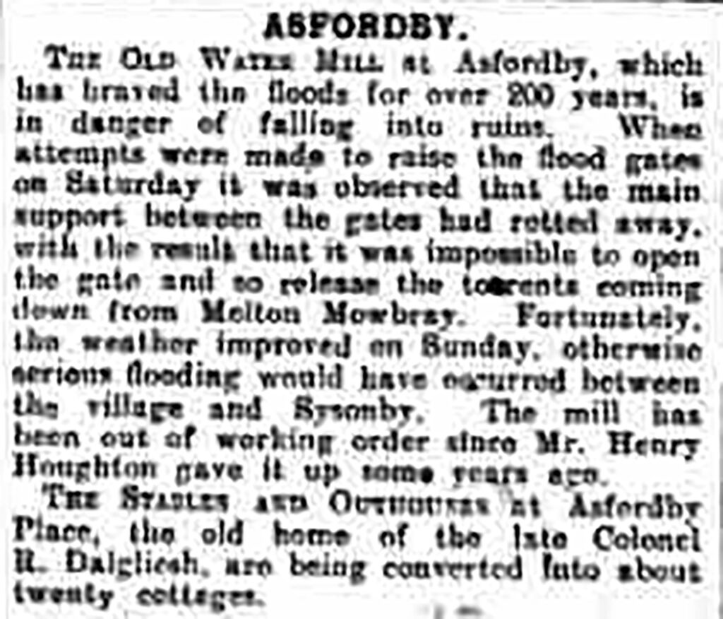
The mill was in operation until the end of the 1920s, when the last miller Henry Houghton gave up his business. On 12 September 1931, the Grantham Journal wrote: “The old water mill at Asfordby, which has braved the flood for over 200 years, is in danger of falling into ruins. When attempts were made to raise the flood gates on Saturday, it was observed that the main support between the gates had rotted away, with the result that it was impossible to open the gate and so release the torrents coming down from Melton Mowbray. Fortunately the weather improved on Sunday, otherwise serious flooding would have occurred between the village and Sysonby.”
The wheel of the watermill was removed for scrap in 1932.

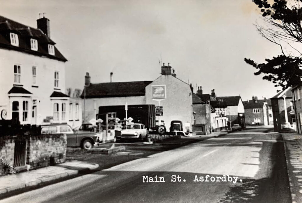
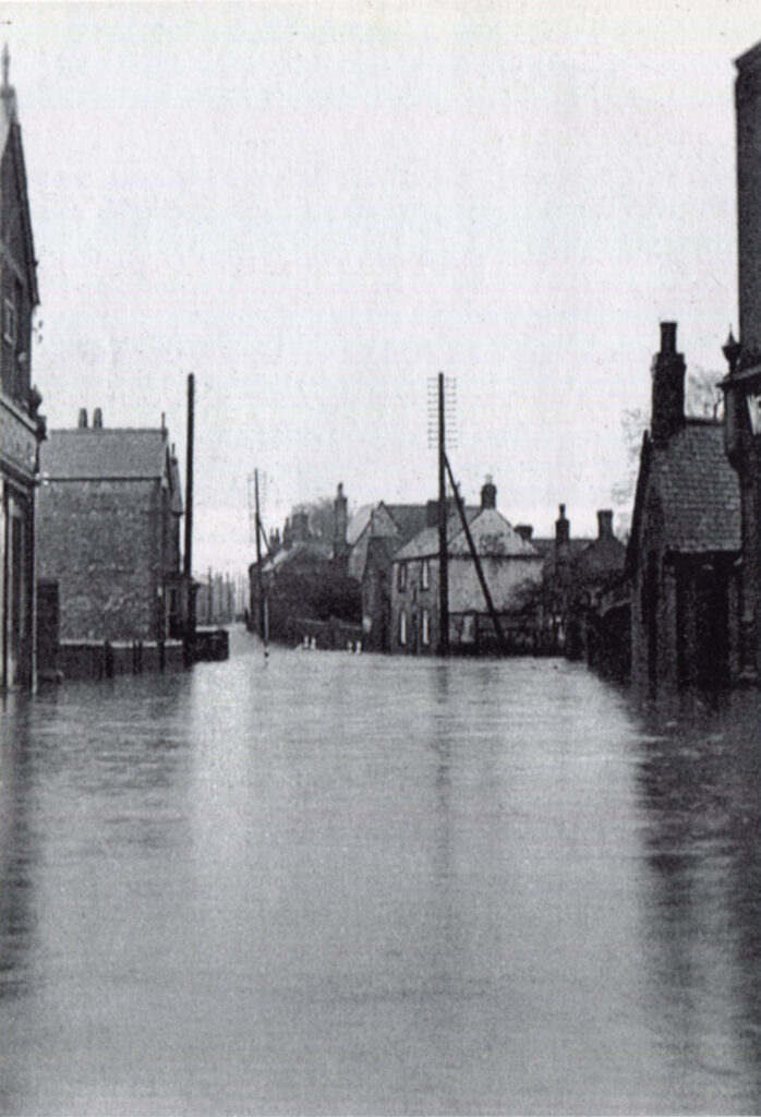
The village was also regularly flooded because it lies along the River Wreake. Melvyn Hudson remembered wading kneedeep through Main Street when going to school. For sure, a lot of other villages have memories of this.
More pictures
Would you like to add pictures? Send a message.
Domesday Book
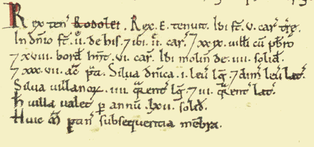
Asfordby was a settlement in Domesday Book, in the hundred of Goscote and the county of Leicestershire.
It had a recorded population of 24.9 households in 1086, putting it in the largest 40% of settlements recorded in Domesday, and is listed under 2 owners in Domesday Book.
- Land of King William
- Households: 186 villagers. 204 freemen. 112 smallholders. 1 priest.
- Ploughland: 2 lord’s plough teams. 88 men’s plough teams.
- Other resources: Meadow 176 acres & 3 * 1.5 furlongs mixed measures. Woodland 3 * 3 furlongs & 5 acres; 1 * 0.5 league & 4 * 3 furlongs mixed measures. 6 mills, value 17 shillings.
Valuation
- Annual value to lord: 34 pounds 10 shillings in 1086.
Owners
- Tenant-in-chief in 1086: King William.
- Lord in 1086: King William.
- Lord in 1066: King Edward.

2. Land of Ralph Framen
- Households: 2 villagers.
- Ploughland: 6 men’s plough teams.
- Other resources: Meadow 12 acres.
Valuation
- Annual value to lord: 10 shillings in 1086.
Owners
- Tenant-in-chief in 1086: Ralph Framen.
- Lord in 1086: Ralph Framen.
5 responses to “Asfordby”
I have so enjoyed reading the beautiful history on this site regarding the village of Asfordby near Melton Mowbray. Myself and my family past and present, have lived there since the early 1900s. A planning application to alter the Mill Pond area has been submitted to Asfordby Parish Council, and it is under Mill Lane Asfordby if you wanted to view it. I’ve put an objection in because I think it should be left alone, in my opinion. It’s part of our history and heritage. Anyway, I just wanted to let you know that your website said that I could comment many thanks.
Hello Hayley,
Happy to share your comment on the Asfordby article. You are right, more and more people ignore the historic value of places around their area. When wondering around Asfordby I must say the Mill Pond area was (and probably still is) a bit overgrown and I was wondering why such an area was closed for the public. Maybe because of the danger people could drown in the Mill Pond? Did you try to get support for your objection by posting a comment on the Asfordby Facebook page (https://www.facebook.com/groups/248382513883640/)?
Regards,
Estelle
Does anyone know when and what happened to the “Butter Cross “ as was called in my childhood, I loved it!
Hi
My relatives left Asfordby in the mid 1800s and went to Van Deimensland. They were the carpenters of the village who made the beautiful alter work in one of the local churches. They were valued members of the community yet a generation left to make new lives in Tasmania. They were the Heazelwood family and if anybody could fill in some of the gaps in my family research it would be greatly appreciated .
Hello Denise,
Thanks you for your comment. Have you tried the Asfordby Facebook page to ask for info about your ancertord. I am happy to post the question for you, I you like.
Estelle