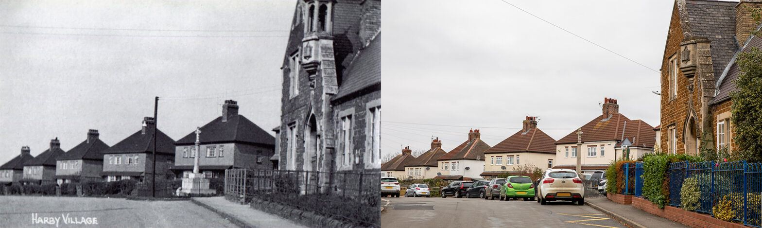
School Lane – End 1930s
Matt Smith moved to London about 25 years ago and has many loving memories about the first 25 years of his life in Harby. “I had a safe upbringing in a rural background. Me and my best mate, went off down the fields for hours and hours on end, never seeing anybody else. Even as a young lad, I knew everybody in Harby, then still a very close-knit village community.” Now Matt spends a lot of his time digging into the village history, especially about the church and its organ. In the past, the late Leslie Cram was the driving force behind the Harby History Group. He wrote three books and collected numerous old pictures.
The Church of England Primary School on the right-hand side of the old postcard opened in 1861. Because of an increasing number of pupils, it was a newly built school, likely erected on the village green site. Matt explained: “In the old picture, you can see a bell tower above the front door. Only the base survives, on one side carved with a swan, the emblem of the school, and on the other side a book, a reference to the book of learning.” The school had two main teaching classrooms, a large kitchen, toilets to the rear, and accommodation for the teacher. Matt continued: “I was a pupil in the late 1970s, early 1980s and have fond memories. Each Friday, we had a craft afternoon. We made all kinds of artwork, did basket weaving, baked cakes and had our kiln for pottery.”
Along the north side of School Lane, the Melton and Belvoir Rural District Council, formed in 1935, built 12 semi-detached houses. The non-parlour houses, in typical 1930s style, were rented out. “My mum and dad moved into 4 School Lane when they married in 1936, the year the houses were just being built”, recollected Pauline Fisher. Some of the houses have now an extension or a garage. In the same period, 1936-1937, also at the east of the village on the north of Stathern Lane semi-detached houses have been built by Melton and Belvoir Rural District Council. Around 1947 there has been further council house building on Pinfold Place to the north of the Stathern Lane council houses.

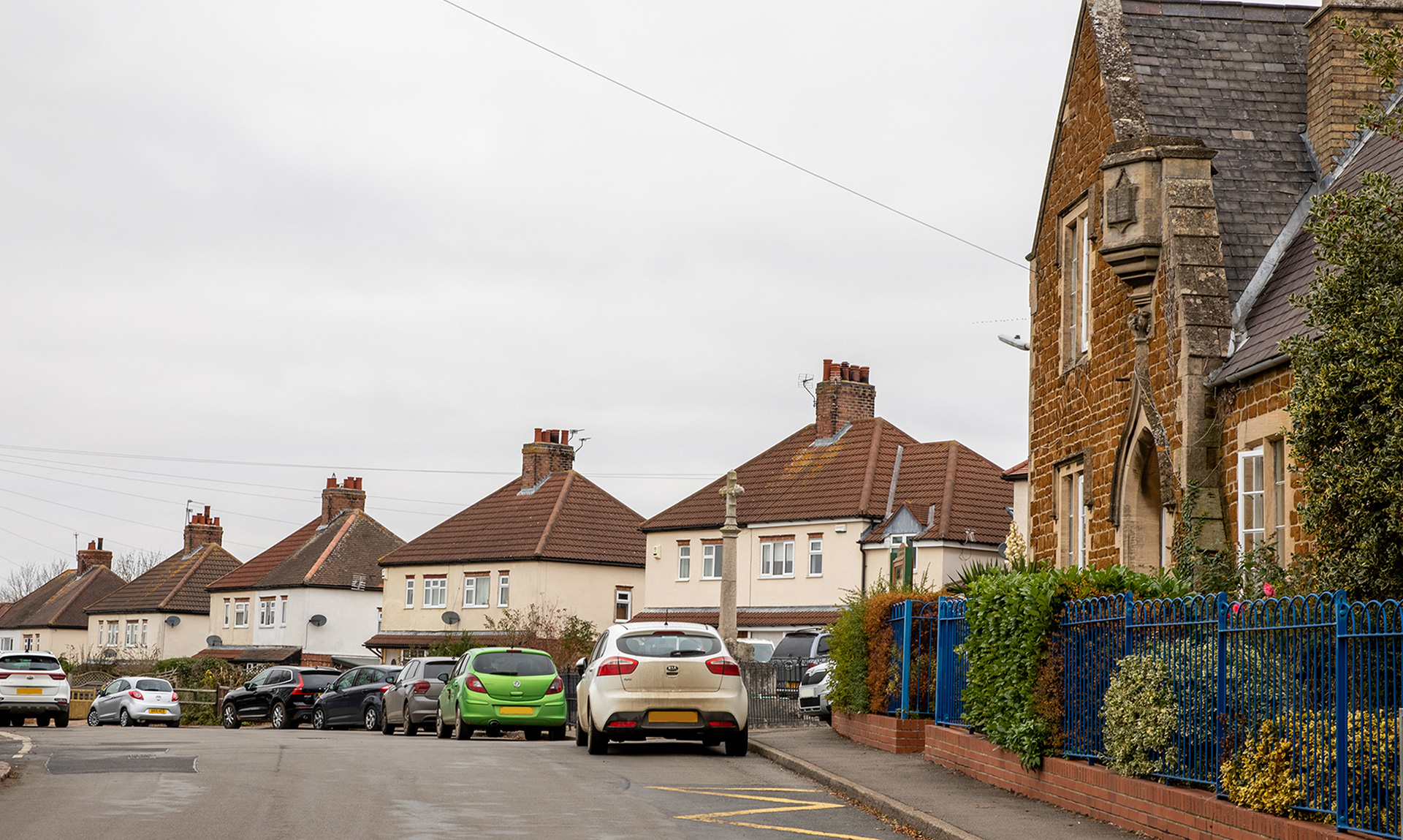
In the curve on School Lane stands the War Memorial Cross erected in 1920. Villager Neil Cunnington researched the history of the cross: “A committee was formed in the village to get drawings and estimates. The accepted plans were drawn up by Mr T. Burbidge, and the work was entrusted to Mr S. Squires of Bingham. The total height is nearly fifteen feet. A stone contains 99 names, nineteen on the front face being those who made the great sacrifice. The remaining 80 names are those who also enlisted from the village and survived the ordeal of The Great War.” Villagers brought together 199 pounds and 10s. The unveiling ceremony took place on the night of Thursday 20 May 1920. “[It] was performed by the Rector Rev. E. H. Stone in the presence of two hundred people. An impressive service was held before the dedication, in which the church and chapel choirs sang, and sixty ex-servicemen formed a guard of honour. The Rev. Stone, in the course of his address, expressed his gratitude to the ex-servicemen of the village for the part they had played in the winning of the war. After the 1939-45 war, two names of men who did not return were carved on the base.” The war memorial has some kind of special touch, explained Matt Smith. “The top step and the pillar going upwards originates from the old village cross, which stood on the village green, not many yards from its present position. When the school was built in 1860 it was removed into the churchyard where it had stood until used as this Memorial.”
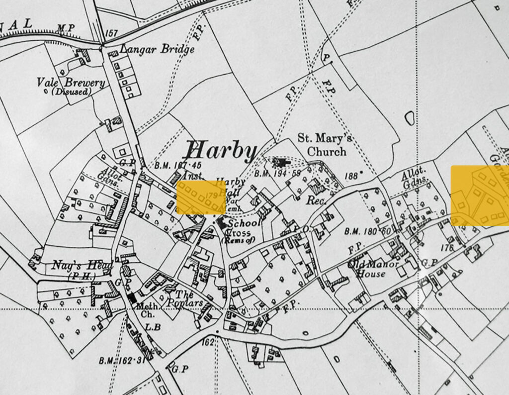
More than 150 years ago, this area, was the centre of the village. Matt: “From School Lane going down from what is Watsons Lane is the original post office of 1847 and it was also the village bakery. The Lamin family were the owners, and they also had the mill and the warehouse along Grantham Canal.” Watsons Lane is named after the Watson family of Harby, who were cheesemakers.
A path from the memorial leads to the church. “The medieval parish church is one of the most stunning places in the Vale of Belvoir. We need to look after this place. As a space for reflection, it can bring the villagers, regardless of their belief, together again”, concluded Matt.

Dickman’s Lane – 1950s

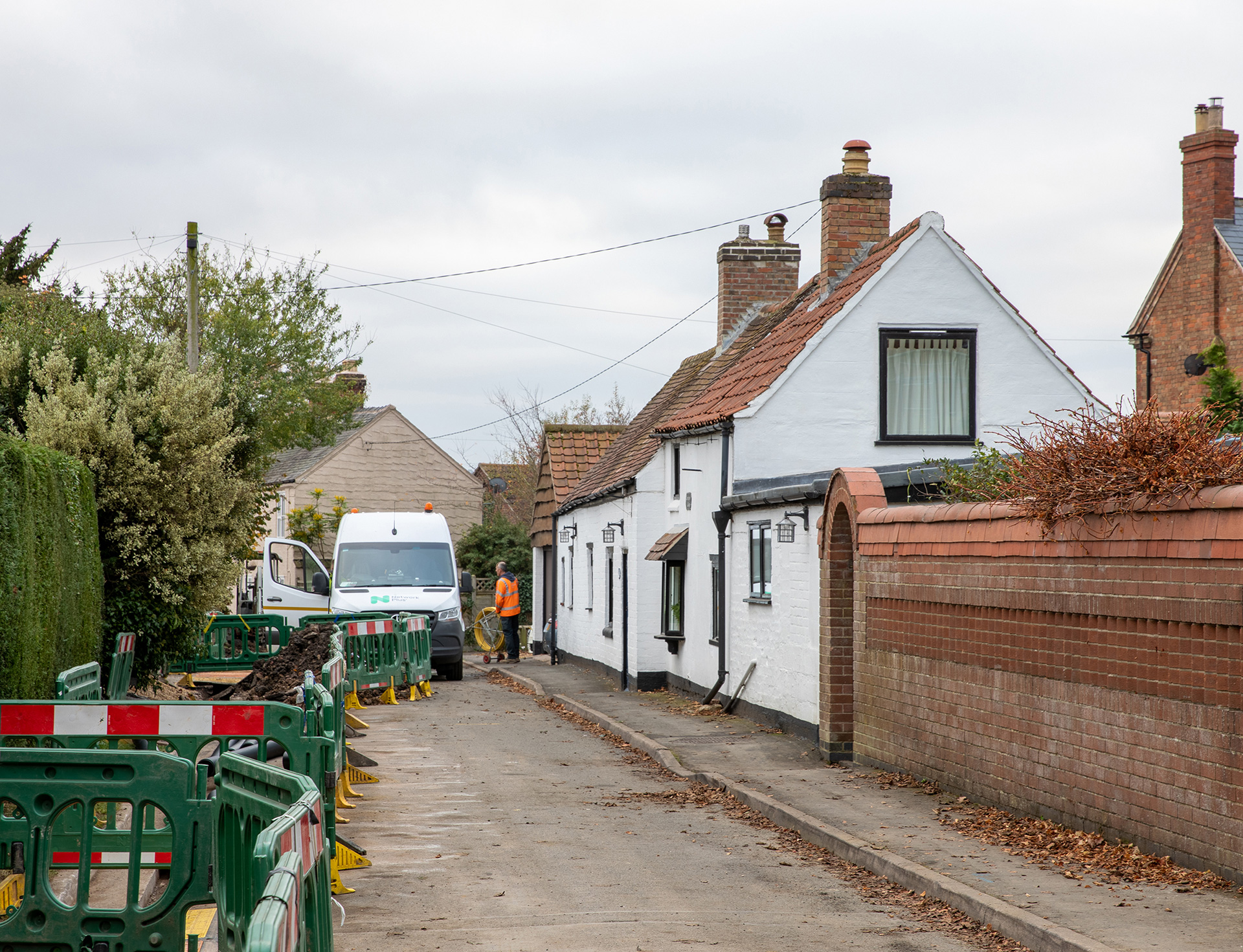
Electricity works were going on when making the remake and made it impossible to stand on the same spot the old picture was taken. In front of the right-hand side is Trevelyan Cottage, which had a thatched roof around 1910. Yvonne Gay said: “My dad was born in Trevelyan Cottage in 1928. When he was about four, he moved to a farmhouse where old peoples bungalows. When he married, he moved again to Stathern Lane, where he still lives.” Before 1965 the cubelike outhouse adjacent to the cottage was lowered, and the wooden outhouse was demolished.
In the old picture, Mr Dickman is walking toward the camera. The lane was named after his grandfather, Dickman’s Cottage is on the far right. Built-up against that cottage was one of the oldest cottages in Harby with its mud walls. The cottages were probably originally built during the 15th century. The Illustrated Leicester Chronicle of 19 August 1956 gave a detailed account: “[They] still retaining an amount of the mud facing which was used at that time. Recently they have been strengthened with brick and concrete in some places, and the original thatch has been replaced by tiles or corrugated iron. Inside they are surprisingly small. The door itself can hardly be more than five feet four inches in height, and the largest room – the sitting room and dining room incorporated – no bigger than 12 feet by ten. The structure of the interior is made even more cramped by its construction. Wooden beams run from wall to wall at the height of a man.” For 60 years, Mr Reeves lived in the mud house, which was never equipped with electricity and was taken down in the 1960s.
On the far left is the house reputed to have been a school for children of the village, described as a Dame School.

Burden Lane – Around 1935
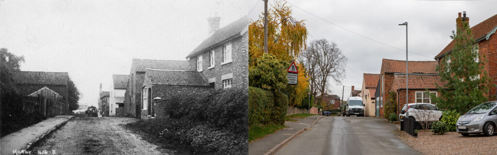
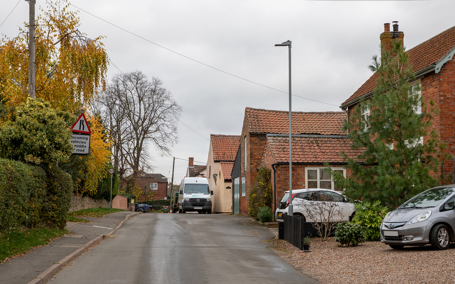
“In the old photo, I believe the shop window on the right was a butchers shop”, recollected Tom Wilson. “And the next building was the slaughterhouse. Julie Whitfield added: “The was at the back also a bakehouse.”
The house on the right-hand side between the white house and the one with the chimney at the front gable was Peppers Stores, run by Fred and Rhonda Pepper in the 1920s and 1930s. It was also the Post Office. For a long time, surely, until October 2000, it was a general store and post office. David and Elaine Moore left it at that time. On the left were Fred Pepper’s cowsheds.

Nether Street – 1947
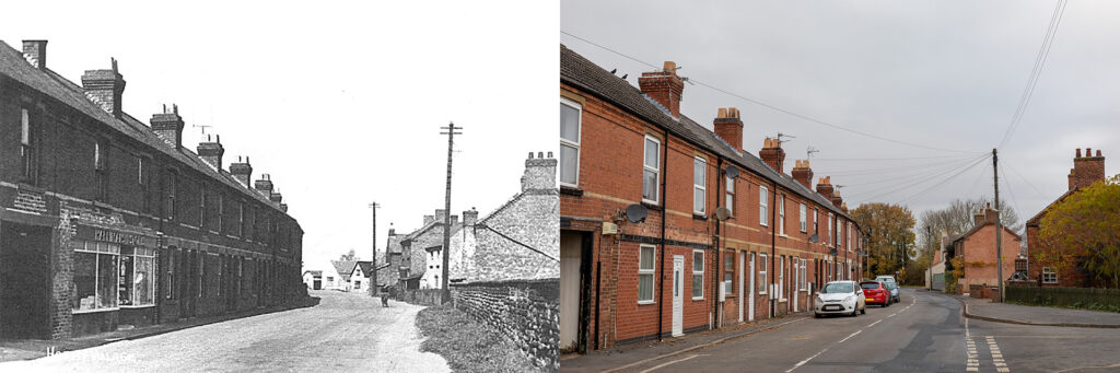
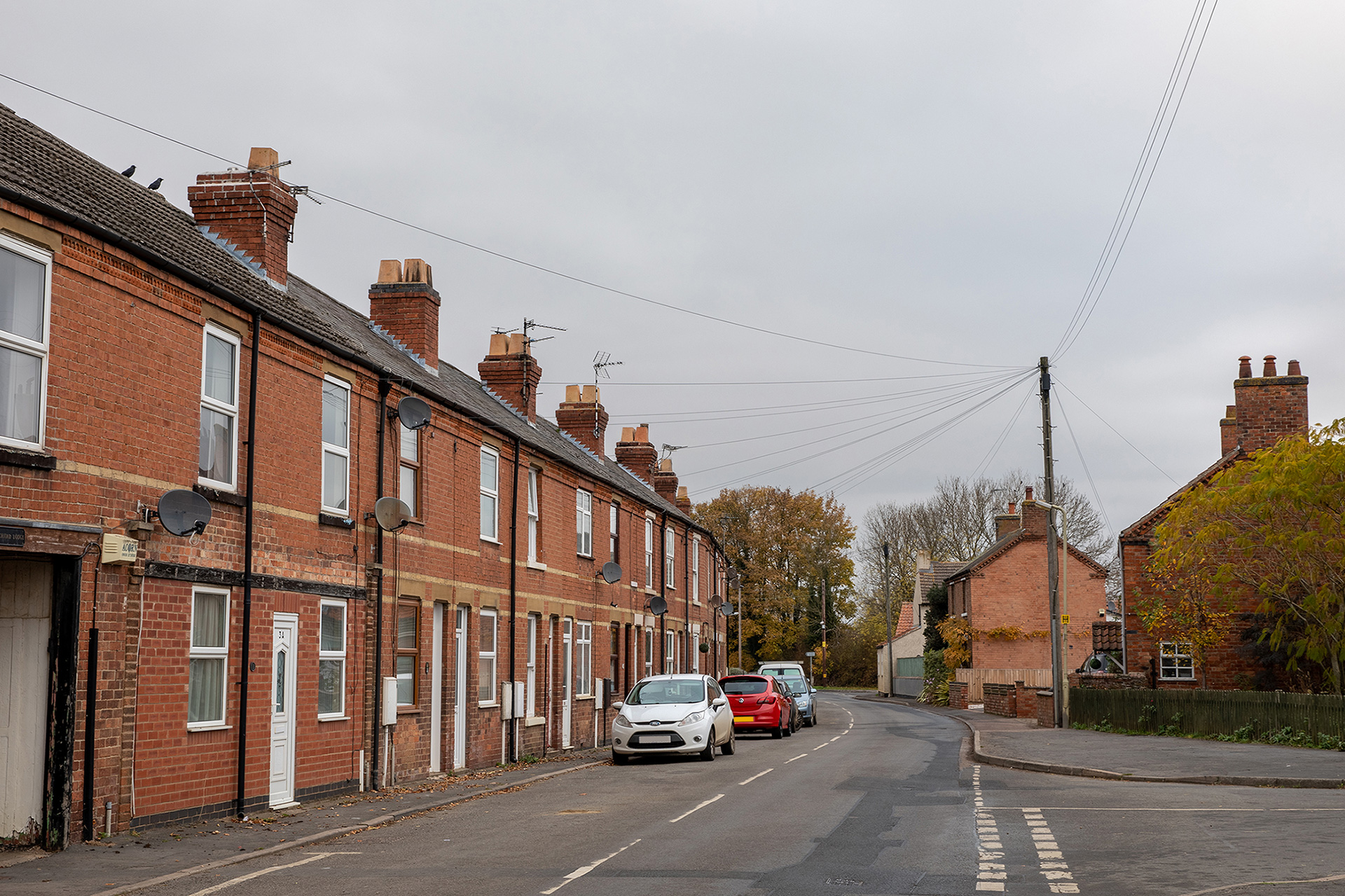
Built at the beginning of the 20th century, Exchange Row, on the left, is still a feature of terraced houses along Nether Street, originally meaning the lower street. ‘The last proprietor of the shop was the lovely Marlene Freeman, and the Freeman family lived in the attached house”, recollected Philip Smith. “I remember back in the 1980s a friend of mine trying to buy a battery-operated speaking parrot with no success in Nottingham. I was in the northeast that week and tried all the department stores to no avail. Friday afternoon, when at Marlene’s shop, I told her about my quest. She reached under the counter, lifted a large box containing a parrot and said: ‘This is my last one!” I cannot repeat what the parrot said.”
Marlene’s grandson Luke Freeman told about the history of the shop. “Mr Brown owned from the start the shop, and he sold the place (between 1937 and 1947) to Mr and Mrs Harriman, who later bought the house next door to create a bigger shop. There was once a tea room upstairs, and to the rear of the property was the old orchard with several fruit trees to make jams to sell locally. There still is an old horse stable to the rear, and the archway housed the cart used to deliver products around local villages. My grandparents, John and Marlene Freeman, came from Nottingham and lived in a cottage on Green Lane, knocked down now. After they renovated their home, my grandmother told my grandad she wanted to buy the shop. He wasn’t happy, but my grandmother wore the trousers. My grandparents bought it from the Harrimans in, I think, in 1967, and they retired in 2000. Now I own the house, so it is still in the Freeman family!” Ali Yates: “I can remember going in the shop lots when your grandmother Marlene ran the store. She was quite a character.” Dave Howitt added: “I remember going in the shop when we visited relatives in the 1960s onward, and I remember the orchard which faced Park Row. Whoever owned the shop at the time did put a goat in the overgrown orchard to clear it.”
On the opposite side was a farm, where Burton Close was built in 1971. In the new picture, you can see its entrance. Matt Smith added his research: “Looking at maps from the 1700s, it seems to have been part of what is now the Nags Head, a public house. It was an open field and had a well, which was somewhere between numbers 1 and 2. I have seen a document that talks about two main farms in the village. One was called Hall Close, which I presume is the Hall near the church. The other is called Kill Close, which I can’t locate as a farm, but it may well be the Nags Head site.”

Wesleyan Chapel – Around 1930
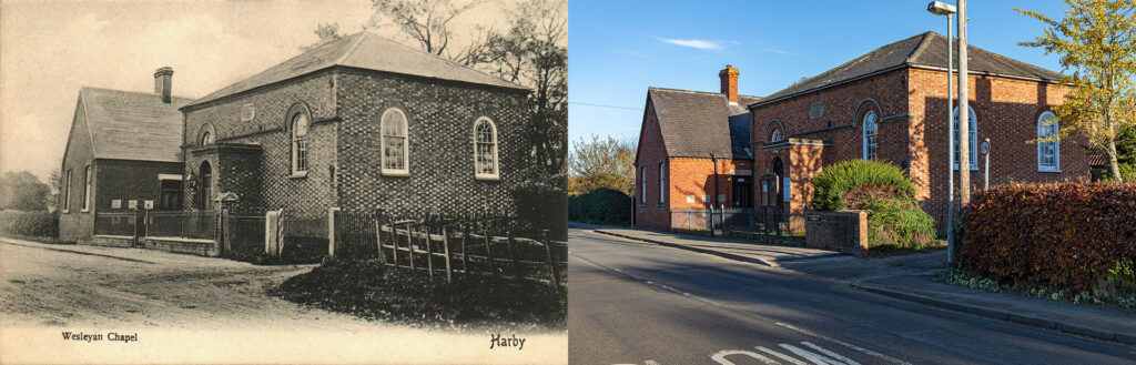
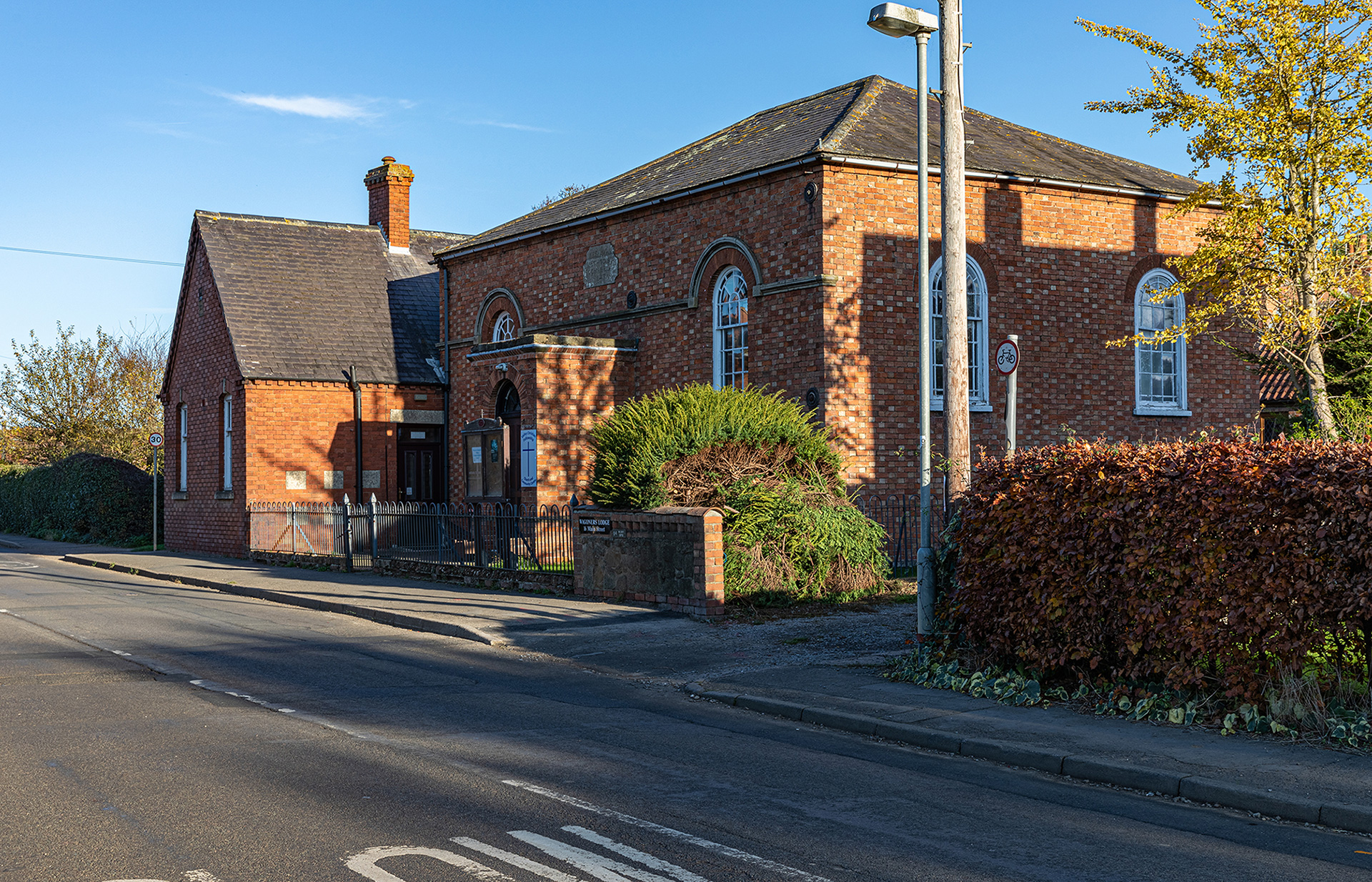
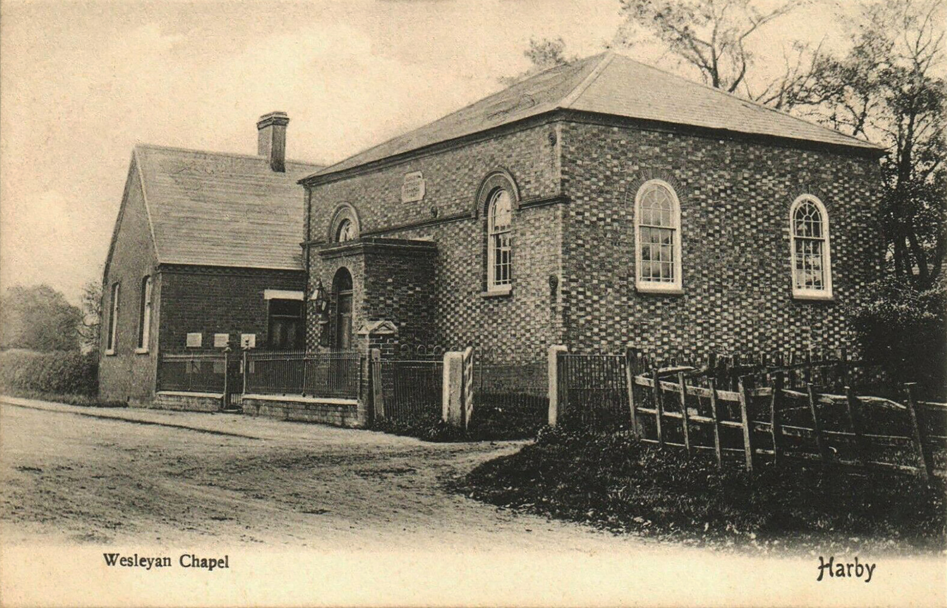
In Harby, Methodists had begun to hold services from 1769 in their homes. In 1847 the main building was put up. The schoolroom on the far side was added in 1897. Matt Smith told the story: “When Mr and Mrs Orson from Old Dalby took residence in the village, they immediately connected with the villagers and that in harmony with their religious beliefs. Mr William Orson converted his coach house along the main road from Eastwell to Langar to hold public meetings, and a licence was granted on 7 April 1828. Services were held in the consecrated coach house for nearly twenty years. Mr Orson preached the first sermon. Mrs Ann Orson was appointed to the office of Class Leader on the formation of the Methodist Society.”
By 1847 the Wesleyan congregation had outgrown the coach house, which was replaced by a chapel built on Orson’s land in October of that year. Matt continued: “Mr C.H. Clark, a Nottingham solicitor, laid the foundation stone and Rev. Jonathan Ratherbury, Rev. Doctor Newton and Rev. James Everet preached the opening sermons.”
The chapel was thoroughly renovated and refurbished in 1873/1874. The Schoolroom was built in June 1897 and opened by the Rev. Joseph Bush. In 1904 there was a purchase of new pews. In 1926 E. Wragg and Son of Nottingham installed a new pipe organ.”
Mr James Wright was a chapel steward and Sunday school teacher for fifty years. Mrs Mabel Stead played the organ for forty years and her daughter, Miss Barbara Stead, also played the organ for nearly thirty years. The Methodist congregation gradually diminished and was converted at the end of the 1980s. Today, the chapel is still a church, run by the Valley Christian Fellowship. Matt: “When my grandmother died, we held a wake in the meeting room next to it. I went into the chapel, and it is just an open space now. There are no pews. The organ got removed, which is very sad, and it is just an open space, and they sit around on chairs.”
On the village
Would you like to add a story on the history of the village? Send a message.
More pictures
Would you like to add pictures? Send a message.
Domesday Book
Harby was a settlement in Domesday Book, in the hundred of Framland and the county of Leicestershire.
It had a recorded population of 47 households in 1086, putting it in the largest 20% of settlements recorded in Domesday, and is listed under 2 owners in Domesday Book.
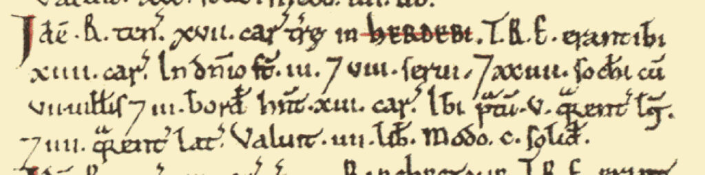
- Land of Robert of Tosny
- Households: 7 villagers. 24 freemen. 3 smallholders. 8 slaves.
- Ploughland: 14 ploughlands. 3 lord’s plough teams. 13 men’s plough teams.
- Other resources: Meadow 5 * 4 furlongs.
Valuation
- Annual value to lord: 5 pounds in 1086; 4 pounds when acquired by the 1086 owner.
Owners
- Tenant-in-chief in 1086: Robert of Tosny.
- Lord in 1086: Robert of Tosny.
- Lords in 1066: Leofric <of Bottesford>; Osmund (Benz); Oswulf (son of Frani); Rolf.

2. Land of Robert of Bucy
- Households: 2 freemen. 3 smallholders.
- Ploughland: 1 ploughland. 1 men’s plough teams.
Valuation
- Annual value to lord: 5 shillings in 1086.
Owners
- Tenant-in-chief in 1086: Robert of Bucy.
- Lord in 1086: Gerard.