-
Nether Broughton
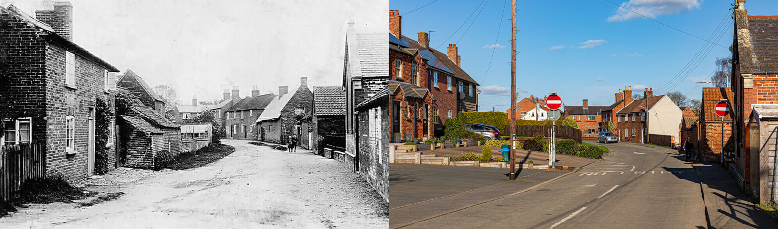
Chapel Lane – Around 1908 The view of Chapel Lane, now a one-way street, is hard to recognise, except for the profile of the chapel and three houses further down the street, all on the right. Dodi Honisett remarks: “My partner, Mark Goodman, his nan and grandad lived in the now knocked down brick house…
-
Redmile

Along The Grantham Canal – 1920s Taken on a calm cloudy winter’s day, the old postcard features an unrippled strip of water, the Grantham Canal. Redmile lies about one-third of the way along the canal towards Nottingham downstream from Grantham. 33 miles in length this nineteenth-century canal was one of many in England, intensively navigated…
-
Pickwell

The village ‘traffic island’ – Early 1930s A 1d. scarlet postage stamp bearing the face of King Edward V on the reverse of the old postcard, and a picture of the War Memorial, dedicated in 1925, would date the picture to the early 1930s. Most of the objects on the villages’ ‘traffic island’ have disappeared.…
-
Waltham on the Wolds

High Street – Early 1900s An empty sandy main street vanishes, curving in the winter mist. All old houses and buildings are still there. Modern features are added: some cars, a satellite dish, and a rooftop antenna. The Church of St. Mary Magdelene, with 13th and 14th century Norman origins, rises as a backdrop. A…
-
Sluis – Oude Kerkstraat

In 2014 historian André Bauwens, history researcher Estelle Slegers Helsen and photographer Peter Verdurmen highlighted the past and present of the main streets in Sluis, a small Dutch city near the Belgian border. This is article #11. In 2014 realiseerden historicus André Bauwens, onderzoekster Estelle Slegers Helsen en fotograaf Peter Verdurmen een reeks over vroeger…